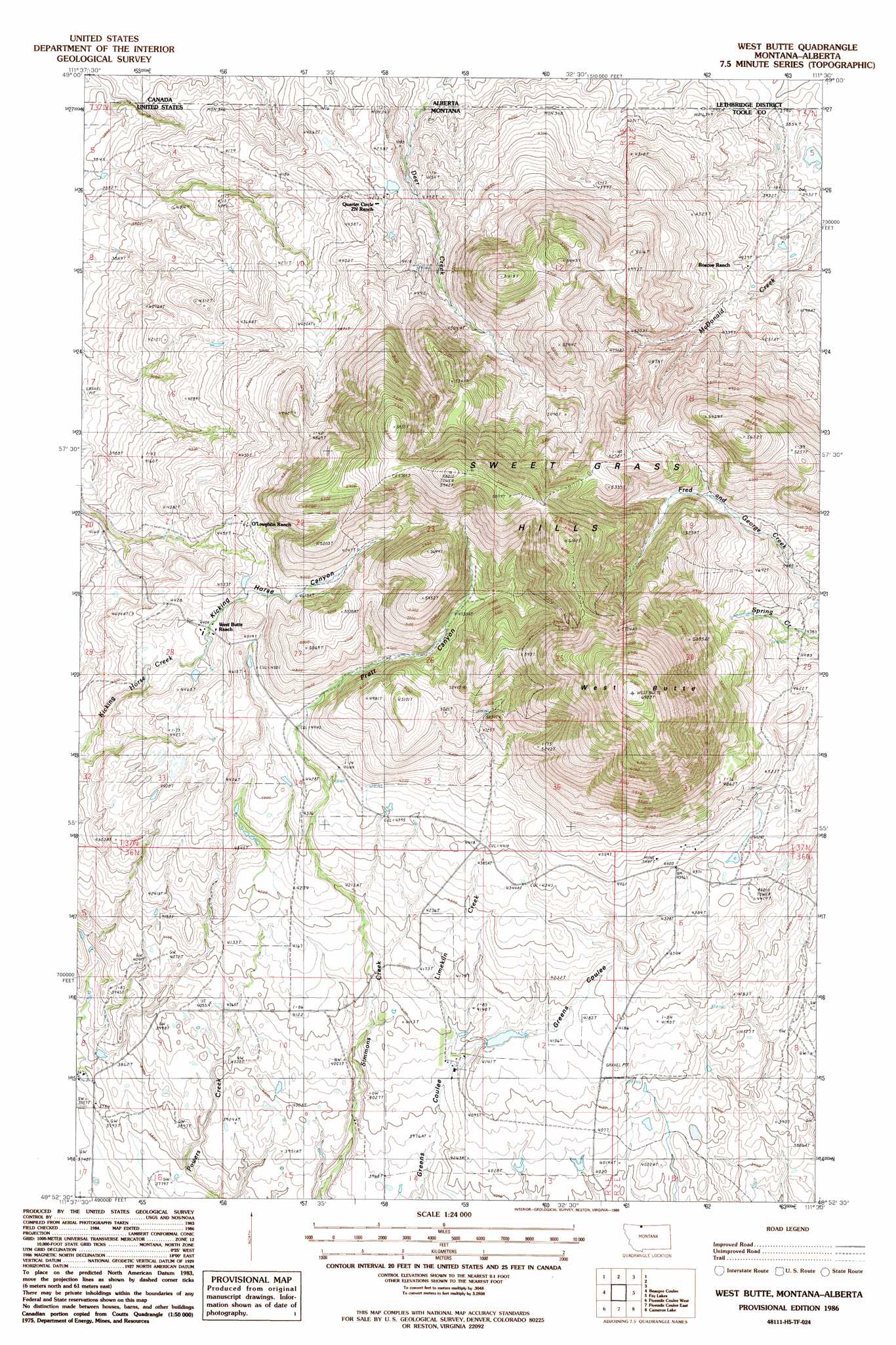
West Butte Topo Map Montana
To zoom in, hover over the map of West Butte
USGS Topo Quad 48111h5 - 1:24,000 scale
| Topo Map Name: | West Butte |
| USGS Topo Quad ID: | 48111h5 |
| Print Size: | ca. 21 1/4" wide x 27" high |
| Southeast Coordinates: | 48.875° N latitude / 111.5° W longitude |
| Map Center Coordinates: | 48.9375° N latitude / 111.5625° W longitude |
| U.S. State: | MT |
| Filename: | o48111h5.jpg |
| Download Map JPG Image: | West Butte topo map 1:24,000 scale |
| Map Type: | Topographic |
| Topo Series: | 7.5´ |
| Map Scale: | 1:24,000 |
| Source of Map Images: | United States Geological Survey (USGS) |
| Alternate Map Versions: |
West Butte MT 1986, updated 1986 Download PDF Buy paper map West Butte MT 2011 Download PDF Buy paper map West Butte MT 2014 Download PDF Buy paper map |
1:24,000 Topo Quads surrounding West Butte
Willshaw Flats |
Beaupre Coulee |
West Butte |
Fey Lakes |
Whitlash |
Ferdig |
Fivemile Coulee West |
Fivemile Coulee East |
Cameron Lake |
Grassy Butte |
Oilmont |
Antelope Coulee Nw |
Johannson Coulee |
Hawthorne School |
Berkholder Reservoir |
> Back to 48111e1 at 1:100,000 scale
> Back to 48110a1 at 1:250,000 scale
> Back to U.S. Topo Maps home
West Butte topo map: Gazetteer
West Butte: Dams
Berthelote Dam elevation 1276m 4186′West Butte: Mines
Deer Creek Mine elevation 1716m 5629′El Pina Mine elevation 1565m 5134′
McDermott Mine elevation 1341m 4399′
Monroe Mine elevation 1632m 5354′
West Butte: Populated Places
McDermott (historical) elevation 1356m 4448′West Butte: Post Offices
McDermott Post Office (historical) elevation 1356m 4448′West Butte: Springs
37N02E31CDDD01 Spring elevation 1361m 4465′West Butte: Streams
Deer Creek elevation 1211m 3973′Limekiln Creek elevation 1233m 4045′
West Butte: Summits
West Butte elevation 2114m 6935′West Butte: Valleys
Kicking Horse Canyon elevation 1343m 4406′Pratt Canyon elevation 1359m 4458′
West Butte digital topo map on disk
Buy this West Butte topo map showing relief, roads, GPS coordinates and other geographical features, as a high-resolution digital map file on DVD: