Agawam North Topo Map Montana
To zoom in, hover over the map of Agawam North
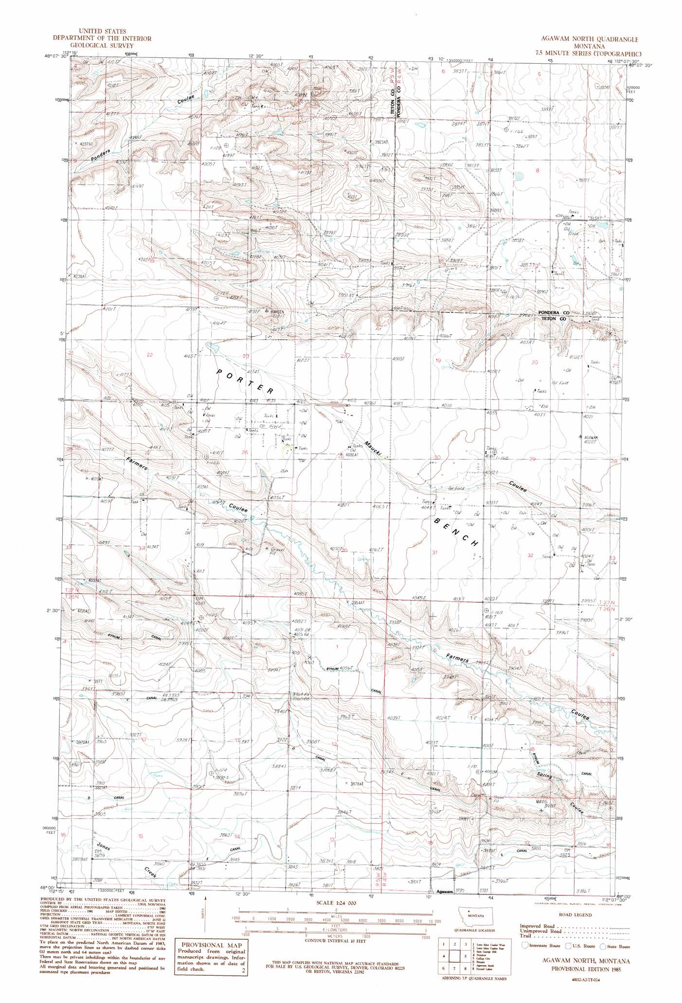
USGS Topo Quad 48112a2 - 1:24,000 scale
| Topo Map Name: | Agawam North |
| USGS Topo Quad ID: | 48112a2 |
| Print Size: | ca. 21 1/4" wide x 27" high |
| Southeast Coordinates: | 48° N latitude / 112.125° W longitude |
| Map Center Coordinates: | 48.0625° N latitude / 112.1875° W longitude |
| U.S. State: | MT |
| Filename: | o48112a2.jpg |
| Download Map JPG Image: | Agawam North topo map 1:24,000 scale |
| Map Type: | Topographic |
| Topo Series: | 7.5´ |
| Map Scale: | 1:24,000 |
| Source of Map Images: | United States Geological Survey (USGS) |
| Alternate Map Versions: |
Agawam North MT 1985, updated 1986 Download PDF Buy paper map Agawam North MT 2011 Download PDF Buy paper map Agawam North MT 2014 Download PDF Buy paper map |
1:24,000 Topo Quads surrounding Agawam North
Kuka Crossing |
Valier West |
Valier East |
Belgian Hill |
Pioneer School |
Dupuyer East |
Lone Man Coulee West |
Lone Man Coulee East |
Sam George Hill |
Conrad |
Soap Creek |
Pendroy |
Agawam North |
Gallup City |
Conrad Sw |
Bynum Reservoir |
Bynum |
Agawam South |
Eyraud Lakes |
Collins Nw |
Watson Flats |
Teton Buttes |
Choteau |
Choteau Se |
T L Gap |
> Back to 48112a1 at 1:100,000 scale
> Back to 48112a1 at 1:250,000 scale
> Back to U.S. Topo Maps home
Agawam North topo map: Gazetteer
Agawam North: Benches
Porter Bench elevation 1243m 4078′Agawam North: Post Offices
Porter Post Office (historical) elevation 1233m 4045′Agawam North: Valleys
North Fork Farmers Coulee elevation 1237m 4058′Spring Coulee elevation 1162m 3812′
Agawam North: Wells
26N05W12CBBB01 Well elevation 1190m 3904′Agawam North digital topo map on disk
Buy this Agawam North topo map showing relief, roads, GPS coordinates and other geographical features, as a high-resolution digital map file on DVD: