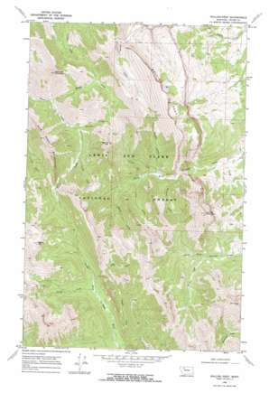
Walling Reef Topo Map Montana
To zoom in, hover over the map of Walling Reef
USGS Topo Quad 48112a7 - 1:24,000 scale
| Topo Map Name: | Walling Reef |
| USGS Topo Quad ID: | 48112a7 |
| Print Size: | ca. 21 1/4" wide x 27" high |
| Southeast Coordinates: | 48° N latitude / 112.75° W longitude |
| Map Center Coordinates: | 48.0625° N latitude / 112.8125° W longitude |
| U.S. State: | MT |
| Filename: | o48112a7.jpg |
| Download Map JPG Image: | Walling Reef topo map 1:24,000 scale |
| Map Type: | Topographic |
| Topo Series: | 7.5´ |
| Map Scale: | 1:24,000 |
| Source of Map Images: | United States Geological Survey (USGS) |
| Alternate Map Versions: |
Walling Reef MT 1968, updated 1972 Download PDF Buy paper map Walling Reef MT 1995, updated 1997 Download PDF Buy paper map Walling Reef MT 2011 Download PDF Buy paper map Walling Reef MT 2014 Download PDF Buy paper map |
| FStopo: | US Forest Service topo Walling Reef is available: Download FStopo PDF Download FStopo TIF |
1:24,000 Topo Quads surrounding Walling Reef
> Back to 48112a1 at 1:100,000 scale
> Back to 48112a1 at 1:250,000 scale
> Back to U.S. Topo Maps home
Walling Reef topo map: Gazetteer
Walling Reef: Cliffs
Walling Reef elevation 2344m 7690′Walling Reef: Streams
Bennie Creek elevation 1783m 5849′Canyon Creek elevation 1692m 5551′
Fright Creek elevation 1797m 5895′
Happy Creek elevation 1646m 5400′
Kid Creek elevation 1867m 6125′
Potshot Creek elevation 1692m 5551′
Rival Creek elevation 1735m 5692′
South Creek elevation 1755m 5757′
Steedling Creek elevation 1731m 5679′
Washout Creek elevation 1673m 5488′
Walling Reef: Summits
Bennie Hill elevation 2335m 7660′Bloody Hill elevation 2443m 8015′
Bum Shot Mountain elevation 2296m 7532′
Hurricane Mountain elevation 2222m 7290′
Mount Frazier elevation 2518m 8261′
Old Man of the Hills elevation 2494m 8182′
Walling Reef: Valleys
Hoy Gulch elevation 1717m 5633′Walling Reef digital topo map on disk
Buy this Walling Reef topo map showing relief, roads, GPS coordinates and other geographical features, as a high-resolution digital map file on DVD:


