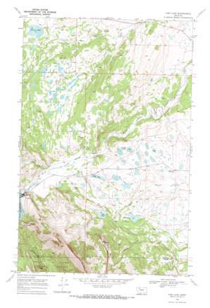
Fish Lake Topo Map Montana
To zoom in, hover over the map of Fish Lake
USGS Topo Quad 48112b7 - 1:24,000 scale
| Topo Map Name: | Fish Lake |
| USGS Topo Quad ID: | 48112b7 |
| Print Size: | ca. 21 1/4" wide x 27" high |
| Southeast Coordinates: | 48.125° N latitude / 112.75° W longitude |
| Map Center Coordinates: | 48.1875° N latitude / 112.8125° W longitude |
| U.S. State: | MT |
| Filename: | o48112b7.jpg |
| Download Map JPG Image: | Fish Lake topo map 1:24,000 scale |
| Map Type: | Topographic |
| Topo Series: | 7.5´ |
| Map Scale: | 1:24,000 |
| Source of Map Images: | United States Geological Survey (USGS) |
| Alternate Map Versions: |
Fish Lake MT 1968, updated 1972 Download PDF Buy paper map Fish Lake MT 1995, updated 1997 Download PDF Buy paper map Fish Lake MT 2011 Download PDF Buy paper map Fish Lake MT 2014 Download PDF Buy paper map |
| FStopo: | US Forest Service topo Fish Lake is available: Download FStopo PDF Download FStopo TIF |
1:24,000 Topo Quads surrounding Fish Lake
> Back to 48112a1 at 1:100,000 scale
> Back to 48112a1 at 1:250,000 scale
> Back to U.S. Topo Maps home
Fish Lake topo map: Gazetteer
Fish Lake: Canals
Miller Ditch elevation 1472m 4829′Fish Lake: Dams
Fish Lake Dam elevation 1504m 4934′Floating Rib Dam elevation 1449m 4753′
Green Lake Dam elevation 1470m 4822′
Swift Dam elevation 1490m 4888′
Twin Lake Dam elevation 1464m 4803′
Fish Lake: Lakes
Cody Lake elevation 1431m 4694′Deep Lake elevation 1426m 4678′
Fish Lake elevation 1504m 4934′
Green Lake elevation 1471m 4826′
Hidden Lake elevation 1426m 4678′
Howes Lakes elevation 1443m 4734′
Round Lake elevation 1450m 4757′
Twin Lakes elevation 1463m 4799′
Waddel Lakes elevation 1427m 4681′
Fish Lake: Reservoirs
Green Lake elevation 1470m 4822′Swift Reservoir elevation 1482m 4862′
Fish Lake: Springs
Hell Roaring Spring elevation 1571m 5154′Fish Lake: Streams
Eagle Creek elevation 1427m 4681′Fish Creek elevation 1402m 4599′
South Fork Blacktail Creek elevation 1378m 4520′
Fish Lake: Summits
Split Mountain elevation 1881m 6171′Fish Lake digital topo map on disk
Buy this Fish Lake topo map showing relief, roads, GPS coordinates and other geographical features, as a high-resolution digital map file on DVD:


