Heart Butte Topo Map Montana
To zoom in, hover over the map of Heart Butte
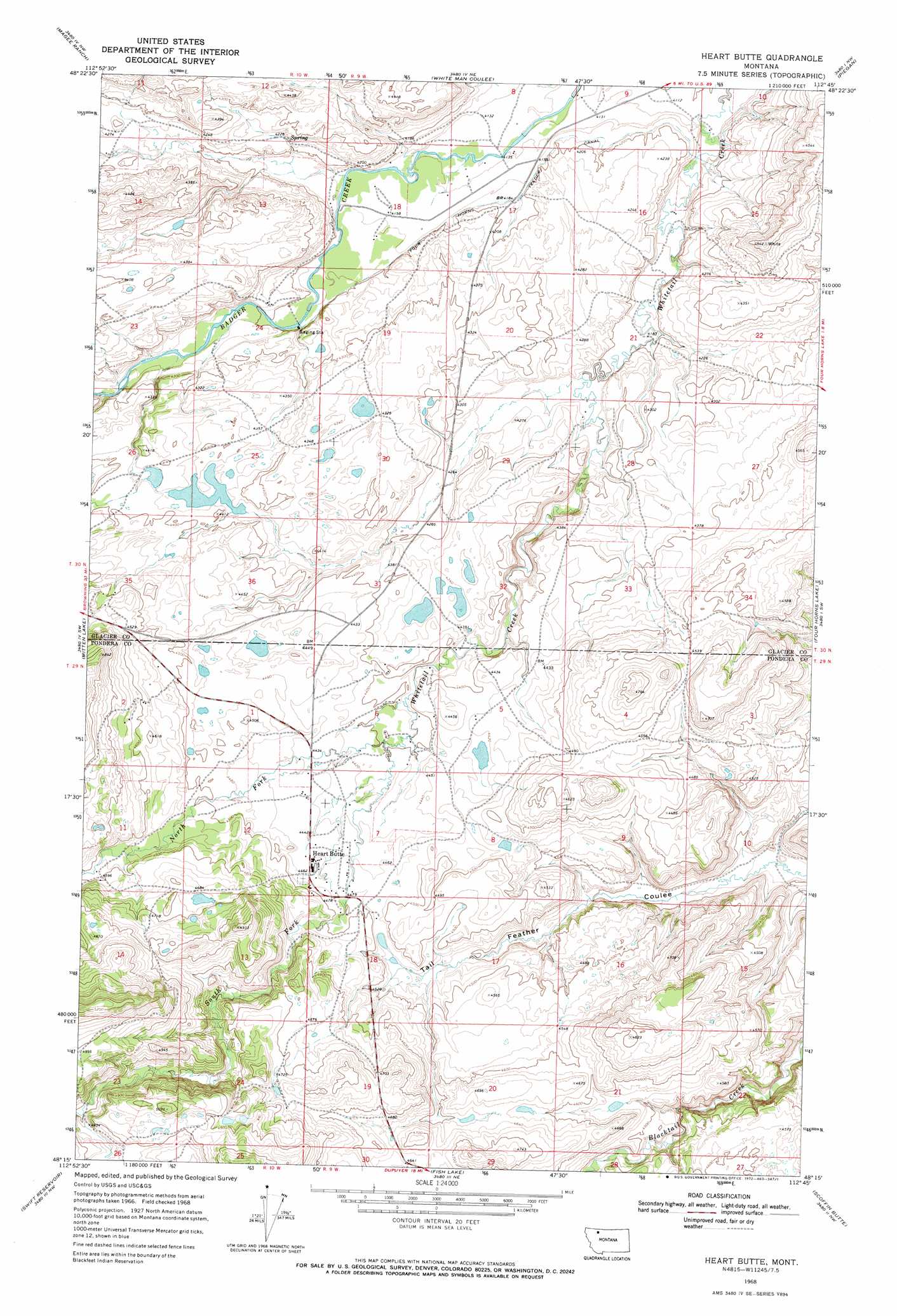
USGS Topo Quad 48112c7 - 1:24,000 scale
| Topo Map Name: | Heart Butte |
| USGS Topo Quad ID: | 48112c7 |
| Print Size: | ca. 21 1/4" wide x 27" high |
| Southeast Coordinates: | 48.25° N latitude / 112.75° W longitude |
| Map Center Coordinates: | 48.3125° N latitude / 112.8125° W longitude |
| U.S. State: | MT |
| Filename: | o48112c7.jpg |
| Download Map JPG Image: | Heart Butte topo map 1:24,000 scale |
| Map Type: | Topographic |
| Topo Series: | 7.5´ |
| Map Scale: | 1:24,000 |
| Source of Map Images: | United States Geological Survey (USGS) |
| Alternate Map Versions: |
Heart Butte MT 1968, updated 1972 Download PDF Buy paper map Heart Butte MT 1968, updated 1972 Download PDF Buy paper map Heart Butte MT 2011 Download PDF Buy paper map Heart Butte MT 2014 Download PDF Buy paper map |
1:24,000 Topo Quads surrounding Heart Butte
Browning |
Blackfoot |
Kipp Lake |
Mission Lake West |
Mission Lake East |
Big Rock |
Magee Ranch |
White Man Coulee |
Piegan |
Rocky Ridge |
Half Dome Crag |
Mitten Lake |
Heart Butte |
Four Horns Lake |
Robere |
Morningstar Mountain |
Swift Reservoir |
Fish Lake |
Scoffin Butte |
Dupuyer West |
Gooseberry Peak |
Gateway Pass |
Walling Reef |
Volcano Reef |
Blackleaf |
> Back to 48112a1 at 1:100,000 scale
> Back to 48112a1 at 1:250,000 scale
> Back to U.S. Topo Maps home
Heart Butte topo map: Gazetteer
Heart Butte: Populated Places
Heart Butte elevation 1363m 4471′Heart Butte: Post Offices
Heart Butte Post Office elevation 1363m 4471′Heart Butte: Streams
North Fork Whitetail Creek elevation 1341m 4399′South Fork Whitetail Creek elevation 1341m 4399′
Heart Butte: Valleys
Bite Coulee elevation 1271m 4169′Hay Coulee elevation 1268m 4160′
Heart Butte: Wells
30N09W17BADA01 Well elevation 1265m 4150′30N09W21CABB01 Well elevation 1282m 4206′
Heart Butte digital topo map on disk
Buy this Heart Butte topo map showing relief, roads, GPS coordinates and other geographical features, as a high-resolution digital map file on DVD: