Mitten Lake Topo Map Montana
To zoom in, hover over the map of Mitten Lake
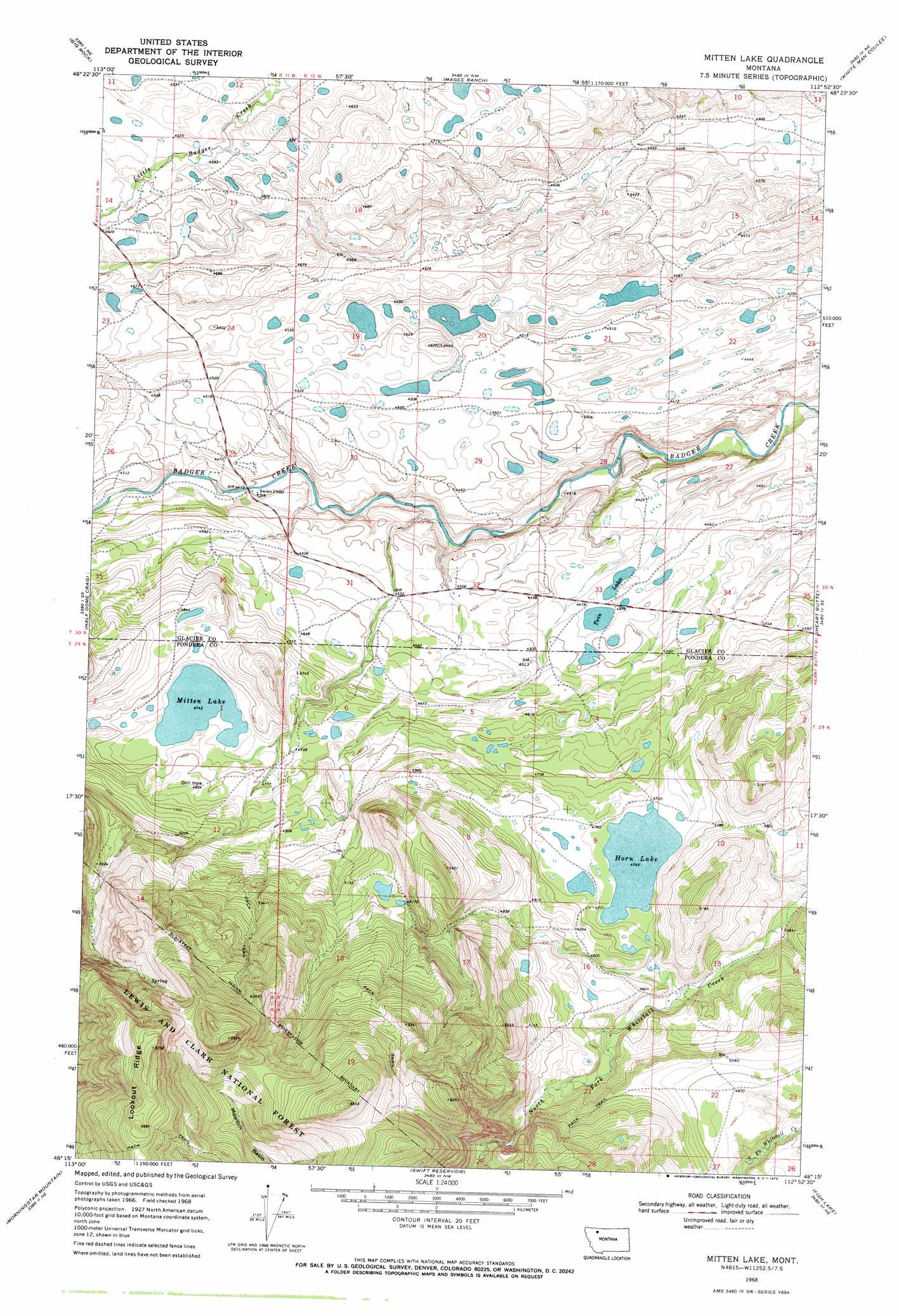
USGS Topo Quad 48112c8 - 1:24,000 scale
| Topo Map Name: | Mitten Lake |
| USGS Topo Quad ID: | 48112c8 |
| Print Size: | ca. 21 1/4" wide x 27" high |
| Southeast Coordinates: | 48.25° N latitude / 112.875° W longitude |
| Map Center Coordinates: | 48.3125° N latitude / 112.9375° W longitude |
| U.S. State: | MT |
| Filename: | o48112c8.jpg |
| Download Map JPG Image: | Mitten Lake topo map 1:24,000 scale |
| Map Type: | Topographic |
| Topo Series: | 7.5´ |
| Map Scale: | 1:24,000 |
| Source of Map Images: | United States Geological Survey (USGS) |
| Alternate Map Versions: |
Mitten Lake MT 1968, updated 1972 Download PDF Buy paper map Mitten Lake MT 1995, updated 1997 Download PDF Buy paper map Mitten Lake MT 2011 Download PDF Buy paper map Mitten Lake MT 2014 Download PDF Buy paper map |
| FStopo: | US Forest Service topo Mitten Lake is available: Download FStopo PDF Download FStopo TIF |
1:24,000 Topo Quads surrounding Mitten Lake
Starr School |
Browning |
Blackfoot |
Kipp Lake |
Mission Lake West |
East Glacier Park |
Big Rock |
Magee Ranch |
White Man Coulee |
Piegan |
Hyde Creek |
Half Dome Crag |
Mitten Lake |
Heart Butte |
Four Horns Lake |
Crescent Cliff |
Morningstar Mountain |
Swift Reservoir |
Fish Lake |
Scoffin Butte |
Gable Peaks |
Gooseberry Peak |
Gateway Pass |
Walling Reef |
Volcano Reef |
> Back to 48112a1 at 1:100,000 scale
> Back to 48112a1 at 1:250,000 scale
> Back to U.S. Topo Maps home
Mitten Lake topo map: Gazetteer
Mitten Lake: Basins
Mowitch Basin elevation 1727m 5666′Mitten Lake: Lakes
Horn Lake elevation 1448m 4750′Mitten Lake elevation 1447m 4747′
Twin Lakes elevation 1360m 4461′
Mitten Lake: Springs
30N11W25CABB01 Spring elevation 1354m 4442′Mitten Lake digital topo map on disk
Buy this Mitten Lake topo map showing relief, roads, GPS coordinates and other geographical features, as a high-resolution digital map file on DVD: