White Man Coulee Topo Map Montana
To zoom in, hover over the map of White Man Coulee
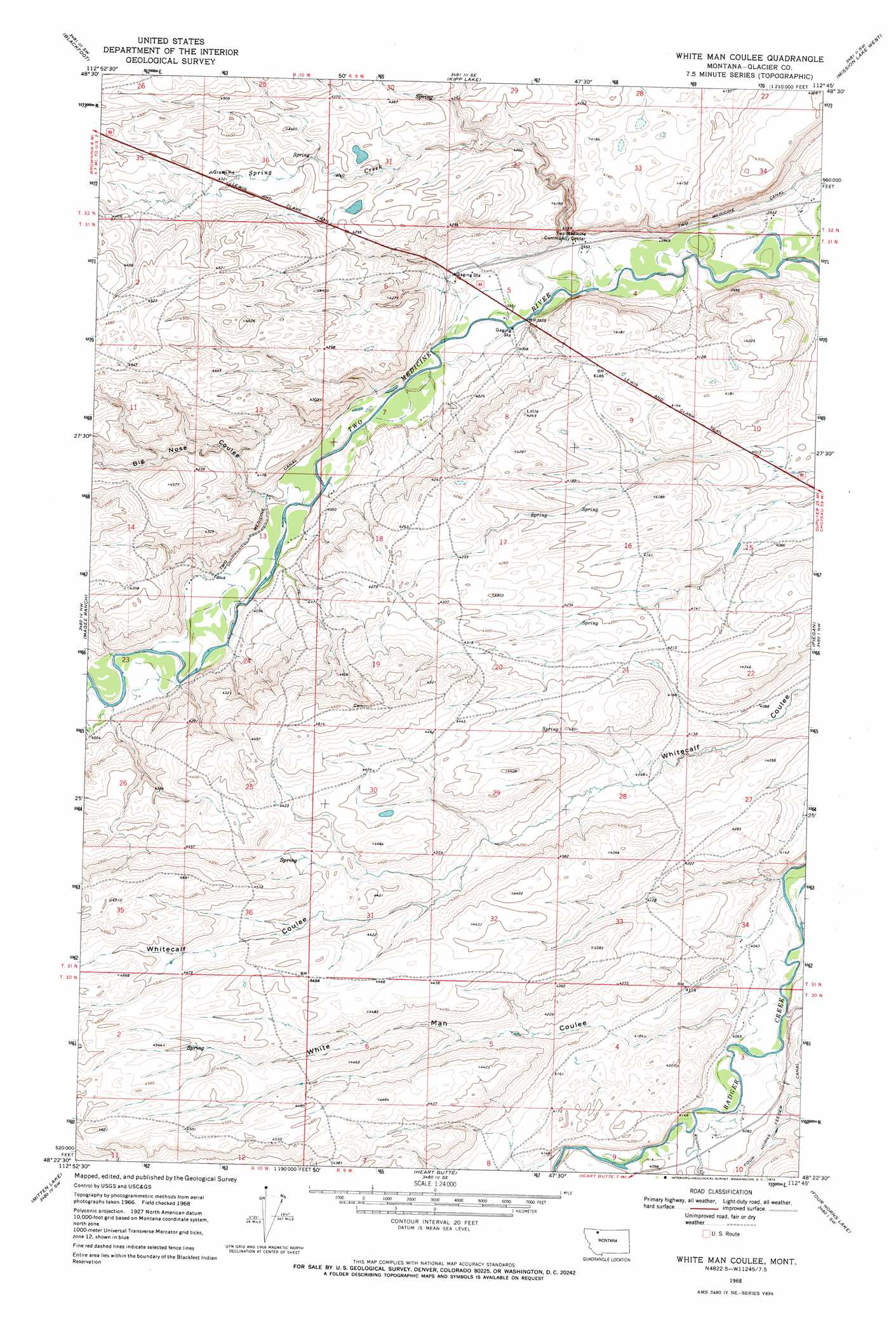
USGS Topo Quad 48112d7 - 1:24,000 scale
| Topo Map Name: | White Man Coulee |
| USGS Topo Quad ID: | 48112d7 |
| Print Size: | ca. 21 1/4" wide x 27" high |
| Southeast Coordinates: | 48.375° N latitude / 112.75° W longitude |
| Map Center Coordinates: | 48.4375° N latitude / 112.8125° W longitude |
| U.S. State: | MT |
| Filename: | o48112d7.jpg |
| Download Map JPG Image: | White Man Coulee topo map 1:24,000 scale |
| Map Type: | Topographic |
| Topo Series: | 7.5´ |
| Map Scale: | 1:24,000 |
| Source of Map Images: | United States Geological Survey (USGS) |
| Alternate Map Versions: |
White Man Coulee MT 1968, updated 1972 Download PDF Buy paper map White Man Coulee MT 2011 Download PDF Buy paper map White Man Coulee MT 2014 Download PDF Buy paper map |
1:24,000 Topo Quads surrounding White Man Coulee
Browning Ne |
Sharp Lake |
Rimrock Butte |
Fort Piegan |
Sundance |
Browning |
Blackfoot |
Kipp Lake |
Mission Lake West |
Mission Lake East |
Big Rock |
Magee Ranch |
White Man Coulee |
Piegan |
Rocky Ridge |
Half Dome Crag |
Mitten Lake |
Heart Butte |
Four Horns Lake |
Robere |
Morningstar Mountain |
Swift Reservoir |
Fish Lake |
Scoffin Butte |
Dupuyer West |
> Back to 48112a1 at 1:100,000 scale
> Back to 48112a1 at 1:250,000 scale
> Back to U.S. Topo Maps home
White Man Coulee topo map: Gazetteer
White Man Coulee: Springs
31N09W09DCAC01 Spring elevation 1238m 4061′31N09W09DDBB01 Spring elevation 1237m 4058′
White Man Coulee: Streams
Little Badger Creek elevation 1232m 4041′Spring Creek elevation 1199m 3933′
Whitetail Creek elevation 1245m 4084′
White Man Coulee: Valleys
Big Nose Coulee elevation 1214m 3982′White Man Coulee elevation 1227m 4025′
White Man Coulee digital topo map on disk
Buy this White Man Coulee topo map showing relief, roads, GPS coordinates and other geographical features, as a high-resolution digital map file on DVD: