Kipp Lake Topo Map Montana
To zoom in, hover over the map of Kipp Lake
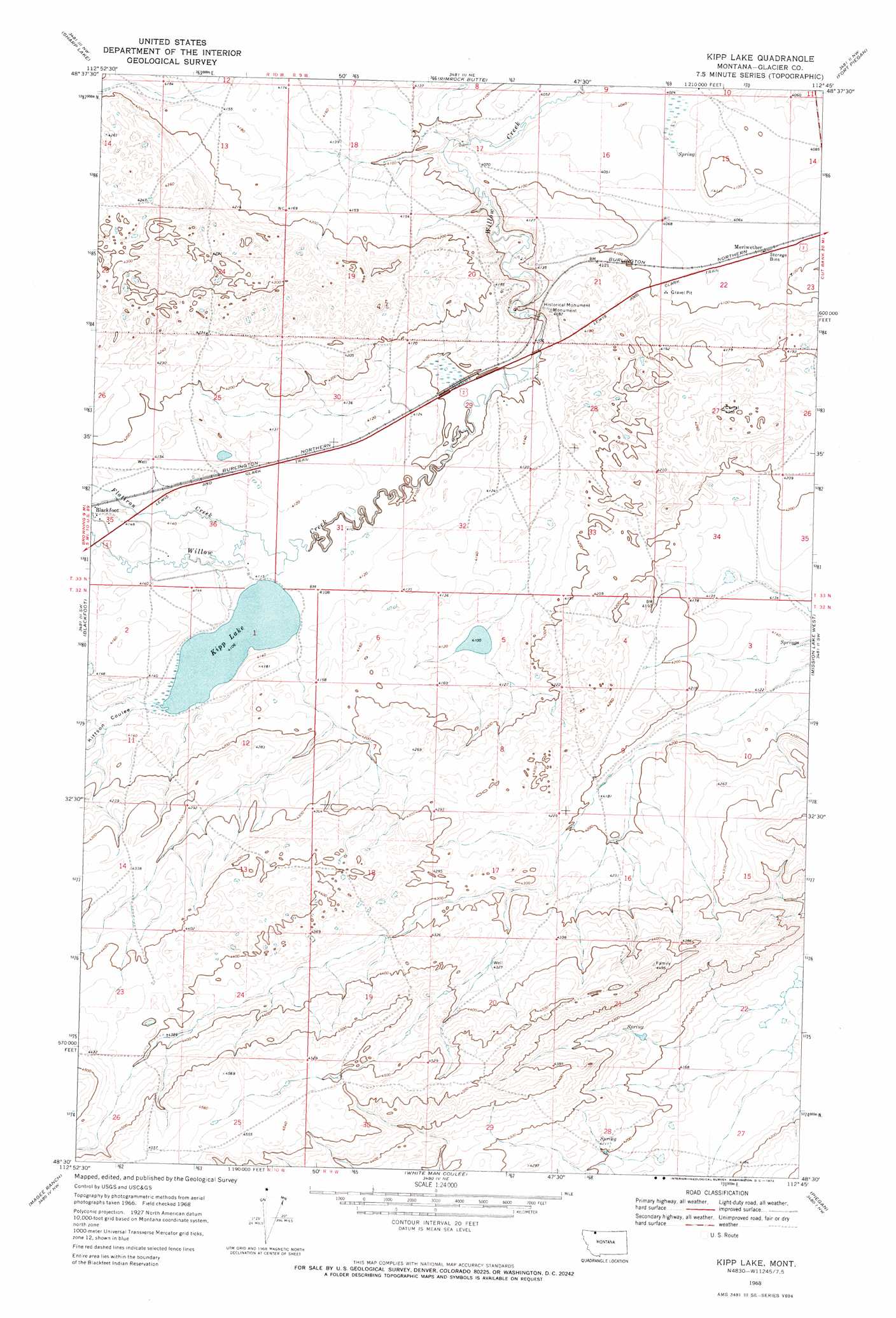
USGS Topo Quad 48112e7 - 1:24,000 scale
| Topo Map Name: | Kipp Lake |
| USGS Topo Quad ID: | 48112e7 |
| Print Size: | ca. 21 1/4" wide x 27" high |
| Southeast Coordinates: | 48.5° N latitude / 112.75° W longitude |
| Map Center Coordinates: | 48.5625° N latitude / 112.8125° W longitude |
| U.S. State: | MT |
| Filename: | o48112e7.jpg |
| Download Map JPG Image: | Kipp Lake topo map 1:24,000 scale |
| Map Type: | Topographic |
| Topo Series: | 7.5´ |
| Map Scale: | 1:24,000 |
| Source of Map Images: | United States Geological Survey (USGS) |
| Alternate Map Versions: |
Kipp Lake MT 1968, updated 1972 Download PDF Buy paper map Kipp Lake MT 2011 Download PDF Buy paper map Kipp Lake MT 2014 Download PDF Buy paper map |
1:24,000 Topo Quads surrounding Kipp Lake
Hoodoo Hill |
Nightshoot Coulee |
Rimrock Ranch |
Buffalo Lake |
Rocky Buttes |
Browning Ne |
Sharp Lake |
Rimrock Butte |
Fort Piegan |
Sundance |
Browning |
Blackfoot |
Kipp Lake |
Mission Lake West |
Mission Lake East |
Big Rock |
Magee Ranch |
White Man Coulee |
Piegan |
Rocky Ridge |
Half Dome Crag |
Mitten Lake |
Heart Butte |
Four Horns Lake |
Robere |
> Back to 48112e1 at 1:100,000 scale
> Back to 48112a1 at 1:250,000 scale
> Back to U.S. Topo Maps home
Kipp Lake topo map: Gazetteer
Kipp Lake: Dams
Kipps Lake Dam elevation 1253m 4110′Kipp Lake: Lakes
Kipp Lake elevation 1253m 4110′Kipp Lake: Populated Places
Meriwether elevation 1244m 4081′Kipp Lake: Reservoirs
Kipps Lake elevation 1253m 4110′Kipp Lake: Streams
Flatiron Creek elevation 1255m 4117′Kipp Lake: Valleys
Kittson Coulee elevation 1253m 4110′Kipp Lake: Wells
33N09W22BBBB01 Well elevation 1242m 4074′Kipp Lake digital topo map on disk
Buy this Kipp Lake topo map showing relief, roads, GPS coordinates and other geographical features, as a high-resolution digital map file on DVD: