Rimrock Butte Topo Map Montana
To zoom in, hover over the map of Rimrock Butte
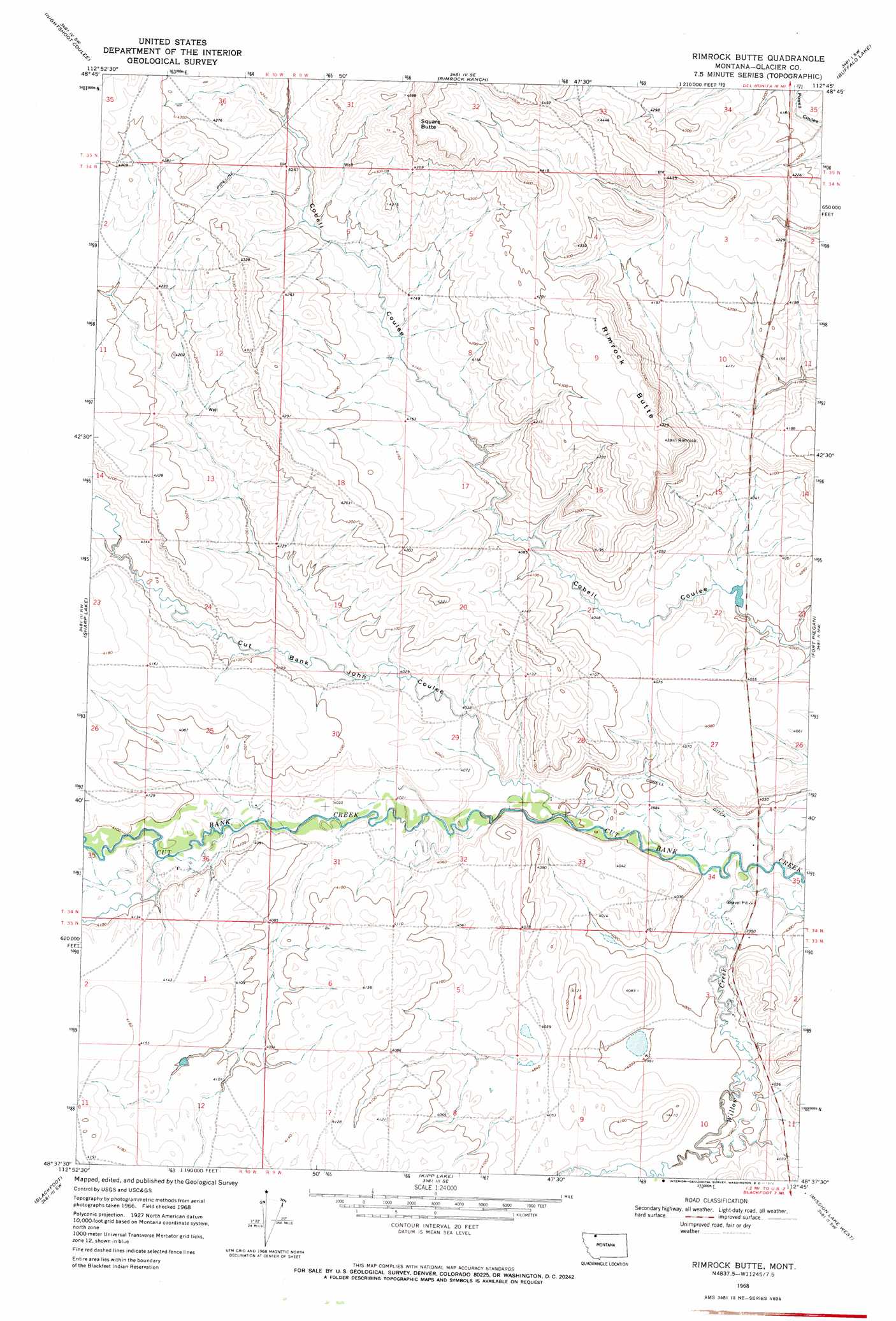
USGS Topo Quad 48112f7 - 1:24,000 scale
| Topo Map Name: | Rimrock Butte |
| USGS Topo Quad ID: | 48112f7 |
| Print Size: | ca. 21 1/4" wide x 27" high |
| Southeast Coordinates: | 48.625° N latitude / 112.75° W longitude |
| Map Center Coordinates: | 48.6875° N latitude / 112.8125° W longitude |
| U.S. State: | MT |
| Filename: | o48112f7.jpg |
| Download Map JPG Image: | Rimrock Butte topo map 1:24,000 scale |
| Map Type: | Topographic |
| Topo Series: | 7.5´ |
| Map Scale: | 1:24,000 |
| Source of Map Images: | United States Geological Survey (USGS) |
| Alternate Map Versions: |
Rimrock Butte MT 1968, updated 1972 Download PDF Buy paper map Rimrock Butte MT 2011 Download PDF Buy paper map Rimrock Butte MT 2014 Download PDF Buy paper map |
1:24,000 Topo Quads surrounding Rimrock Butte
Emigrant Gap |
Bushnell Hill |
Del Bonita |
Landslide Butte |
Love Rock |
Hoodoo Hill |
Nightshoot Coulee |
Rimrock Ranch |
Buffalo Lake |
Rocky Buttes |
Browning Ne |
Sharp Lake |
Rimrock Butte |
Fort Piegan |
Sundance |
Browning |
Blackfoot |
Kipp Lake |
Mission Lake West |
Mission Lake East |
Big Rock |
Magee Ranch |
White Man Coulee |
Piegan |
Rocky Ridge |
> Back to 48112e1 at 1:100,000 scale
> Back to 48112a1 at 1:250,000 scale
> Back to U.S. Topo Maps home
Rimrock Butte topo map: Gazetteer
Rimrock Butte: Summits
Rimrock Butte elevation 1316m 4317′Square Butte elevation 1393m 4570′
Rimrock Butte: Valleys
Cut Bank John Coulee elevation 1219m 3999′Rimrock Butte digital topo map on disk
Buy this Rimrock Butte topo map showing relief, roads, GPS coordinates and other geographical features, as a high-resolution digital map file on DVD: