Buffalo Lake Topo Map Montana
To zoom in, hover over the map of Buffalo Lake
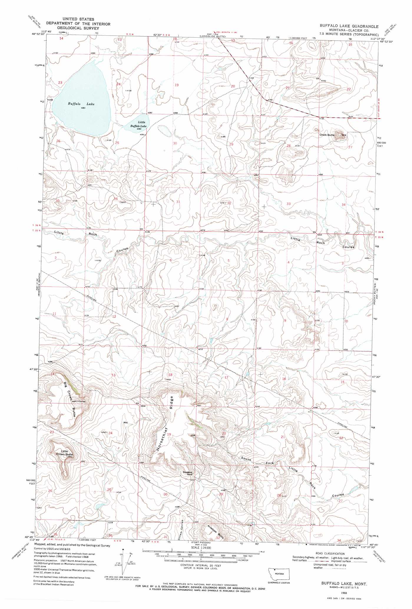
USGS Topo Quad 48112g6 - 1:24,000 scale
| Topo Map Name: | Buffalo Lake |
| USGS Topo Quad ID: | 48112g6 |
| Print Size: | ca. 21 1/4" wide x 27" high |
| Southeast Coordinates: | 48.75° N latitude / 112.625° W longitude |
| Map Center Coordinates: | 48.8125° N latitude / 112.6875° W longitude |
| U.S. State: | MT |
| Filename: | o48112g6.jpg |
| Download Map JPG Image: | Buffalo Lake topo map 1:24,000 scale |
| Map Type: | Topographic |
| Topo Series: | 7.5´ |
| Map Scale: | 1:24,000 |
| Source of Map Images: | United States Geological Survey (USGS) |
| Alternate Map Versions: |
Buffalo Lake MT 1968, updated 1972 Download PDF Buy paper map Buffalo Lake MT 2011 Download PDF Buy paper map Buffalo Lake MT 2014 Download PDF Buy paper map |
1:24,000 Topo Quads surrounding Buffalo Lake
Bushnell Hill |
Del Bonita |
Landslide Butte |
Love Rock |
Headlight Butte Nw |
Nightshoot Coulee |
Rimrock Ranch |
Buffalo Lake |
Rocky Buttes |
Dead Indian Spring |
Sharp Lake |
Rimrock Butte |
Fort Piegan |
Sundance |
Gunsight |
Blackfoot |
Kipp Lake |
Mission Lake West |
Mission Lake East |
Squaw Buttes |
> Back to 48112e1 at 1:100,000 scale
> Back to 48112a1 at 1:250,000 scale
> Back to U.S. Topo Maps home
Buffalo Lake topo map: Gazetteer
Buffalo Lake: Lakes
Buffalo Lake elevation 1239m 4064′Little Buffalo Lake elevation 1245m 4084′
Buffalo Lake: Summits
Antelope Butte elevation 1363m 4471′Chalk Butte elevation 1316m 4317′
Horsethief Ridge elevation 1403m 4603′
Little Crown Butte elevation 1390m 4560′
Buffalo Lake digital topo map on disk
Buy this Buffalo Lake topo map showing relief, roads, GPS coordinates and other geographical features, as a high-resolution digital map file on DVD: