Headlight Butte Nw Topo Map Montana
To zoom in, hover over the map of Headlight Butte Nw
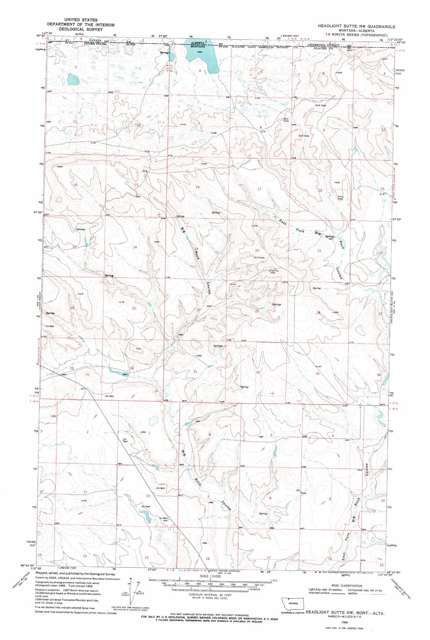
USGS Topo Quad 48112h4 - 1:24,000 scale
| Topo Map Name: | Headlight Butte Nw |
| USGS Topo Quad ID: | 48112h4 |
| Print Size: | ca. 21 1/4" wide x 27" high |
| Southeast Coordinates: | 48.875° N latitude / 112.375° W longitude |
| Map Center Coordinates: | 48.9375° N latitude / 112.4375° W longitude |
| U.S. State: | MT |
| Filename: | o48112h4.jpg |
| Download Map JPG Image: | Headlight Butte Nw topo map 1:24,000 scale |
| Map Type: | Topographic |
| Topo Series: | 7.5´ |
| Map Scale: | 1:24,000 |
| Source of Map Images: | United States Geological Survey (USGS) |
| Alternate Map Versions: |
Headlight Butte NW MT 1968, updated 1972 Download PDF Buy paper map Headlight Butte NW MT 2011 Download PDF Buy paper map Headlight Butte NW MT 2014 Download PDF Buy paper map |
1:24,000 Topo Quads surrounding Headlight Butte Nw
Landslide Butte |
Love Rock |
Headlight Butte Nw |
Headlight Butte Ne |
Fitzpatrick Lake |
Buffalo Lake |
Rocky Buttes |
Dead Indian Spring |
Headlight Butte |
Glacier Colony |
Fort Piegan |
Sundance |
Gunsight |
Cut Bank |
Ethridge Nw |
> Back to 48112e1 at 1:100,000 scale
> Back to 48112a1 at 1:250,000 scale
> Back to U.S. Topo Maps home
Headlight Butte Nw topo map: Gazetteer
Headlight Butte Nw: Dams
Marathon Dam elevation 1209m 3966′Headlight Butte Nw: Lakes
Boundary Lake elevation 1223m 4012′Headlight Butte Nw digital topo map on disk
Buy this Headlight Butte Nw topo map showing relief, roads, GPS coordinates and other geographical features, as a high-resolution digital map file on DVD: