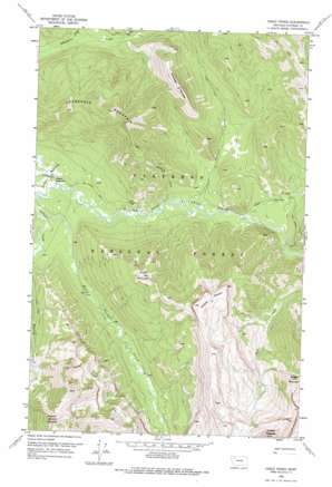
Gable Peaks Topo Map Montana
To zoom in, hover over the map of Gable Peaks
USGS Topo Quad 48113a2 - 1:24,000 scale
| Topo Map Name: | Gable Peaks |
| USGS Topo Quad ID: | 48113a2 |
| Print Size: | ca. 21 1/4" wide x 27" high |
| Southeast Coordinates: | 48° N latitude / 113.125° W longitude |
| Map Center Coordinates: | 48.0625° N latitude / 113.1875° W longitude |
| U.S. State: | MT |
| Filename: | o48113a2.jpg |
| Download Map JPG Image: | Gable Peaks topo map 1:24,000 scale |
| Map Type: | Topographic |
| Topo Series: | 7.5´ |
| Map Scale: | 1:24,000 |
| Source of Map Images: | United States Geological Survey (USGS) |
| Alternate Map Versions: |
Gable Peaks MT 1958, updated 1959 Download PDF Buy paper map Gable Peaks MT 1958, updated 1975 Download PDF Buy paper map Gable Peaks MT 1994, updated 1997 Download PDF Buy paper map Gable Peaks MT 2011 Download PDF Buy paper map Gable Peaks MT 2014 Download PDF Buy paper map |
| FStopo: | US Forest Service topo Gable Peaks is available: Download FStopo PDF Download FStopo TIF |
1:24,000 Topo Quads surrounding Gable Peaks
> Back to 48113a1 at 1:100,000 scale
> Back to 48112a1 at 1:250,000 scale
> Back to U.S. Topo Maps home
Gable Peaks topo map: Gazetteer
Gable Peaks: Flats
Schafer Meadows elevation 1477m 4845′Gable Peaks: Streams
Calbick Creek elevation 1496m 4908′Cox Creek elevation 1510m 4954′
Dolly Varden Creek elevation 1469m 4819′
Surprise Creek elevation 1495m 4904′
Whistler Creek elevation 1485m 4872′
Gable Peaks: Summits
Argosy Mountain elevation 2453m 8047′Arrowhead Mountain elevation 2072m 6797′
Chair Mountain elevation 2155m 7070′
Gable Peaks elevation 2347m 7700′
Lodgepole Mountain elevation 2191m 7188′
Gable Peaks digital topo map on disk
Buy this Gable Peaks topo map showing relief, roads, GPS coordinates and other geographical features, as a high-resolution digital map file on DVD:


