Nimrod Topo Map Montana
To zoom in, hover over the map of Nimrod
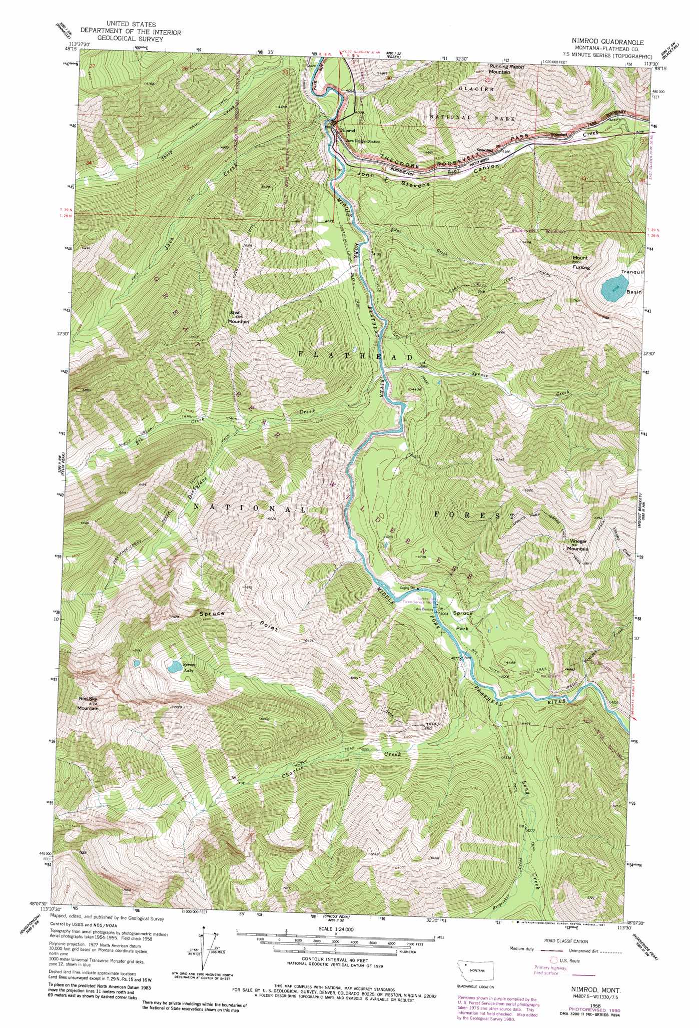
USGS Topo Quad 48113b5 - 1:24,000 scale
| Topo Map Name: | Nimrod |
| USGS Topo Quad ID: | 48113b5 |
| Print Size: | ca. 21 1/4" wide x 27" high |
| Southeast Coordinates: | 48.125° N latitude / 113.5° W longitude |
| Map Center Coordinates: | 48.1875° N latitude / 113.5625° W longitude |
| U.S. State: | MT |
| Filename: | o48113b5.jpg |
| Download Map JPG Image: | Nimrod topo map 1:24,000 scale |
| Map Type: | Topographic |
| Topo Series: | 7.5´ |
| Map Scale: | 1:24,000 |
| Source of Map Images: | United States Geological Survey (USGS) |
| Alternate Map Versions: |
Nimrod MT 1958, updated 1960 Download PDF Buy paper map Nimrod MT 1958, updated 1976 Download PDF Buy paper map Nimrod MT 1958, updated 1981 Download PDF Buy paper map Nimrod MT 1994, updated 1997 Download PDF Buy paper map Nimrod MT 2011 Download PDF Buy paper map Nimrod MT 2014 Download PDF Buy paper map |
| FStopo: | US Forest Service topo Nimrod is available: Download FStopo PDF Download FStopo TIF |
1:24,000 Topo Quads surrounding Nimrod
Nyack |
Stanton Lake |
Mount Saint Nicholas |
Mount Rockwell |
Squaw Mountain |
Mount Grant |
Pinnacle |
Essex |
Blacktail |
Summit |
Pioneer Ridge |
Felix Peak |
Nimrod |
Mount Bradley |
Red Plume Mountain |
Big Hawk Mountain |
Quintonkon |
Circus Peak |
Horseshoe Peak |
Capitol Mountain |
Swan Lake |
Connor Creek |
Tin Creek |
Spotted Bear Mountain |
Whitcomb Peak |
> Back to 48113a1 at 1:100,000 scale
> Back to 48112a1 at 1:250,000 scale
> Back to U.S. Topo Maps home
Nimrod topo map: Gazetteer
Nimrod: Basins
Tranquil Basin elevation 1918m 6292′Nimrod: Flats
Spruce Park elevation 1255m 4117′Nimrod: Lakes
Spruce Lake elevation 1812m 5944′Nimrod: Mines
Nimrod Mine elevation 1434m 4704′Nimrod: Populated Places
Nimrod elevation 1220m 4002′Nimrod: Streams
Bear Creek elevation 1178m 3864′Bergsicker Creek elevation 1310m 4297′
Charlie Creek elevation 1242m 4074′
Dirtyface Creek elevation 1195m 3920′
Edna Creek elevation 1189m 3900′
Elk Creek elevation 1280m 4199′
Java Creek elevation 1174m 3851′
Long Creek elevation 1248m 4094′
Spruce Creek elevation 1201m 3940′
Vinegar Creek elevation 1260m 4133′
Vinegar Creek elevation 1731m 5679′
Nimrod: Summits
Java Mountain elevation 2069m 6788′Mount Furlong elevation 2213m 7260′
Red Sky Mountain elevation 2480m 8136′
Spruce Point elevation 2091m 6860′
Vinegar Mountain elevation 2165m 7103′
Nimrod: Trails
Dirtyface-Logan Creek Trail elevation 1421m 4662′Edna Creek Trail elevation 1767m 5797′
Nimrod digital topo map on disk
Buy this Nimrod topo map showing relief, roads, GPS coordinates and other geographical features, as a high-resolution digital map file on DVD: