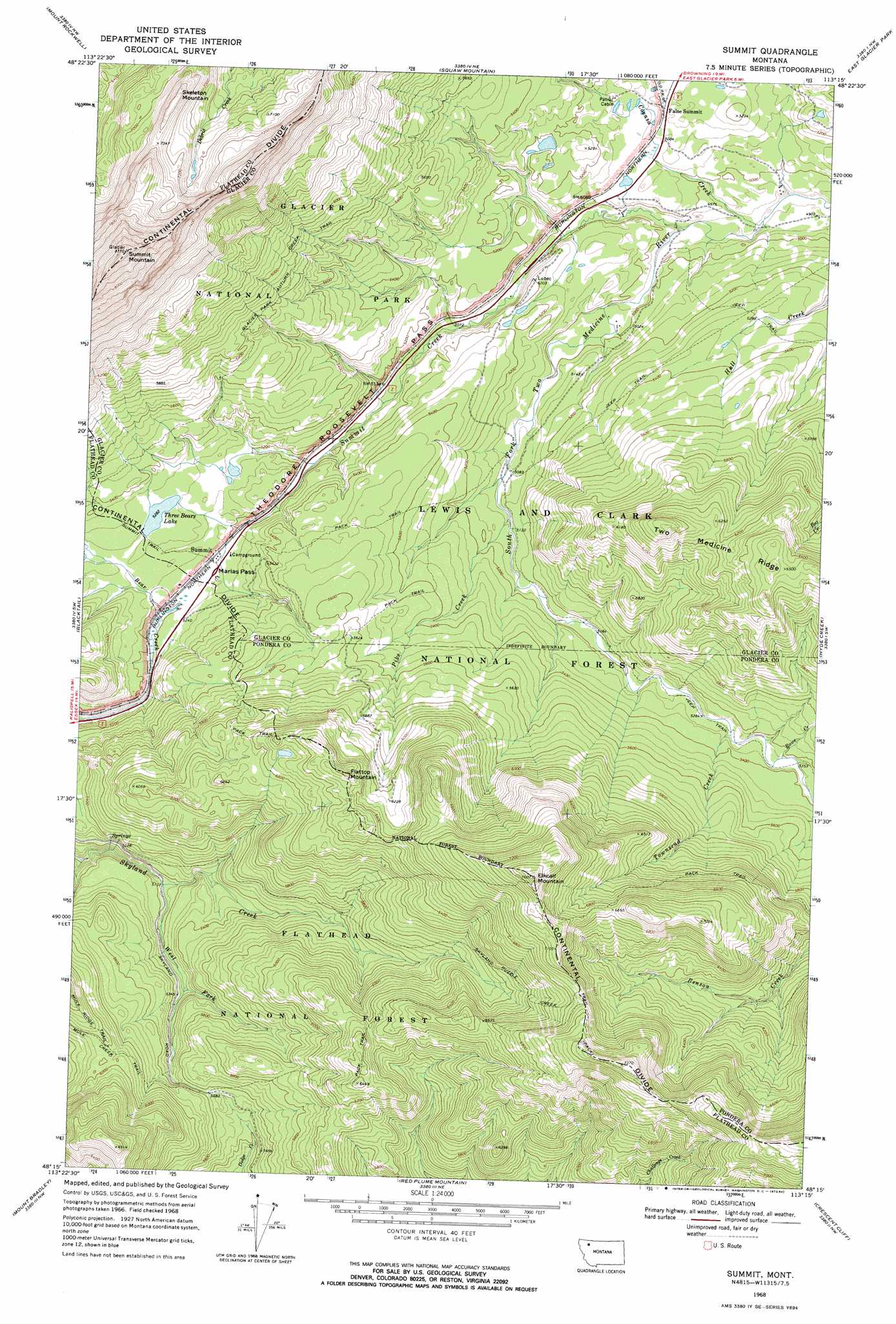
Summit Topo Map Montana
To zoom in, hover over the map of Summit
USGS Topo Quad 48113c3 - 1:24,000 scale
| Topo Map Name: | Summit |
| USGS Topo Quad ID: | 48113c3 |
| Print Size: | ca. 21 1/4" wide x 27" high |
| Southeast Coordinates: | 48.25° N latitude / 113.25° W longitude |
| Map Center Coordinates: | 48.3125° N latitude / 113.3125° W longitude |
| U.S. State: | MT |
| Filename: | o48113c3.jpg |
| Download Map JPG Image: | Summit topo map 1:24,000 scale |
| Map Type: | Topographic |
| Topo Series: | 7.5´ |
| Map Scale: | 1:24,000 |
| Source of Map Images: | United States Geological Survey (USGS) |
| Alternate Map Versions: |
Summit MT 1968, updated 1984 Download PDF Buy paper map Summit MT 1995, updated 1997 Download PDF Buy paper map Summit MT 2011 Download PDF Buy paper map Summit MT 2014 Download PDF Buy paper map |
| FStopo: | US Forest Service topo Summit is available: Download FStopo PDF Download FStopo TIF |
1:24,000 Topo Quads surrounding Summit
Mount Stimson |
Cut Bank Pass |
Kiowa |
Starr School |
Browning |
Mount Saint Nicholas |
Mount Rockwell |
Squaw Mountain |
East Glacier Park |
Big Rock |
Essex |
Blacktail |
Summit |
Hyde Creek |
Half Dome Crag |
Nimrod |
Mount Bradley |
Red Plume Mountain |
Crescent Cliff |
Morningstar Mountain |
Circus Peak |
Horseshoe Peak |
Capitol Mountain |
Gable Peaks |
Gooseberry Peak |
> Back to 48113a1 at 1:100,000 scale
> Back to 48112a1 at 1:250,000 scale
> Back to U.S. Topo Maps home
Summit topo map: Gazetteer
Summit: Gaps
Marias Pass elevation 1596m 5236′Summit: Lakes
Three Bears Lake elevation 1611m 5285′Summit: Populated Places
False Summit elevation 1555m 5101′Summit elevation 1592m 5223′
Summit: Post Offices
Lubec Post Office (historical) elevation 1562m 5124′Pike Post Office (historical) elevation 1529m 5016′
Summit: Streams
Coonsa Creek elevation 1489m 4885′Pike Creek elevation 1550m 5085′
Rowe Creek elevation 1634m 5360′
Summit elevation 1497m 4911′
Townsend Creek elevation 1617m 5305′
West Fork Skyland Creek elevation 1567m 5141′
Summit: Summits
Elkcalf Mountain elevation 2307m 7568′Flattop Mountain elevation 2016m 6614′
Skeleton Mountain elevation 2277m 7470′
Summit Mountain elevation 2651m 8697′
Summit: Trails
Summit Trail elevation 1611m 5285′Summit digital topo map on disk
Buy this Summit topo map showing relief, roads, GPS coordinates and other geographical features, as a high-resolution digital map file on DVD: