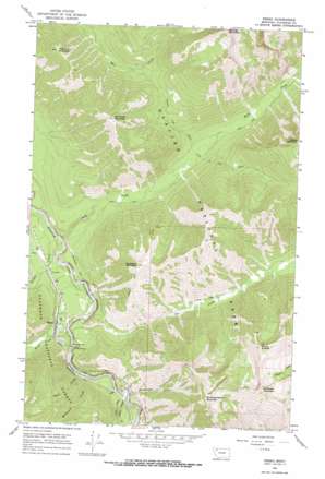
Essex Topo Map Montana
To zoom in, hover over the map of Essex
USGS Topo Quad 48113c5 - 1:24,000 scale
| Topo Map Name: | Essex |
| USGS Topo Quad ID: | 48113c5 |
| Print Size: | ca. 21 1/4" wide x 27" high |
| Southeast Coordinates: | 48.25° N latitude / 113.5° W longitude |
| Map Center Coordinates: | 48.3125° N latitude / 113.5625° W longitude |
| U.S. State: | MT |
| Filename: | o48113c5.jpg |
| Download Map JPG Image: | Essex topo map 1:24,000 scale |
| Map Type: | Topographic |
| Topo Series: | 7.5´ |
| Map Scale: | 1:24,000 |
| Source of Map Images: | United States Geological Survey (USGS) |
| Alternate Map Versions: |
Essex MT 1964, updated 1966 Download PDF Buy paper map Essex MT 1994, updated 1997 Download PDF Buy paper map Essex MT 2011 Download PDF Buy paper map Essex MT 2014 Download PDF Buy paper map |
| FStopo: | US Forest Service topo Essex is available: Download FStopo PDF Download FStopo TIF |
1:24,000 Topo Quads surrounding Essex
> Back to 48113a1 at 1:100,000 scale
> Back to 48112a1 at 1:250,000 scale
> Back to U.S. Topo Maps home
Essex topo map: Gazetteer
Essex: Gaps
Theodore Roosevelt Pass elevation 1142m 3746′Essex: Populated Places
Essex elevation 1179m 3868′Essex: Post Offices
Essex Post Office elevation 1168m 3832′Essex: Streams
Dickey Creek elevation 1119m 3671′Essex Creek elevation 1144m 3753′
McDonald Creek elevation 1164m 3818′
Ole Creek elevation 1135m 3723′
Park Creek elevation 1114m 3654′
Sheep Creek elevation 1161m 3809′
Tank Creek elevation 1158m 3799′
Essex: Summits
Mount Shields elevation 2173m 7129′Rampage Mountain elevation 2079m 6820′
Riverview Mountain elevation 1945m 6381′
Running Rabbit Mountain elevation 2342m 7683′
Salvage Mountain elevation 2507m 8225′
Scalplock Mountain elevation 2099m 6886′
Snowslip Mountain elevation 2203m 7227′
Soldier Mountain elevation 2227m 7306′
Essex: Trails
Fielding Coal Creek Trail elevation 1220m 4002′Essex: Valleys
Snowslide Gulch elevation 1156m 3792′Essex digital topo map on disk
Buy this Essex topo map showing relief, roads, GPS coordinates and other geographical features, as a high-resolution digital map file on DVD:


