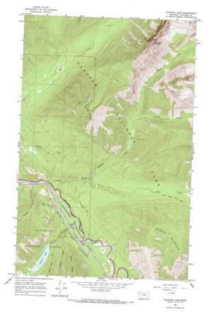
Stanton Lake Topo Map Montana
To zoom in, hover over the map of Stanton Lake
USGS Topo Quad 48113d6 - 1:24,000 scale
| Topo Map Name: | Stanton Lake |
| USGS Topo Quad ID: | 48113d6 |
| Print Size: | ca. 21 1/4" wide x 27" high |
| Southeast Coordinates: | 48.375° N latitude / 113.625° W longitude |
| Map Center Coordinates: | 48.4375° N latitude / 113.6875° W longitude |
| U.S. State: | MT |
| Filename: | o48113d6.jpg |
| Download Map JPG Image: | Stanton Lake topo map 1:24,000 scale |
| Map Type: | Topographic |
| Topo Series: | 7.5´ |
| Map Scale: | 1:24,000 |
| Source of Map Images: | United States Geological Survey (USGS) |
| Alternate Map Versions: |
Stanton Lake MT 1964, updated 1968 Download PDF Buy paper map Stanton Lake MT 1964, updated 1986 Download PDF Buy paper map Stanton Lake MT 1994, updated 1997 Download PDF Buy paper map Stanton Lake MT 2011 Download PDF Buy paper map Stanton Lake MT 2014 Download PDF Buy paper map |
| FStopo: | US Forest Service topo Stanton Lake is available: Download FStopo PDF Download FStopo TIF |
1:24,000 Topo Quads surrounding Stanton Lake
> Back to 48113a1 at 1:100,000 scale
> Back to 48112a1 at 1:250,000 scale
> Back to U.S. Topo Maps home
Stanton Lake topo map: Gazetteer
Stanton Lake: Lakes
Stanton Lake elevation 1141m 3743′Stanton Lake: Post Offices
Garry Post Office (historical) elevation 1082m 3549′Stanton Lake: Streams
Coal Creek elevation 1041m 3415′Crystal Creek elevation 1052m 3451′
Disbrow Creek elevation 1070m 3510′
Hidden Creek elevation 1086m 3562′
Peril Creek elevation 1243m 4078′
Pinchot Creek elevation 1100m 3608′
Stanton Creek elevation 1048m 3438′
Stanton Lake: Summits
Double Mountain elevation 1837m 6026′Threesuns Mountain elevation 2412m 7913′
Threetops Mountain elevation 2057m 6748′
Stanton Lake: Trails
Boundary Trail elevation 1149m 3769′Coal Creek Fire Trail elevation 1195m 3920′
Threetops Trail elevation 1335m 4379′
Stanton Lake digital topo map on disk
Buy this Stanton Lake topo map showing relief, roads, GPS coordinates and other geographical features, as a high-resolution digital map file on DVD:


