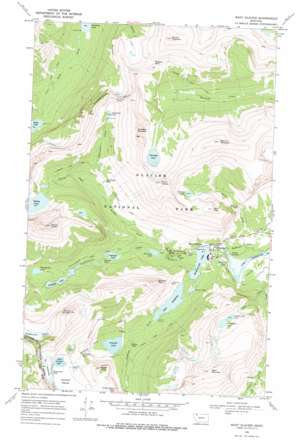
Many Glacier Topo Map Montana
To zoom in, hover over the map of Many Glacier
USGS Topo Quad 48113g6 - 1:24,000 scale
| Topo Map Name: | Many Glacier |
| USGS Topo Quad ID: | 48113g6 |
| Print Size: | ca. 21 1/4" wide x 27" high |
| Southeast Coordinates: | 48.75° N latitude / 113.625° W longitude |
| Map Center Coordinates: | 48.8125° N latitude / 113.6875° W longitude |
| U.S. State: | MT |
| Filename: | o48113g6.jpg |
| Download Map JPG Image: | Many Glacier topo map 1:24,000 scale |
| Map Type: | Topographic |
| Topo Series: | 7.5´ |
| Map Scale: | 1:24,000 |
| Source of Map Images: | United States Geological Survey (USGS) |
| Alternate Map Versions: |
Many Glacier MT 1968, updated 1972 Download PDF Buy paper map Many Glacier MT 1968, updated 1977 Download PDF Buy paper map Many Glacier MT 1968, updated 1977 Download PDF Buy paper map Many Glacier MT 2011 Download PDF Buy paper map Many Glacier MT 2014 Download PDF Buy paper map |
1:24,000 Topo Quads surrounding Many Glacier
> Back to 48113e1 at 1:100,000 scale
> Back to 48112a1 at 1:250,000 scale
> Back to U.S. Topo Maps home
Many Glacier topo map: Gazetteer
Many Glacier: Cliffs
Grinnell Point elevation 2195m 7201′The Garden Wall elevation 2285m 7496′
Many Glacier: Falls
Apikuni Falls elevation 1683m 5521′Feather Plume Falls elevation 1907m 6256′
Grinnell Falls elevation 1815m 5954′
Hidden Falls elevation 1517m 4977′
Ptarmigan Falls elevation 1725m 5659′
Redrock Falls elevation 1562m 5124′
Salamander Falls elevation 2131m 6991′
Swiftcurrent Falls elevation 1480m 4855′
Many Glacier: Flats
Apikuni Flat elevation 1484m 4868′Cracker Flats elevation 1475m 4839′
Many Glacier: Gaps
Redgap Pass elevation 2298m 7539′Many Glacier: Glaciers
Grinnell Glacier elevation 2038m 6686′Swiftcurrent Glacier elevation 2259m 7411′
The Salamander Glacier elevation 2204m 7230′
Many Glacier: Lakes
Bullhead Lake elevation 1580m 5183′Falling Leaf Lake elevation 2023m 6637′
Fishercap Lake elevation 1507m 4944′
Governor Pond elevation 1487m 4878′
Grinnell Lake elevation 1507m 4944′
Iceberg Lake elevation 1859m 6099′
Kennedy Lake elevation 2068m 6784′
Lake Josephine elevation 1488m 4881′
Natahki Lake elevation 2005m 6578′
Ptarmigan Lake elevation 2021m 6630′
Redrock Lake elevation 1549m 5082′
Snow Moon Lake elevation 2031m 6663′
Stump Lake elevation 1488m 4881′
Swiftcurrent Lake elevation 1488m 4881′
Upper Grinnell Lake elevation 1970m 6463′
Windmaker Lake elevation 1623m 5324′
Many Glacier: Mines
Josephine Mine elevation 1627m 5337′Many Glacier: Populated Places
Swiftcurrent elevation 1503m 4931′Many Glacier: Post Offices
Swiftcurrent Post Office (historical) elevation 1503m 4931′Many Glacier: Ridges
Ptarmigan Wall elevation 2244m 7362′Many Glacier: Streams
Allen Creek elevation 1466m 4809′Cataract Creek elevation 1488m 4881′
Grinnell Creek elevation 1504m 4934′
Iceberg Creek elevation 1642m 5387′
Ptarmigan Creek elevation 1642m 5387′
Wilbur Creek elevation 1507m 4944′
Many Glacier: Summits
Allen Mountain elevation 2864m 9396′Altyn Peak elevation 2419m 7936′
Angel Wing elevation 2257m 7404′
Apikuni Mountain elevation 2740m 8989′
Crowfeet Mountain elevation 2667m 8750′
Mount Grinnell elevation 2686m 8812′
Mount Henkel elevation 2658m 8720′
Mount Wilbur elevation 2838m 9311′
Seward Mountain elevation 2711m 8894′
Many Glacier: Trails
Grinnell Glacier Trail elevation 1764m 5787′Helen Lake Trail elevation 1512m 4960′
Iceberg Lake Trail elevation 1871m 6138′
Piegan Pass Trail elevation 1608m 5275′
Ptarmigan Trail elevation 1828m 5997′
Redgap Pass Trail elevation 1951m 6400′
Swiftcurrent Pass Trail elevation 1569m 5147′
Many Glacier: Tunnels
Ptarmigan Tunnel elevation 2164m 7099′Many Glacier: Wells
35N16W12CACC01 Well elevation 1477m 4845′35N16W12CBBB01 Well elevation 1474m 4835′
35N16W12CCAB01 Well elevation 1473m 4832′
35N16W12DCCA01 Well elevation 1472m 4829′
Many Glacier digital topo map on disk
Buy this Many Glacier topo map showing relief, roads, GPS coordinates and other geographical features, as a high-resolution digital map file on DVD:


