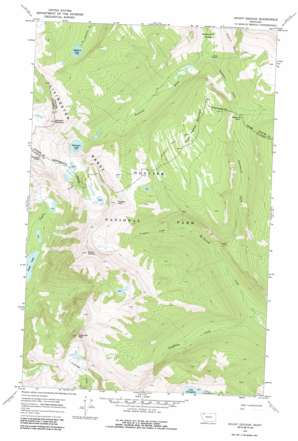
Mount Geduhn Topo Map Montana
To zoom in, hover over the map of Mount Geduhn
USGS Topo Quad 48113g8 - 1:24,000 scale
| Topo Map Name: | Mount Geduhn |
| USGS Topo Quad ID: | 48113g8 |
| Print Size: | ca. 21 1/4" wide x 27" high |
| Southeast Coordinates: | 48.75° N latitude / 113.875° W longitude |
| Map Center Coordinates: | 48.8125° N latitude / 113.9375° W longitude |
| U.S. State: | MT |
| Filename: | o48113g8.jpg |
| Download Map JPG Image: | Mount Geduhn topo map 1:24,000 scale |
| Map Type: | Topographic |
| Topo Series: | 7.5´ |
| Map Scale: | 1:24,000 |
| Source of Map Images: | United States Geological Survey (USGS) |
| Alternate Map Versions: |
Mount Geduhn MT 1968, updated 1972 Download PDF Buy paper map Mount Geduhn MT 1968, updated 1987 Download PDF Buy paper map Mount Geduhn MT 2011 Download PDF Buy paper map Mount Geduhn MT 2014 Download PDF Buy paper map |
1:24,000 Topo Quads surrounding Mount Geduhn
> Back to 48113e1 at 1:100,000 scale
> Back to 48112a1 at 1:250,000 scale
> Back to U.S. Topo Maps home
Mount Geduhn topo map: Gazetteer
Mount Geduhn: Gaps
Kootenai Pass elevation 1744m 5721′Mount Geduhn: Lakes
Grace Lake elevation 1209m 3966′Lake Evangeline elevation 1601m 5252′
Nahsukin Lake elevation 1650m 5413′
Redhorn Lake elevation 1863m 6112′
Mount Geduhn: Streams
Continental Creek elevation 1290m 4232′Kootenai Creek elevation 1436m 4711′
Longfellow Creek elevation 1214m 3982′
Trapper Creek elevation 1361m 4465′
Mount Geduhn: Summits
Anaconda Peak elevation 2489m 8166′Mount Geduhn elevation 2545m 8349′
Nahsukin Mountain elevation 2491m 8172′
Trapper Peak elevation 2348m 7703′
West Flattop Mountain elevation 2079m 6820′
Mount Geduhn: Trails
Waterton Valley Trail elevation 1785m 5856′Mount Geduhn digital topo map on disk
Buy this Mount Geduhn topo map showing relief, roads, GPS coordinates and other geographical features, as a high-resolution digital map file on DVD:


