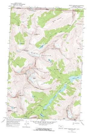
Mount Cleveland Topo Map Montana
To zoom in, hover over the map of Mount Cleveland
USGS Topo Quad 48113h7 - 1:24,000 scale
| Topo Map Name: | Mount Cleveland |
| USGS Topo Quad ID: | 48113h7 |
| Print Size: | ca. 21 1/4" wide x 27" high |
| Southeast Coordinates: | 48.875° N latitude / 113.75° W longitude |
| Map Center Coordinates: | 48.9375° N latitude / 113.8125° W longitude |
| U.S. State: | MT |
| Filename: | o48113h7.jpg |
| Download Map JPG Image: | Mount Cleveland topo map 1:24,000 scale |
| Map Type: | Topographic |
| Topo Series: | 7.5´ |
| Map Scale: | 1:24,000 |
| Source of Map Images: | United States Geological Survey (USGS) |
| Alternate Map Versions: |
Mount Cleveland MT 1968, updated 1971 Download PDF Buy paper map Mount Cleveland MT 1968, updated 1971 Download PDF Buy paper map Mount Cleveland MT 2011 Download PDF Buy paper map Mount Cleveland MT 2014 Download PDF Buy paper map |
1:24,000 Topo Quads surrounding Mount Cleveland
> Back to 48113e1 at 1:100,000 scale
> Back to 48112a1 at 1:250,000 scale
> Back to U.S. Topo Maps home
Mount Cleveland topo map: Gazetteer
Mount Cleveland: Falls
Miche Wabun Falls elevation 1691m 5547′Mokowanis Cascade elevation 1730m 5675′
White Quiver Falls elevation 1489m 4885′
Mount Cleveland: Gaps
Stoney Indian Pass elevation 2104m 6902′Mount Cleveland: Glaciers
Miche Wabun Glacier elevation 2132m 6994′Whitecrow Glacier elevation 2119m 6952′
Mount Cleveland: Lakes
Cosley Lake elevation 1477m 4845′Glenns Lake elevation 1483m 4865′
Goat Haunt Lake elevation 1825m 5987′
Kaina Lake elevation 2094m 6870′
Miche Wabun Lake elevation 1818m 5964′
Mokowanis Lake elevation 1520m 4986′
Stoney Indian Lake elevation 1929m 6328′
Whitecrow Lake elevation 1875m 6151′
Mount Cleveland: Ranges
Lewis Range elevation 2491m 8172′Wilson Range elevation 2170m 7119′
Mount Cleveland: Ridges
Cosley Ridge elevation 2477m 8126′Mount Cleveland: Streams
Kaina Creek elevation 1481m 4858′Pyramid Creek elevation 1483m 4865′
Whitecrow Creek elevation 1594m 5229′
Mount Cleveland: Summits
Bear Mountain elevation 2691m 8828′Goat Haunt Mountain elevation 2621m 8599′
Kaina Mountain elevation 2884m 9461′
Miche Wabun Peak elevation 2695m 8841′
Mount Cleveland elevation 3175m 10416′
Sarcee Mountain elevation 2545m 8349′
Stoney Indian Peaks elevation 2701m 8861′
Wahcheechee Mountain elevation 2566m 8418′
Whitecrow Mountain elevation 2209m 7247′
Mount Cleveland: Trails
Stoney Indian Pass Trail elevation 2001m 6564′Mount Cleveland digital topo map on disk
Buy this Mount Cleveland topo map showing relief, roads, GPS coordinates and other geographical features, as a high-resolution digital map file on DVD:


