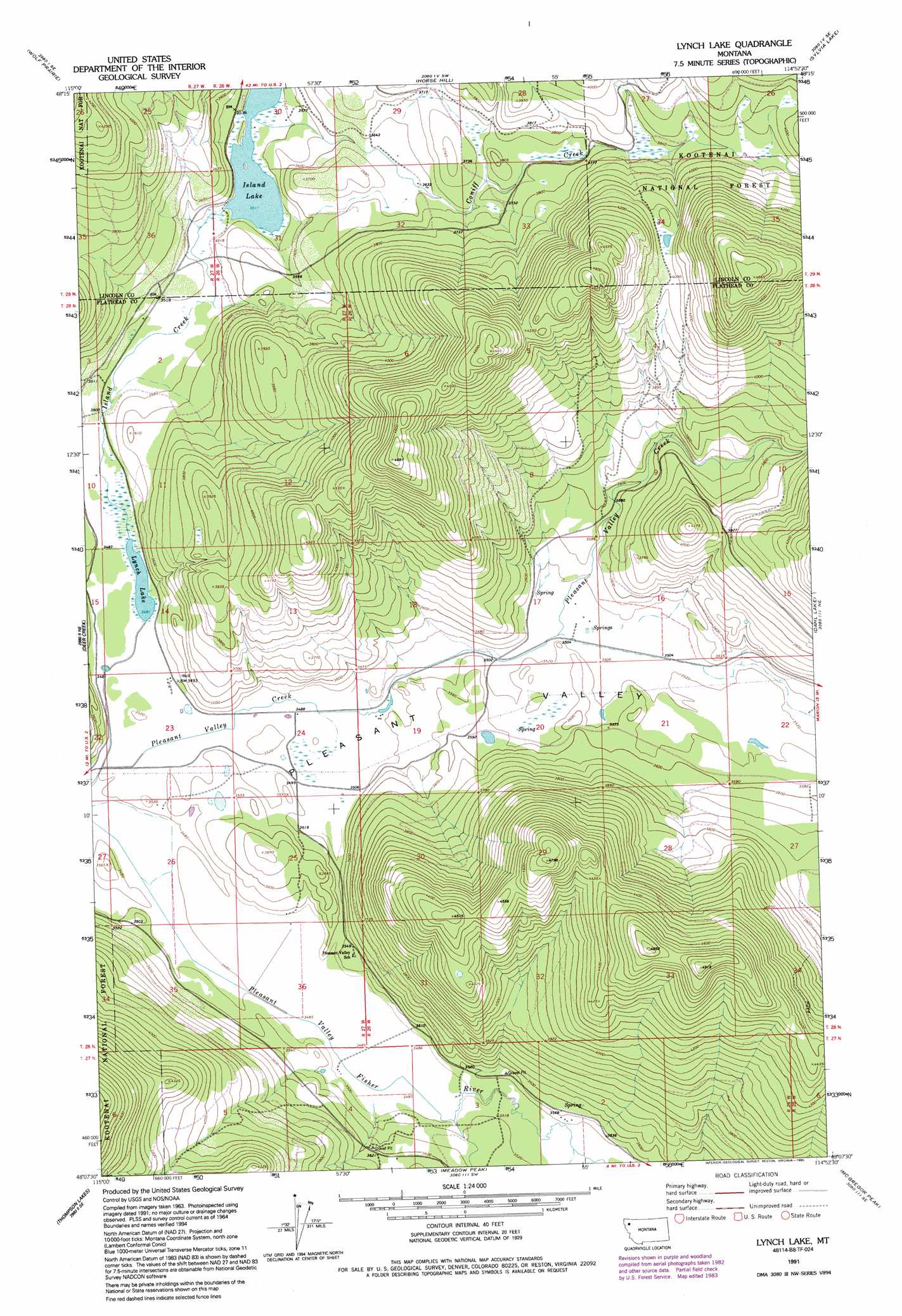
Lynch Lake Topo Map Montana
To zoom in, hover over the map of Lynch Lake
USGS Topo Quad 48114b8 - 1:24,000 scale
| Topo Map Name: | Lynch Lake |
| USGS Topo Quad ID: | 48114b8 |
| Print Size: | ca. 21 1/4" wide x 27" high |
| Southeast Coordinates: | 48.125° N latitude / 114.875° W longitude |
| Map Center Coordinates: | 48.1875° N latitude / 114.9375° W longitude |
| U.S. State: | MT |
| Filename: | o48114b8.jpg |
| Download Map JPG Image: | Lynch Lake topo map 1:24,000 scale |
| Map Type: | Topographic |
| Topo Series: | 7.5´ |
| Map Scale: | 1:24,000 |
| Source of Map Images: | United States Geological Survey (USGS) |
| Alternate Map Versions: |
Lynch Lake MT 1964, updated 1967 Download PDF Buy paper map Lynch Lake MT 1964, updated 1984 Download PDF Buy paper map Lynch Lake MT 1991, updated 1995 Download PDF Buy paper map Lynch Lake MT 1997, updated 2000 Download PDF Buy paper map Lynch Lake MT 2011 Download PDF Buy paper map Lynch Lake MT 2014 Download PDF Buy paper map |
| FStopo: | US Forest Service topo Lynch Lake is available: Download FStopo PDF Download FStopo TIF |
1:24,000 Topo Quads surrounding Lynch Lake
Cripple Horse Mountain |
Warland Peak |
Bowen Lake |
Dunsire Point |
Johnson Peak |
Richards Mountain |
Wolf Prairie |
Horse Hill |
Sylvia Lake |
Ashley Mountain |
Calx Mountain |
Deer Creek |
Lynch Lake |
Dahl Lake |
Pleasant Valley Mountain |
Loon Lake |
Thompson Lakes |
Meadow Peak |
Mcgregor Peak |
Marion |
Mantrap Fork |
Bend |
Shroder Creek |
Murr Peak |
Hubbart Reservoir |
> Back to 48114a1 at 1:100,000 scale
> Back to 48114a1 at 1:250,000 scale
> Back to U.S. Topo Maps home
Lynch Lake topo map: Gazetteer
Lynch Lake: Lakes
Island Lake elevation 1071m 3513′Lynch Lake elevation 1062m 3484′
Lynch Lake: Post Offices
Pleasant Valley Post Office (historical) elevation 1068m 3503′Richland Post Office (historical) elevation 1073m 3520′
Lynch Lake: Streams
Coniff Creek elevation 1071m 3513′Island Creek elevation 1062m 3484′
Lynch Lake digital topo map on disk
Buy this Lynch Lake topo map showing relief, roads, GPS coordinates and other geographical features, as a high-resolution digital map file on DVD: