Lost Creek Divide Topo Map Montana
To zoom in, hover over the map of Lost Creek Divide
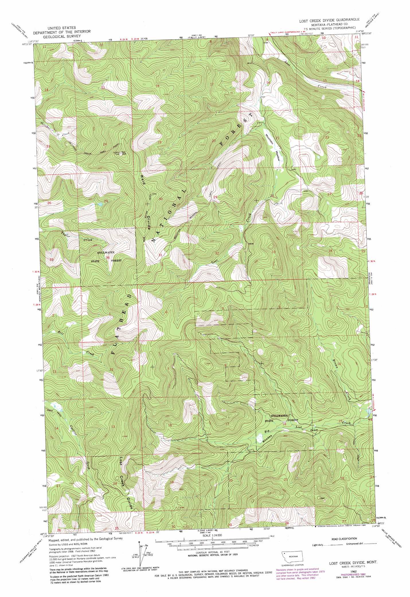
USGS Topo Quad 48114c5 - 1:24,000 scale
| Topo Map Name: | Lost Creek Divide |
| USGS Topo Quad ID: | 48114c5 |
| Print Size: | ca. 21 1/4" wide x 27" high |
| Southeast Coordinates: | 48.25° N latitude / 114.5° W longitude |
| Map Center Coordinates: | 48.3125° N latitude / 114.5625° W longitude |
| U.S. State: | MT |
| Filename: | o48114c5.jpg |
| Download Map JPG Image: | Lost Creek Divide topo map 1:24,000 scale |
| Map Type: | Topographic |
| Topo Series: | 7.5´ |
| Map Scale: | 1:24,000 |
| Source of Map Images: | United States Geological Survey (USGS) |
| Alternate Map Versions: |
Lost Creek Divide MT 1962, updated 1964 Download PDF Buy paper map Lost Creek Divide MT 1962, updated 1969 Download PDF Buy paper map Lost Creek Divide MT 1962, updated 1983 Download PDF Buy paper map Lost Creek Divide MT 1990, updated 1997 Download PDF Buy paper map Lost Creek Divide MT 2011 Download PDF Buy paper map Lost Creek Divide MT 2014 Download PDF Buy paper map |
| FStopo: | US Forest Service topo Lost Creek Divide is available: Download FStopo PDF Download FStopo TIF |
1:24,000 Topo Quads surrounding Lost Creek Divide
Sunday Mountain |
Radnor |
Olney |
Werner Peak |
Skookoleel Creek |
Dunsire Point |
Johnson Peak |
Tally Lake |
Beaver Lake |
Whitefish |
Sylvia Lake |
Ashley Mountain |
Lost Creek Divide |
Rhodes |
Rose Crossing |
Dahl Lake |
Pleasant Valley Mountain |
Lone Lake |
Blue Grass Ridge |
Kalispell |
Mcgregor Peak |
Marion |
Haskill Mountain |
Kila |
Lion Mountain |
> Back to 48114a1 at 1:100,000 scale
> Back to 48114a1 at 1:250,000 scale
> Back to U.S. Topo Maps home
Lost Creek Divide topo map: Gazetteer
Lost Creek Divide: Flats
Mountain Meadow elevation 1264m 4146′Lost Creek Divide: Ridges
Lost Creek Divide elevation 1618m 5308′Reid Divide elevation 1745m 5725′
Lost Creek Divide: Trails
Mountain Meadow Trail elevation 1571m 5154′Oettiker Creek Trail elevation 1622m 5321′
Reid Divide Trail elevation 1723m 5652′
Tally Mountain Billy Creek Trail elevation 1706m 5597′
Lost Creek Divide digital topo map on disk
Buy this Lost Creek Divide topo map showing relief, roads, GPS coordinates and other geographical features, as a high-resolution digital map file on DVD: