Bowen Lake Topo Map Montana
To zoom in, hover over the map of Bowen Lake
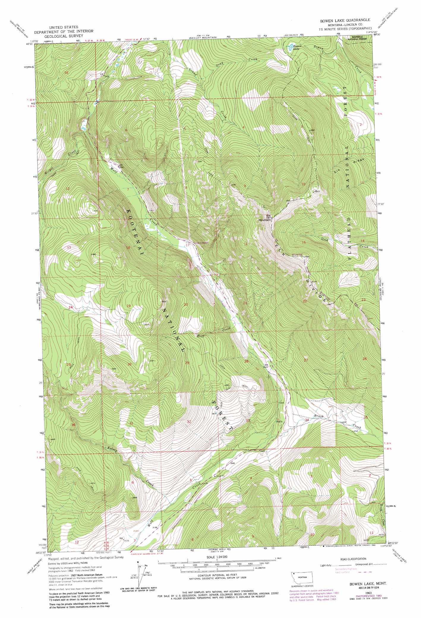
USGS Topo Quad 48114d8 - 1:24,000 scale
| Topo Map Name: | Bowen Lake |
| USGS Topo Quad ID: | 48114d8 |
| Print Size: | ca. 21 1/4" wide x 27" high |
| Southeast Coordinates: | 48.375° N latitude / 114.875° W longitude |
| Map Center Coordinates: | 48.4375° N latitude / 114.9375° W longitude |
| U.S. State: | MT |
| Filename: | o48114d8.jpg |
| Download Map JPG Image: | Bowen Lake topo map 1:24,000 scale |
| Map Type: | Topographic |
| Topo Series: | 7.5´ |
| Map Scale: | 1:24,000 |
| Source of Map Images: | United States Geological Survey (USGS) |
| Alternate Map Versions: |
Bowen Lake MT 1963, updated 1966 Download PDF Buy paper map Bowen Lake MT 1963, updated 1984 Download PDF Buy paper map Bowen Lake MT 1997, updated 2000 Download PDF Buy paper map Bowen Lake MT 2011 Download PDF Buy paper map Bowen Lake MT 2014 Download PDF Buy paper map |
| FStopo: | US Forest Service topo Bowen Lake is available: Download FStopo PDF Download FStopo TIF |
1:24,000 Topo Quads surrounding Bowen Lake
Mcguire Mountain |
Pinkham Mountain |
Edna Mountain |
Stryker |
Bull Lake |
Volcour |
Davis Mountain |
Skillet Mountain |
Sunday Mountain |
Radnor |
Cripple Horse Mountain |
Warland Peak |
Bowen Lake |
Dunsire Point |
Johnson Peak |
Richards Mountain |
Wolf Prairie |
Horse Hill |
Sylvia Lake |
Ashley Mountain |
Calx Mountain |
Deer Creek |
Lynch Lake |
Dahl Lake |
Pleasant Valley Mountain |
> Back to 48114a1 at 1:100,000 scale
> Back to 48114a1 at 1:250,000 scale
> Back to U.S. Topo Maps home
Bowen Lake topo map: Gazetteer
Bowen Lake: Lakes
Bowen Lake elevation 1560m 5118′Bowen Lake: Ridges
Elk Ridge elevation 1609m 5278′Bowen Lake: Streams
Brush Creek elevation 985m 3231′Gray Creek elevation 1310m 4297′
Kelsey Creek elevation 960m 3149′
Rock Creek elevation 1060m 3477′
Weigel Creek elevation 1098m 3602′
Bowen Lake: Summits
Elk Mountain elevation 1987m 6519′Bowen Lake digital topo map on disk
Buy this Bowen Lake topo map showing relief, roads, GPS coordinates and other geographical features, as a high-resolution digital map file on DVD: