Moose Peak Topo Map Montana
To zoom in, hover over the map of Moose Peak
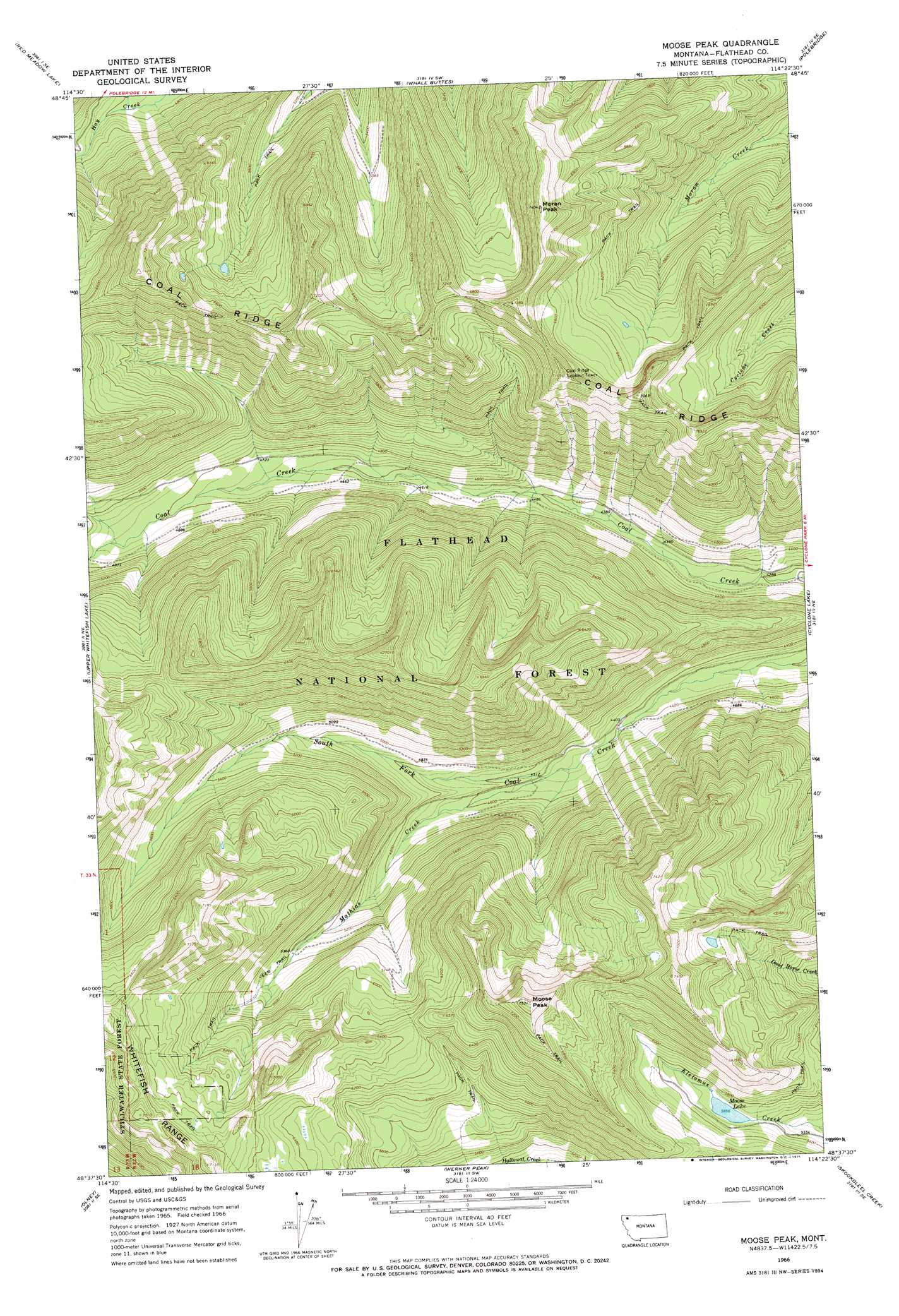
USGS Topo Quad 48114f4 - 1:24,000 scale
| Topo Map Name: | Moose Peak |
| USGS Topo Quad ID: | 48114f4 |
| Print Size: | ca. 21 1/4" wide x 27" high |
| Southeast Coordinates: | 48.625° N latitude / 114.375° W longitude |
| Map Center Coordinates: | 48.6875° N latitude / 114.4375° W longitude |
| U.S. State: | MT |
| Filename: | o48114f4.jpg |
| Download Map JPG Image: | Moose Peak topo map 1:24,000 scale |
| Map Type: | Topographic |
| Topo Series: | 7.5´ |
| Map Scale: | 1:24,000 |
| Source of Map Images: | United States Geological Survey (USGS) |
| Alternate Map Versions: |
Moose Peak MT 1966, updated 1971 Download PDF Buy paper map Moose Peak MT 1994, updated 1997 Download PDF Buy paper map Moose Peak MT 2011 Download PDF Buy paper map Moose Peak MT 2014 Download PDF Buy paper map |
| FStopo: | US Forest Service topo Moose Peak is available: Download FStopo PDF Download FStopo TIF |
1:24,000 Topo Quads surrounding Moose Peak
Tuchuck Mountain |
Mount Hefty |
Trailcreek |
Kintla Lake |
Kintla Peak |
Mount Thompson-Seton |
Red Meadow Lake |
Whale Buttes |
Polebridge |
Quartz Ridge |
Bull Lake |
Upper Whitefish Lake |
Moose Peak |
Cyclone Lake |
Demers Ridge |
Radnor |
Olney |
Werner Peak |
Skookoleel Creek |
Huckleberry Mountain |
Johnson Peak |
Tally Lake |
Beaver Lake |
Whitefish |
Columbia Falls North |
> Back to 48114e1 at 1:100,000 scale
> Back to 48114a1 at 1:250,000 scale
> Back to U.S. Topo Maps home
Moose Peak topo map: Gazetteer
Moose Peak: Lakes
Moose Lake elevation 1725m 5659′Moose Peak: Ranges
Whitefish Range elevation 2128m 6981′Moose Peak: Ridges
Coal Ridge elevation 2102m 6896′Moose Peak: Streams
Mathias Creek elevation 1375m 4511′Moose Peak: Summits
Moose Peak elevation 2293m 7522′Moran Peak elevation 2259m 7411′
Moose Peak digital topo map on disk
Buy this Moose Peak topo map showing relief, roads, GPS coordinates and other geographical features, as a high-resolution digital map file on DVD: