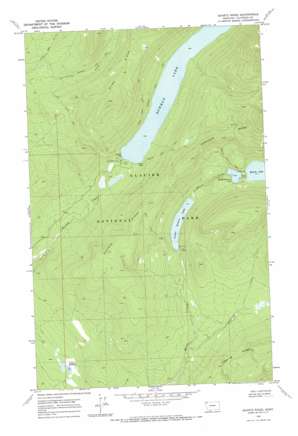
Quartz Ridge Topo Map Montana
To zoom in, hover over the map of Quartz Ridge
USGS Topo Quad 48114g2 - 1:24,000 scale
| Topo Map Name: | Quartz Ridge |
| USGS Topo Quad ID: | 48114g2 |
| Print Size: | ca. 21 1/4" wide x 27" high |
| Southeast Coordinates: | 48.75° N latitude / 114.125° W longitude |
| Map Center Coordinates: | 48.8125° N latitude / 114.1875° W longitude |
| U.S. State: | MT |
| Filename: | o48114g2.jpg |
| Download Map JPG Image: | Quartz Ridge topo map 1:24,000 scale |
| Map Type: | Topographic |
| Topo Series: | 7.5´ |
| Map Scale: | 1:24,000 |
| Source of Map Images: | United States Geological Survey (USGS) |
| Alternate Map Versions: |
Quartz Ridge MT 1968, updated 1971 Download PDF Buy paper map Quartz Ridge MT 2011 Download PDF Buy paper map Quartz Ridge MT 2014 Download PDF Buy paper map |
1:24,000 Topo Quads surrounding Quartz Ridge
> Back to 48114e1 at 1:100,000 scale
> Back to 48114a1 at 1:250,000 scale
> Back to U.S. Topo Maps home
Quartz Ridge topo map: Gazetteer
Quartz Ridge: Flats
Hidden Meadow elevation 1166m 3825′Quartz Ridge: Lakes
Bowman Lake elevation 1230m 4035′Lower Quartz Lake elevation 1279m 4196′
Middle Quartz Lake elevation 1341m 4399′
Quartz Ridge: Post Offices
Bowman Lake Post Office (historical) elevation 1234m 4048′Quartz Ridge: Ridges
Logging Ridge elevation 1481m 4858′Quartz Ridge elevation 1569m 5147′
Quartz Ridge: Streams
Cummings Creek elevation 1216m 3989′Long Bow Creek elevation 1297m 4255′
Quartz Ridge: Trails
Akokala Lake Trail elevation 1424m 4671′Numa Ridge Lookout Trail elevation 1495m 4904′
Quartz Lake Trail elevation 1652m 5419′
Quartz Ridge digital topo map on disk
Buy this Quartz Ridge topo map showing relief, roads, GPS coordinates and other geographical features, as a high-resolution digital map file on DVD:


