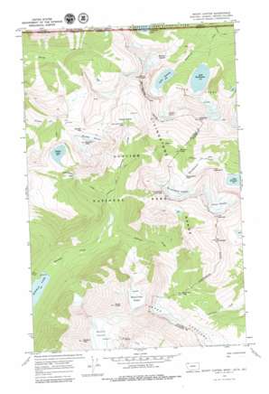
Mount Carter Topo Map Montana
To zoom in, hover over the map of Mount Carter
USGS Topo Quad 48114h1 - 1:24,000 scale
| Topo Map Name: | Mount Carter |
| USGS Topo Quad ID: | 48114h1 |
| Print Size: | ca. 21 1/4" wide x 27" high |
| Southeast Coordinates: | 48.875° N latitude / 114° W longitude |
| Map Center Coordinates: | 48.9375° N latitude / 114.0625° W longitude |
| U.S. State: | MT |
| Filename: | o48114h1.jpg |
| Download Map JPG Image: | Mount Carter topo map 1:24,000 scale |
| Map Type: | Topographic |
| Topo Series: | 7.5´ |
| Map Scale: | 1:24,000 |
| Source of Map Images: | United States Geological Survey (USGS) |
| Alternate Map Versions: |
Mount Carter MT 1968, updated 1972 Download PDF Buy paper map Mount Carter MT 1968, updated 1979 Download PDF Buy paper map Mount Carter MT 1968, updated 1979 Download PDF Buy paper map Mount Carter MT 2011 Download PDF Buy paper map Mount Carter MT 2014 Download PDF Buy paper map |
1:24,000 Topo Quads surrounding Mount Carter
> Back to 48114e1 at 1:100,000 scale
> Back to 48114a1 at 1:250,000 scale
> Back to U.S. Topo Maps home
Mount Carter topo map: Gazetteer
Mount Carter: Basins
Hole-in-the Wall elevation 1917m 6289′Mount Carter: Cliffs
The Hawksbill elevation 2150m 7053′Mount Carter: Falls
Hole-in-the Wall Falls elevation 1907m 6256′Thunderbird Falls elevation 2031m 6663′
Mount Carter: Gaps
Boulder Pass elevation 2268m 7440′Brown Pass elevation 1910m 6266′
Jefferson Pass elevation 1998m 6555′
Mount Carter: Glaciers
Boulder Glacier elevation 2366m 7762′Carter Glaciers elevation 2318m 7604′
Dixon Glacier elevation 2280m 7480′
Herbst Glacier elevation 2221m 7286′
Hudson Glacier elevation 2143m 7030′
Rainbow Glacier elevation 2506m 8221′
Thunderbird Glacier elevation 2291m 7516′
Weasel Collar Glacier elevation 2190m 7185′
Mount Carter: Lakes
Cameron Lake elevation 1661m 5449′Lake Frances elevation 1603m 5259′
Lake Nooney elevation 1678m 5505′
Lake Wurdeman elevation 1606m 5269′
North Lakes elevation 1606m 5269′
Pocket Lake elevation 2017m 6617′
Mount Carter: Ranges
Livingston Range elevation 2841m 9320′Mount Carter: Streams
Jefferson Creek elevation 1254m 4114′Numa Creek elevation 1234m 4048′
Pocket Creek elevation 1306m 4284′
Thunderbird Creek elevation 1603m 5259′
Mount Carter: Summits
Boulder Peak elevation 2599m 8526′Chapman Peak elevation 2841m 9320′
Mount Carter elevation 2996m 9829′
Mount Custer elevation 2683m 8802′
Rainbow Peak elevation 2988m 9803′
The Guardhouse elevation 2844m 9330′
The Sentinel elevation 2679m 8789′
Thunderbird Mountain elevation 2629m 8625′
Mount Carter digital topo map on disk
Buy this Mount Carter topo map showing relief, roads, GPS coordinates and other geographical features, as a high-resolution digital map file on DVD:


