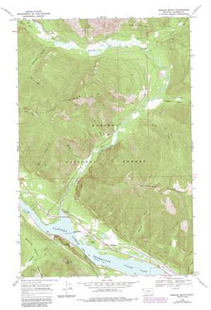
Smeads Bench Topo Map Montana
To zoom in, hover over the map of Smeads Bench
USGS Topo Quad 48115a7 - 1:24,000 scale
| Topo Map Name: | Smeads Bench |
| USGS Topo Quad ID: | 48115a7 |
| Print Size: | ca. 21 1/4" wide x 27" high |
| Southeast Coordinates: | 48° N latitude / 115.75° W longitude |
| Map Center Coordinates: | 48.0625° N latitude / 115.8125° W longitude |
| U.S. State: | MT |
| Filename: | o48115a7.jpg |
| Download Map JPG Image: | Smeads Bench topo map 1:24,000 scale |
| Map Type: | Topographic |
| Topo Series: | 7.5´ |
| Map Scale: | 1:24,000 |
| Source of Map Images: | United States Geological Survey (USGS) |
| Alternate Map Versions: |
Smeads Bench MT 1966, updated 1971 Download PDF Buy paper map Smeads Bench MT 1966, updated 1984 Download PDF Buy paper map Smeads Bench MT 1997, updated 2000 Download PDF Buy paper map Smeads Bench MT 2011 Download PDF Buy paper map Smeads Bench MT 2014 Download PDF Buy paper map |
| FStopo: | US Forest Service topo Smeads Bench is available: Download FStopo PDF Download FStopo TIF |
1:24,000 Topo Quads surrounding Smeads Bench
> Back to 48115a1 at 1:100,000 scale
> Back to 48114a1 at 1:250,000 scale
> Back to U.S. Topo Maps home
Smeads Bench topo map: Gazetteer
Smeads Bench: Benches
Smeads Bench elevation 905m 2969′Smeads Bench: Forests
Kaniksu National Forest elevation 685m 2247′Smeads Bench: Populated Places
Smead (historical) elevation 666m 2185′Smeads Bench: Post Offices
Smead Post Office (historical) elevation 666m 2185′Smeads Bench: Ridges
Pilik Ridge elevation 1780m 5839′Smeads Bench: Streams
Basin Creek elevation 690m 2263′Bull River elevation 664m 2178′
East Fork Bull River elevation 699m 2293′
Miller Creek elevation 747m 2450′
Smeads Creek elevation 701m 2299′
Smoky Creek elevation 674m 2211′
Snake Creek elevation 752m 2467′
Soldier Creek elevation 665m 2181′
Smeads Bench: Summits
Chimney Rock elevation 1307m 4288′Government Mountain elevation 1838m 6030′
Smeads Bench: Valleys
Copper Gulch elevation 694m 2276′Ellis Gulch elevation 679m 2227′
Gin Gulch elevation 688m 2257′
Hemlock Gulch elevation 940m 3083′
Napoleon Gulch elevation 706m 2316′
Star Gulch elevation 708m 2322′
Thirteen Gulch elevation 684m 2244′
Smeads Bench: Wells
26N33W03CACD01 Well elevation 699m 2293′26N33W04CBAB01 Well elevation 721m 2365′
Smeads Bench digital topo map on disk
Buy this Smeads Bench topo map showing relief, roads, GPS coordinates and other geographical features, as a high-resolution digital map file on DVD:


