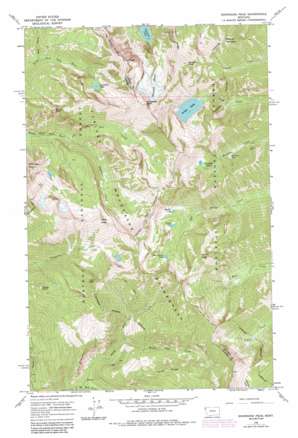
Snowshoe Peak Topo Map Montana
To zoom in, hover over the map of Snowshoe Peak
USGS Topo Quad 48115b6 - 1:24,000 scale
| Topo Map Name: | Snowshoe Peak |
| USGS Topo Quad ID: | 48115b6 |
| Print Size: | ca. 21 1/4" wide x 27" high |
| Southeast Coordinates: | 48.125° N latitude / 115.625° W longitude |
| Map Center Coordinates: | 48.1875° N latitude / 115.6875° W longitude |
| U.S. State: | MT |
| Filename: | o48115b6.jpg |
| Download Map JPG Image: | Snowshoe Peak topo map 1:24,000 scale |
| Map Type: | Topographic |
| Topo Series: | 7.5´ |
| Map Scale: | 1:24,000 |
| Source of Map Images: | United States Geological Survey (USGS) |
| Alternate Map Versions: |
Snowshoe Peak MT 1966, updated 1971 Download PDF Buy paper map Snowshoe Peak MT 1966, updated 1984 Download PDF Buy paper map Snowshoe Peak MT 1997, updated 2000 Download PDF Buy paper map Snowshoe Peak MT 2011 Download PDF Buy paper map Snowshoe Peak MT 2014 Download PDF Buy paper map |
| FStopo: | US Forest Service topo Snowshoe Peak is available: Download FStopo PDF Download FStopo TIF |
1:24,000 Topo Quads surrounding Snowshoe Peak
> Back to 48115a1 at 1:100,000 scale
> Back to 48114a1 at 1:250,000 scale
> Back to U.S. Topo Maps home
Snowshoe Peak topo map: Gazetteer
Snowshoe Peak: Glaciers
Blackwell Glacier elevation 2093m 6866′Snowshoe Peak: Lakes
Big Cherry Lake elevation 1789m 5869′Granite Lake elevation 1405m 4609′
Leigh Lake elevation 1569m 5147′
Little Ibex Lake elevation 1579m 5180′
Martin Lake elevation 1603m 5259′
Snowshoe Lake elevation 1874m 6148′
Snowshoe Lakes elevation 1720m 5643′
Tahoka Lake elevation 1655m 5429′
Snowshoe Peak: Mines
Big Sky Mine elevation 1365m 4478′Saint Paul Mine elevation 1462m 4796′
Saint Paul Mine elevation 1459m 4786′
Silver Cable Mine elevation 1389m 4557′
Snowshoe Mine elevation 1392m 4566′
Snowshoe Mine elevation 1395m 4576′
Snowshoe Peak: Pillars
Goat Rocks elevation 1293m 4242′Snowshoe Peak: Post Offices
Snowshoe Post Office (historical) elevation 1375m 4511′Snowshoe Peak: Ridges
Hayes Ridge elevation 1689m 5541′Vimy Ridge elevation 2267m 7437′
Snowshoe Peak: Streams
Bighorn Creek elevation 1277m 4189′Devils Club Creek elevation 1046m 3431′
Ibex Creek elevation 1277m 4189′
Verdun Creek elevation 1384m 4540′
Snowshoe Peak: Summits
A Peak elevation 2625m 8612′Alaska Peak elevation 2129m 6984′
Big Loaf Mountain elevation 2311m 7582′
Bockman Peak elevation 2490m 8169′
Dad Peak elevation 2063m 6768′
Lentz Peak elevation 2221m 7286′
Poplar Point elevation 1750m 5741′
Scotty Peak elevation 2063m 6768′
Snowshoe Peak elevation 2654m 8707′
Snowshoe Peak digital topo map on disk
Buy this Snowshoe Peak topo map showing relief, roads, GPS coordinates and other geographical features, as a high-resolution digital map file on DVD:


