Lost Horse Mountain Topo Map Montana
To zoom in, hover over the map of Lost Horse Mountain
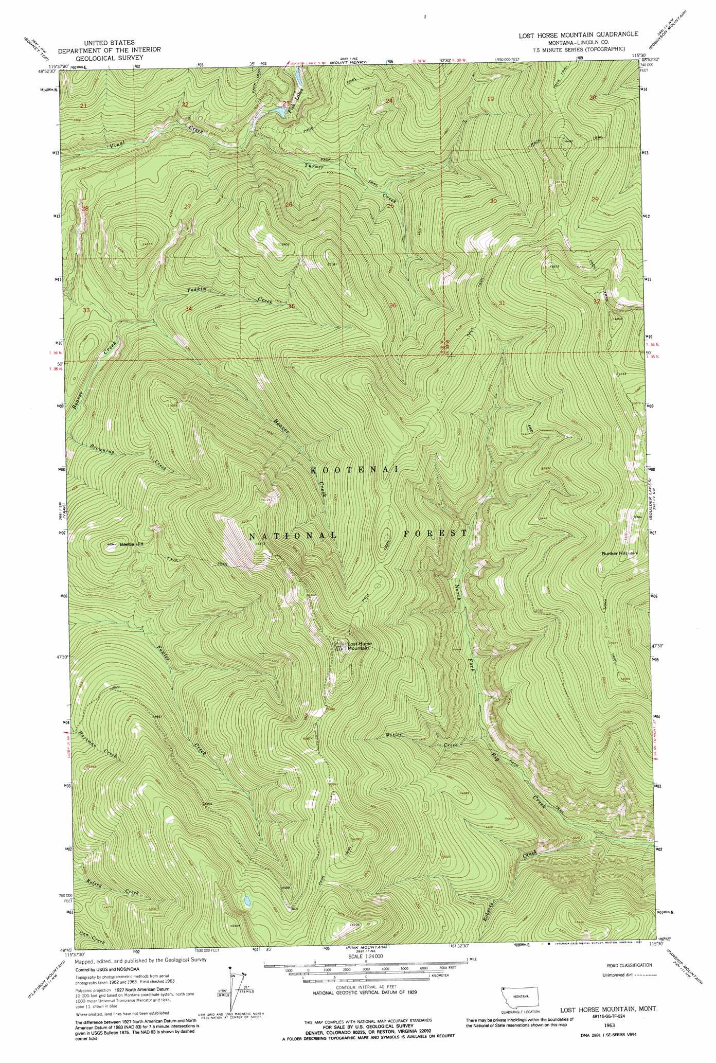
USGS Topo Quad 48115g5 - 1:24,000 scale
| Topo Map Name: | Lost Horse Mountain |
| USGS Topo Quad ID: | 48115g5 |
| Print Size: | ca. 21 1/4" wide x 27" high |
| Southeast Coordinates: | 48.75° N latitude / 115.5° W longitude |
| Map Center Coordinates: | 48.8125° N latitude / 115.5625° W longitude |
| U.S. State: | MT |
| Filename: | o48115g5.jpg |
| Download Map JPG Image: | Lost Horse Mountain topo map 1:24,000 scale |
| Map Type: | Topographic |
| Topo Series: | 7.5´ |
| Map Scale: | 1:24,000 |
| Source of Map Images: | United States Geological Survey (USGS) |
| Alternate Map Versions: |
Lost Horse Mountain MT 1963, updated 1966 Download PDF Buy paper map Lost Horse Mountain MT 1963, updated 1991 Download PDF Buy paper map Lost Horse Mountain MT 1997, updated 2000 Download PDF Buy paper map Lost Horse Mountain MT 2011 Download PDF Buy paper map Lost Horse Mountain MT 2014 Download PDF Buy paper map |
| FStopo: | US Forest Service topo Lost Horse Mountain is available: Download FStopo PDF Download FStopo TIF |
1:24,000 Topo Quads surrounding Lost Horse Mountain
Garver Mountain |
Bonnet Top |
Mount Henry |
Robinson Mountain |
Red Mountain |
Clark Mountain |
Yaak |
Lost Horse Mountain |
Boulder Lakes |
Webb Mountain |
Sylvanite |
Flatiron Mountain |
Pink Mountain |
Parsnip Mountain |
Inch Mountain |
Pulpit Mountain |
Turner Mountain |
Gold Hill |
Banfield Mountain |
Ural |
> Back to 48115e1 at 1:100,000 scale
> Back to 48114a1 at 1:250,000 scale
> Back to U.S. Topo Maps home
Lost Horse Mountain topo map: Gazetteer
Lost Horse Mountain: Falls
Turner Falls elevation 1090m 3576′Lost Horse Mountain: Streams
Mesler Creek elevation 1143m 3750′Roberts Creek elevation 1031m 3382′
Turner Creek elevation 1071m 3513′
Yodlin Creek elevation 1157m 3795′
Lost Horse Mountain: Summits
Beetle Hill elevation 1491m 4891′Bunker Hill elevation 1979m 6492′
Lost Horse Mountain elevation 1993m 6538′
Lost Horse Mountain digital topo map on disk
Buy this Lost Horse Mountain topo map showing relief, roads, GPS coordinates and other geographical features, as a high-resolution digital map file on DVD: