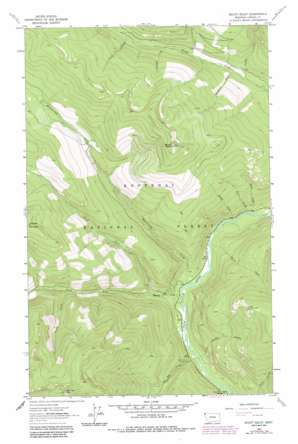
Mount Baldy Topo Map Montana
To zoom in, hover over the map of Mount Baldy
USGS Topo Quad 48115g8 - 1:24,000 scale
| Topo Map Name: | Mount Baldy |
| USGS Topo Quad ID: | 48115g8 |
| Print Size: | ca. 21 1/4" wide x 27" high |
| Southeast Coordinates: | 48.75° N latitude / 115.875° W longitude |
| Map Center Coordinates: | 48.8125° N latitude / 115.9375° W longitude |
| U.S. State: | MT |
| Filename: | o48115g8.jpg |
| Download Map JPG Image: | Mount Baldy topo map 1:24,000 scale |
| Map Type: | Topographic |
| Topo Series: | 7.5´ |
| Map Scale: | 1:24,000 |
| Source of Map Images: | United States Geological Survey (USGS) |
| Alternate Map Versions: |
Mount Baldy MT 1963, updated 1966 Download PDF Buy paper map Mount Baldy MT 1963, updated 1984 Download PDF Buy paper map Mount Baldy MT 1997, updated 2000 Download PDF Buy paper map Mount Baldy MT 2011 Download PDF Buy paper map Mount Baldy MT 2014 Download PDF Buy paper map |
| FStopo: | US Forest Service topo Mount Baldy is available: Download FStopo PDF Download FStopo TIF |
1:24,000 Topo Quads surrounding Mount Baldy
> Back to 48115e1 at 1:100,000 scale
> Back to 48114a1 at 1:250,000 scale
> Back to U.S. Topo Maps home
Mount Baldy topo map: Gazetteer
Mount Baldy: Streams
Baldy Creek elevation 862m 2828′Blind Creek elevation 869m 2851′
Forest Creek elevation 1122m 3681′
Grace Creek elevation 1272m 4173′
Green Creek elevation 1277m 4189′
Hellroaring Creek elevation 862m 2828′
Large Creek elevation 1113m 3651′
Meadow Creek elevation 850m 2788′
North Creek elevation 1182m 3877′
North Fork Meadow Creek elevation 924m 3031′
Red Top Creek elevation 838m 2749′
Shine Creek elevation 861m 2824′
South Fork Meadow Creek elevation 924m 3031′
Sunday Creek elevation 1222m 4009′
Sunshine Creek elevation 1129m 3704′
Zero Creek elevation 868m 2847′
Mount Baldy: Summits
Lucky Point elevation 1578m 5177′Mount Baldy elevation 1984m 6509′
Red Top Mountain elevation 1891m 6204′
Mount Baldy: Valleys
Lucky Gulch elevation 838m 2749′Mount Baldy digital topo map on disk
Buy this Mount Baldy topo map showing relief, roads, GPS coordinates and other geographical features, as a high-resolution digital map file on DVD:


