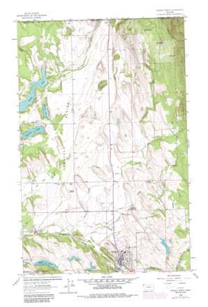
Eureka North Topo Map Montana
To zoom in, hover over the map of Eureka North
USGS Topo Quad 48115h1 - 1:24,000 scale
| Topo Map Name: | Eureka North |
| USGS Topo Quad ID: | 48115h1 |
| Print Size: | ca. 21 1/4" wide x 27" high |
| Southeast Coordinates: | 48.875° N latitude / 115° W longitude |
| Map Center Coordinates: | 48.9375° N latitude / 115.0625° W longitude |
| U.S. State: | MT |
| Filename: | o48115h1.jpg |
| Download Map JPG Image: | Eureka North topo map 1:24,000 scale |
| Map Type: | Topographic |
| Topo Series: | 7.5´ |
| Map Scale: | 1:24,000 |
| Source of Map Images: | United States Geological Survey (USGS) |
| Alternate Map Versions: |
Eureka North MT 1963, updated 1966 Download PDF Buy paper map Eureka North MT 1963, updated 1980 Download PDF Buy paper map Eureka North MT 1963, updated 1984 Download PDF Buy paper map Eureka North MT 1997, updated 2000 Download PDF Buy paper map Eureka North MT 2011 Download PDF Buy paper map Eureka North MT 2014 Download PDF Buy paper map |
| FStopo: | US Forest Service topo Eureka North is available: Download FStopo PDF Download FStopo TIF |
1:24,000 Topo Quads surrounding Eureka North
Red Mountain |
Rexford |
Eureka North |
Ksanka Peak |
Stahl Peak |
Webb Mountain |
Beartrap Mountain |
Eureka South |
Fortine |
Mount Marston |
Inch Mountain |
Mcguire Mountain |
Pinkham Mountain |
Edna Mountain |
Stryker |
> Back to 48115e1 at 1:100,000 scale
> Back to 48114a1 at 1:250,000 scale
> Back to U.S. Topo Maps home
Eureka North topo map: Gazetteer
Eureka North: Airports
Eureka Airport elevation 824m 2703′Eureka North: Bridges
Saint Clair Creek Bridge elevation 785m 2575′Tobacco River Bridge elevation 760m 2493′
Eureka North: Dams
Costich Dam elevation 869m 2851′Eureka North: Flats
Iowa Flats elevation 796m 2611′Tobacco Plains elevation 800m 2624′
Eureka North: Lakes
Black Lake elevation 839m 2752′Costich Lake elevation 869m 2851′
Gregor Lake elevation 845m 2772′
L-Lake elevation 845m 2772′
Moran Lake elevation 762m 2500′
Sophie Lake elevation 767m 2516′
Tetrault Lake elevation 766m 2513′
Eureka North: Parks
Memorial Park elevation 797m 2614′Riverside Park elevation 782m 2565′
Eureka North: Populated Places
Eureka elevation 787m 2582′Mills Springs (historical) elevation 812m 2664′
Mountain View Mobile Home Park elevation 789m 2588′
Roosville elevation 821m 2693′
Tobacco (historical) elevation 814m 2670′
Eureka North: Post Offices
Eureka Post Office elevation 788m 2585′Tobacco Post Office (historical) elevation 814m 2670′
Eureka North: Reservoirs
Costich Lake elevation 869m 2851′Eureka North: Springs
Mills Spring elevation 819m 2687′Eureka North: Streams
DeRozier Creek elevation 844m 2769′Indian Creek elevation 767m 2516′
Ksanka Creek elevation 792m 2598′
Phillips Creek elevation 770m 2526′
Sinclair Creek elevation 780m 2559′
Eureka North: Valleys
Dry Gulch elevation 1202m 3943′Eureka North: Wells
36N27W01DBCA01 Well elevation 872m 2860′36N27W04DC__02 Well elevation 795m 2608′
36N27W05BD__01 Well elevation 793m 2601′
36N27W05DCBC01 Well elevation 792m 2598′
36N27W08AB__01 Well elevation 789m 2588′
36N27W14BA__01 Well elevation 791m 2595′
36N27W14DCCB01 Well elevation 786m 2578′
36N27W23AAC_01 Well elevation 784m 2572′
37N27W01CACB01 Well elevation 823m 2700′
37N27W02DADD01 Well elevation 814m 2670′
37N27W14CBCC01 Well elevation 816m 2677′
37N27W24BABB01 Well elevation 835m 2739′
37N27W24BDCC01 Well elevation 820m 2690′
37N27W27ACCB01 Well elevation 812m 2664′
37N27W33DCCC01 Well elevation 798m 2618′
37N27W34DBA_01 Well elevation 802m 2631′
37N27W35DDCD01 Well elevation 817m 2680′
Eureka North digital topo map on disk
Buy this Eureka North topo map showing relief, roads, GPS coordinates and other geographical features, as a high-resolution digital map file on DVD:


