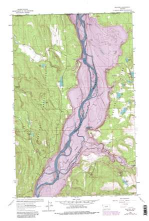
Rexford Topo Map Montana
To zoom in, hover over the map of Rexford
USGS Topo Quad 48115h2 - 1:24,000 scale
| Topo Map Name: | Rexford |
| USGS Topo Quad ID: | 48115h2 |
| Print Size: | ca. 21 1/4" wide x 27" high |
| Southeast Coordinates: | 48.875° N latitude / 115.125° W longitude |
| Map Center Coordinates: | 48.9375° N latitude / 115.1875° W longitude |
| U.S. State: | MT |
| Filename: | o48115h2.jpg |
| Download Map JPG Image: | Rexford topo map 1:24,000 scale |
| Map Type: | Topographic |
| Topo Series: | 7.5´ |
| Map Scale: | 1:24,000 |
| Source of Map Images: | United States Geological Survey (USGS) |
| Alternate Map Versions: |
Rexford MT 1963, updated 1966 Download PDF Buy paper map Rexford MT 1963, updated 1976 Download PDF Buy paper map Rexford MT 1963, updated 1984 Download PDF Buy paper map Rexford MT 1983, updated 1984 Download PDF Buy paper map Rexford MT 1997, updated 2000 Download PDF Buy paper map Rexford MT 2011 Download PDF Buy paper map Rexford MT 2014 Download PDF Buy paper map |
| FStopo: | US Forest Service topo Rexford is available: Download FStopo PDF Download FStopo TIF |
1:24,000 Topo Quads surrounding Rexford
> Back to 48115e1 at 1:100,000 scale
> Back to 48114a1 at 1:250,000 scale
> Back to U.S. Topo Maps home
Rexford topo map: Gazetteer
Rexford: Basins
Green Basin elevation 761m 2496′Rexford: Cliffs
Hunter Point elevation 867m 2844′Rexford: Flats
Kootenai Flats elevation 751m 2463′Rexford: Islands
Kins Island (historical) elevation 751m 2463′Murray Island (historical) elevation 751m 2463′
Whites Island (historical) elevation 751m 2463′
Rexford: Lakes
Alkali Lake elevation 834m 2736′Arnolds Pond elevation 895m 2936′
Baney Lake elevation 766m 2513′
Grob Lake elevation 765m 2509′
Lake Livermore (historical) elevation 751m 2463′
Madden Lake elevation 867m 2844′
O'Brien Lake elevation 863m 2831′
Rush Lake elevation 835m 2739′
Sales Lake elevation 767m 2516′
Swisher Lake elevation 760m 2493′
Tooley Lake elevation 775m 2542′
Rexford: Populated Places
Gateway (historical) elevation 751m 2463′Rexford elevation 777m 2549′
Riverside (historical) elevation 751m 2463′
Rexford: Post Offices
Gateway Post Office (historical) elevation 751m 2463′Hayden Post Office (historical) elevation 751m 2463′
Rexford Post Office elevation 775m 2542′
Riverside Post Office (historical) elevation 751m 2463′
Rexford: Springs
37N27W17CD__01 Spring elevation 764m 2506′Fourmile Spring elevation 935m 3067′
Rexford: Streams
Dodge Creek elevation 751m 2463′Murray Creek (historical) elevation 751m 2463′
Poverty Creek elevation 751m 2463′
Sophie Creek elevation 751m 2463′
Sullivan Creek elevation 751m 2463′
Tobacco River elevation 751m 2463′
Young Creek elevation 751m 2463′
Rexford: Summits
Olsen Hill elevation 862m 2828′Sand Hill elevation 769m 2522′
Rexford: Valleys
Melvin Draw elevation 751m 2463′Rexford: Wells
36N28W01ADC_01 Well elevation 785m 2575′36N28W11AADB01 Well elevation 763m 2503′
37N27W06CABA01 Well elevation 769m 2522′
37N27W06CB__01 Well elevation 755m 2477′
37N27W06CBAA01 Well elevation 765m 2509′
37N27W07CCD01_ Well elevation 751m 2463′
37N27W21CBAB01 Well elevation 767m 2516′
37N27W28CBBB01 Well elevation 796m 2611′
37N28W13CABB01 Well elevation 766m 2513′
37N28W13CADB01 Well elevation 763m 2503′
Rexford digital topo map on disk
Buy this Rexford topo map showing relief, roads, GPS coordinates and other geographical features, as a high-resolution digital map file on DVD:


