Garver Mountain Topo Map Montana
To zoom in, hover over the map of Garver Mountain
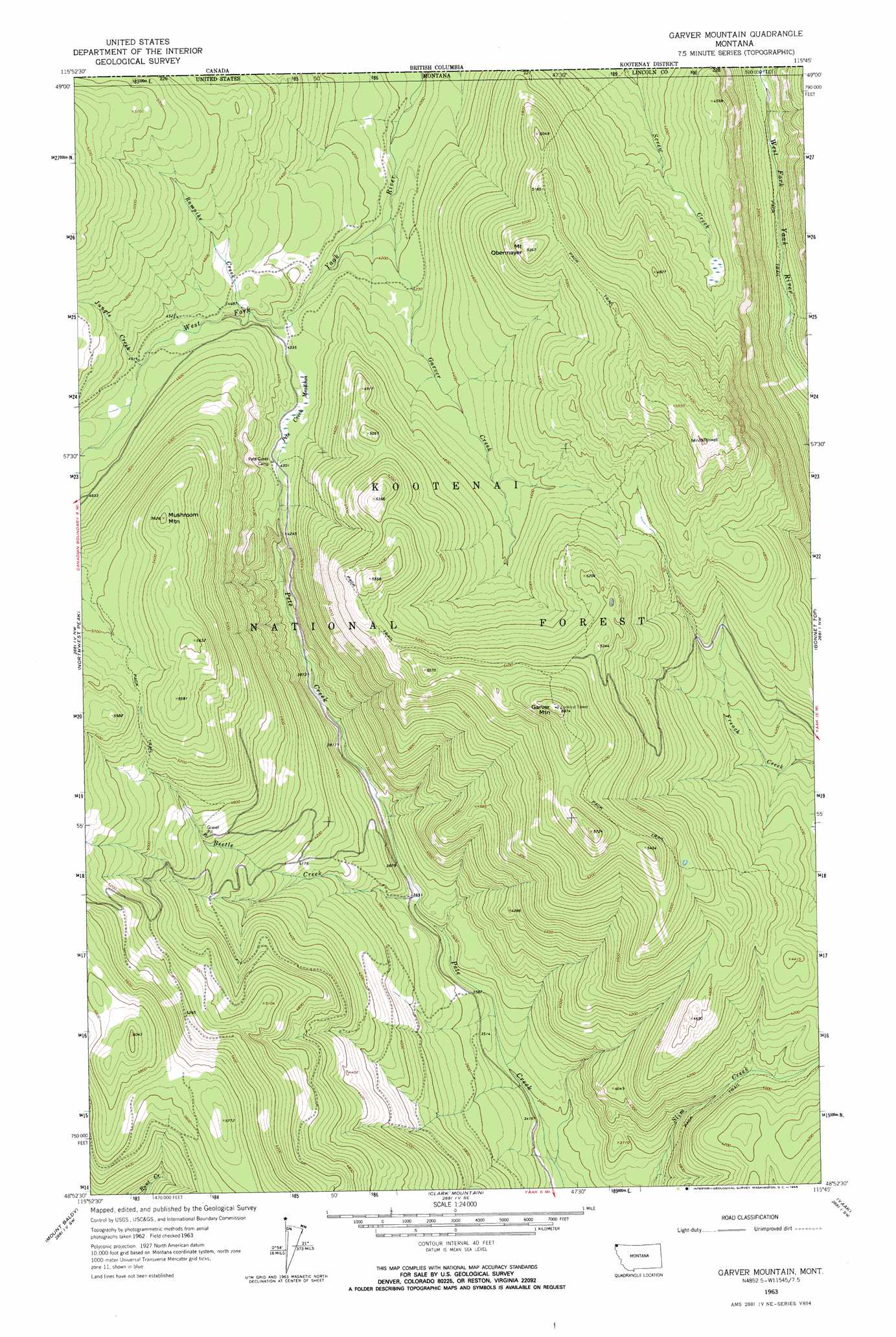
USGS Topo Quad 48115h7 - 1:24,000 scale
| Topo Map Name: | Garver Mountain |
| USGS Topo Quad ID: | 48115h7 |
| Print Size: | ca. 21 1/4" wide x 27" high |
| Southeast Coordinates: | 48.875° N latitude / 115.75° W longitude |
| Map Center Coordinates: | 48.9375° N latitude / 115.8125° W longitude |
| U.S. State: | MT |
| Filename: | o48115h7.jpg |
| Download Map JPG Image: | Garver Mountain topo map 1:24,000 scale |
| Map Type: | Topographic |
| Topo Series: | 7.5´ |
| Map Scale: | 1:24,000 |
| Source of Map Images: | United States Geological Survey (USGS) |
| Alternate Map Versions: |
Garver Mountain MT 1963, updated 1966 Download PDF Buy paper map Garver Mountain MT 1963, updated 1966 Download PDF Buy paper map Garver Mountain MT 1997, updated 2000 Download PDF Buy paper map Garver Mountain MT 2011 Download PDF Buy paper map Garver Mountain MT 2014 Download PDF Buy paper map |
| FStopo: | US Forest Service topo Garver Mountain is available: Download FStopo PDF Download FStopo TIF |
1:24,000 Topo Quads surrounding Garver Mountain
Canuck Peak |
Northwest Peak |
Garver Mountain |
Bonnet Top |
Mount Henry |
Line Point |
Mount Baldy |
Clark Mountain |
Yaak |
Lost Horse Mountain |
Curley Creek |
Newton Mountain |
Sylvanite |
Flatiron Mountain |
Pink Mountain |
> Back to 48115e1 at 1:100,000 scale
> Back to 48114a1 at 1:250,000 scale
> Back to U.S. Topo Maps home
Garver Mountain topo map: Gazetteer
Garver Mountain: Streams
Beetle Creek elevation 1103m 3618′Garver Creek elevation 1249m 4097′
Jungle Creek elevation 1366m 4481′
Rampike Creek elevation 1332m 4370′
Garver Mountain: Summits
Garver Mountain elevation 1785m 5856′Mount Obermayer elevation 1620m 5314′
Mushroom Mountain elevation 1711m 5613′
Garver Mountain: Swamps
Pete Creek Meadows elevation 1313m 4307′Garver Mountain digital topo map on disk
Buy this Garver Mountain topo map showing relief, roads, GPS coordinates and other geographical features, as a high-resolution digital map file on DVD: