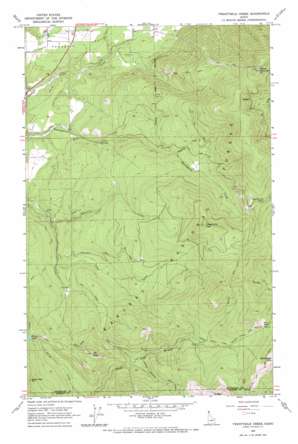
Twentymile Creek Topo Map Idaho
To zoom in, hover over the map of Twentymile Creek
USGS Topo Quad 48116e3 - 1:24,000 scale
| Topo Map Name: | Twentymile Creek |
| USGS Topo Quad ID: | 48116e3 |
| Print Size: | ca. 21 1/4" wide x 27" high |
| Southeast Coordinates: | 48.5° N latitude / 116.25° W longitude |
| Map Center Coordinates: | 48.5625° N latitude / 116.3125° W longitude |
| U.S. State: | ID |
| Filename: | o48116e3.jpg |
| Download Map JPG Image: | Twentymile Creek topo map 1:24,000 scale |
| Map Type: | Topographic |
| Topo Series: | 7.5´ |
| Map Scale: | 1:24,000 |
| Source of Map Images: | United States Geological Survey (USGS) |
| Alternate Map Versions: |
Twentymile Creek ID 1965, updated 1967 Download PDF Buy paper map Twentymile Creek ID 1996, updated 1999 Download PDF Buy paper map Twentymile Creek ID 2011 Download PDF Buy paper map Twentymile Creek ID 2013 Download PDF Buy paper map |
| FStopo: | US Forest Service topo Twentymile Creek is available: Download FStopo PDF Download FStopo TIF |
1:24,000 Topo Quads surrounding Twentymile Creek
> Back to 48116e1 at 1:100,000 scale
> Back to 48116a1 at 1:250,000 scale
> Back to U.S. Topo Maps home
Twentymile Creek topo map: Gazetteer
Twentymile Creek: Gaps
Kelly Pass elevation 1605m 5265′Twentymile Pass elevation 1385m 4543′
Twentymile Creek: Lakes
Beaver Lake elevation 1179m 3868′Twentymile Creek: Streams
Cone Creek elevation 754m 2473′Contrary Creek elevation 685m 2247′
Seed Creek elevation 886m 2906′
Wishbone Creek elevation 1028m 3372′
Twentymile Creek: Summits
Bald Eagle Mountain elevation 1858m 6095′Black Mountain elevation 1857m 6092′
Jay Peak elevation 1384m 4540′
Sand Mountain elevation 1366m 4481′
Twentymile Peak elevation 1641m 5383′
Twentymile Creek: Trails
Beaver Lake Trail elevation 1151m 3776′Grouse Mountain Trail elevation 1761m 5777′
Upper North Fork Grouse Creek Trail elevation 1410m 4625′
Twentymile Creek digital topo map on disk
Buy this Twentymile Creek topo map showing relief, roads, GPS coordinates and other geographical features, as a high-resolution digital map file on DVD:


