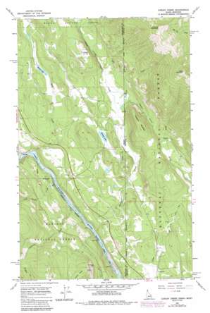
Curley Creek Topo Map Idaho
To zoom in, hover over the map of Curley Creek
USGS Topo Quad 48116f1 - 1:24,000 scale
| Topo Map Name: | Curley Creek |
| USGS Topo Quad ID: | 48116f1 |
| Print Size: | ca. 21 1/4" wide x 27" high |
| Southeast Coordinates: | 48.625° N latitude / 116° W longitude |
| Map Center Coordinates: | 48.6875° N latitude / 116.0625° W longitude |
| U.S. States: | ID, MT |
| Filename: | o48116f1.jpg |
| Download Map JPG Image: | Curley Creek topo map 1:24,000 scale |
| Map Type: | Topographic |
| Topo Series: | 7.5´ |
| Map Scale: | 1:24,000 |
| Source of Map Images: | United States Geological Survey (USGS) |
| Alternate Map Versions: |
Curley Creek ID 1965, updated 1967 Download PDF Buy paper map Curley Creek ID 1965, updated 1980 Download PDF Buy paper map Curley Creek ID 1965, updated 1984 Download PDF Buy paper map Curley Creek ID 1997, updated 2000 Download PDF Buy paper map Curley Creek ID 2011 Download PDF Buy paper map Curley Creek ID 2013 Download PDF Buy paper map |
| FStopo: | US Forest Service topo Curley Creek is available: Download FStopo PDF Download FStopo TIF |
1:24,000 Topo Quads surrounding Curley Creek
> Back to 48116e1 at 1:100,000 scale
> Back to 48116a1 at 1:250,000 scale
> Back to U.S. Topo Maps home
Curley Creek topo map: Gazetteer
Curley Creek: Lakes
Bonner Lake elevation 760m 2493′Herman Lake elevation 757m 2483′
Curley Creek: Mines
Homestake Mine elevation 830m 2723′Curley Creek: Streams
Caboose Creek elevation 550m 1804′Curley Creek elevation 565m 1853′
Curley Creek elevation 548m 1797′
John Crown Creek elevation 547m 1794′
Kingsley Creek elevation 759m 2490′
Lime Creek elevation 586m 1922′
Lime Creek elevation 549m 1801′
Sand Creek elevation 544m 1784′
Curley Creek: Summits
Cross Mountain elevation 1993m 6538′Haystack Mountain elevation 1126m 3694′
Murphy Mountain elevation 1959m 6427′
Curley Creek: Valleys
Newton Gulch elevation 769m 2522′Curley Creek digital topo map on disk
Buy this Curley Creek topo map showing relief, roads, GPS coordinates and other geographical features, as a high-resolution digital map file on DVD:


