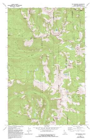
The Wigwams Topo Map Idaho
To zoom in, hover over the map of The Wigwams
USGS Topo Quad 48116f6 - 1:24,000 scale
| Topo Map Name: | The Wigwams |
| USGS Topo Quad ID: | 48116f6 |
| Print Size: | ca. 21 1/4" wide x 27" high |
| Southeast Coordinates: | 48.625° N latitude / 116.625° W longitude |
| Map Center Coordinates: | 48.6875° N latitude / 116.6875° W longitude |
| U.S. State: | ID |
| Filename: | o48116f6.jpg |
| Download Map JPG Image: | The Wigwams topo map 1:24,000 scale |
| Map Type: | Topographic |
| Topo Series: | 7.5´ |
| Map Scale: | 1:24,000 |
| Source of Map Images: | United States Geological Survey (USGS) |
| Alternate Map Versions: |
The Wigwams ID 1967, updated 1971 Download PDF Buy paper map The Wigwams ID 1967, updated 1978 Download PDF Buy paper map The Wigwams ID 1967, updated 1993 Download PDF Buy paper map The Wigwams ID 1996, updated 1999 Download PDF Buy paper map The Wigwams ID 2011 Download PDF Buy paper map The Wigwams ID 2013 Download PDF Buy paper map |
| FStopo: | US Forest Service topo The Wigwams is available: Download FStopo PDF Download FStopo TIF |
1:24,000 Topo Quads surrounding The Wigwams
> Back to 48116e1 at 1:100,000 scale
> Back to 48116a1 at 1:250,000 scale
> Back to U.S. Topo Maps home
The Wigwams topo map: Gazetteer
The Wigwams: Lakes
Beehive lake elevation 1822m 5977′Beehive Lakes elevation 1927m 6322′
Harrison Lake elevation 1887m 6190′
Kent Lake elevation 1741m 5711′
Standard Lakes elevation 1622m 5321′
Two Mouth Lakes elevation 1799m 5902′
Upper Standard Lake elevation 1622m 5321′
The Wigwams: Ranges
Seven Sisters elevation 2112m 6929′The Wigwams: Reservoirs
Lower Standard Lake elevation 1557m 5108′The Wigwams: Streams
Slide Creek elevation 1391m 4563′Slide Creek elevation 1307m 4288′
The Wigwams: Summits
Eddy Peak elevation 1984m 6509′Goblin Knob elevation 2004m 6574′
Harrison Peak elevation 2077m 6814′
Kent Peak elevation 2163m 7096′
Myrtle Peak elevation 2105m 6906′
Silver Dollar Peak elevation 2005m 6578′
Temple Mountain elevation 2040m 6692′
The Wigwams elevation 2122m 6961′
Twin Peaks elevation 2155m 7070′
The Wigwams digital topo map on disk
Buy this The Wigwams topo map showing relief, roads, GPS coordinates and other geographical features, as a high-resolution digital map file on DVD:


