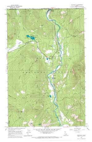
Eastport Topo Map Idaho
To zoom in, hover over the map of Eastport
USGS Topo Quad 48116h2 - 1:24,000 scale
| Topo Map Name: | Eastport |
| USGS Topo Quad ID: | 48116h2 |
| Print Size: | ca. 21 1/4" wide x 27" high |
| Southeast Coordinates: | 48.875° N latitude / 116.125° W longitude |
| Map Center Coordinates: | 48.9375° N latitude / 116.1875° W longitude |
| U.S. State: | ID |
| Filename: | o48116h2.jpg |
| Download Map JPG Image: | Eastport topo map 1:24,000 scale |
| Map Type: | Topographic |
| Topo Series: | 7.5´ |
| Map Scale: | 1:24,000 |
| Source of Map Images: | United States Geological Survey (USGS) |
| Alternate Map Versions: |
Eastport ID 1965, updated 1967 Download PDF Buy paper map Eastport ID 1996, updated 1999 Download PDF Buy paper map Eastport ID 2011 Download PDF Buy paper map Eastport ID 2013 Download PDF Buy paper map |
| FStopo: | US Forest Service topo Eastport is available: Download FStopo PDF Download FStopo TIF |
1:24,000 Topo Quads surrounding Eastport
Copeland |
Hall Mountain |
Eastport |
Canuck Peak |
Northwest Peak |
Farnham Peak |
Ritz |
Meadow Creek |
Line Point |
Mount Baldy |
Moravia |
Bonners Ferry |
Moyie Springs |
Curley Creek |
Newton Mountain |
> Back to 48116e1 at 1:100,000 scale
> Back to 48116a1 at 1:250,000 scale
> Back to U.S. Topo Maps home
Eastport topo map: Gazetteer
Eastport: Falls
Copper Falls elevation 1049m 3441′Eastport: Lakes
Bussard Lake elevation 771m 2529′Geyselman Lake elevation 830m 2723′
Queen Lake elevation 1716m 5629′
Robinson Lake elevation 807m 2647′
Sinclair Lake elevation 775m 2542′
Eastport: Mines
Queen Mine elevation 1738m 5702′Tilley Mine elevation 1614m 5295′
Eastport: Populated Places
Addie elevation 789m 2588′Eastport elevation 801m 2627′
Good Grief elevation 804m 2637′
Sinclair elevation 779m 2555′
Eastport: Streams
Brass Creek elevation 793m 2601′Bussard Creek elevation 762m 2500′
Copper Creek elevation 785m 2575′
Feist Creek elevation 765m 2509′
Gillon Creek elevation 803m 2634′
Harvey Creek elevation 901m 2956′
Hellroaring Creek elevation 812m 2664′
Kreist Creek elevation 763m 2503′
Line Creek elevation 792m 2598′
Little Hellroaring Creek elevation 789m 2588′
Orser Creek elevation 769m 2522′
Round Prairie Creek elevation 772m 2532′
Spruce Creek elevation 781m 2562′
Eastport: Summits
Border Mountain elevation 1452m 4763′Bussard Mountain elevation 1815m 5954′
Hogue Mountain elevation 1320m 4330′
Queen Mountain elevation 1863m 6112′
Eastport: Trails
Hellroaring Ridge Trail elevation 1521m 4990′Queen Mountain Trail elevation 1427m 4681′
Sidehill Trail elevation 1427m 4681′
Eastport digital topo map on disk
Buy this Eastport topo map showing relief, roads, GPS coordinates and other geographical features, as a high-resolution digital map file on DVD:


