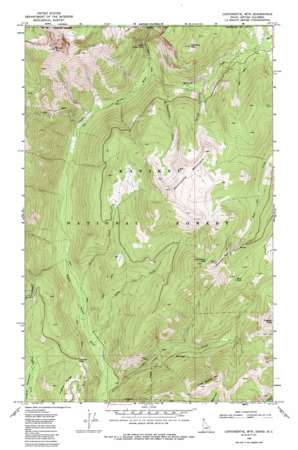
Continental Mountain Topo Map Idaho
To zoom in, hover over the map of Continental Mountain
USGS Topo Quad 48116h8 - 1:24,000 scale
| Topo Map Name: | Continental Mountain |
| USGS Topo Quad ID: | 48116h8 |
| Print Size: | ca. 21 1/4" wide x 27" high |
| Southeast Coordinates: | 48.875° N latitude / 116.875° W longitude |
| Map Center Coordinates: | 48.9375° N latitude / 116.9375° W longitude |
| U.S. State: | ID |
| Filename: | o48116h8.jpg |
| Download Map JPG Image: | Continental Mountain topo map 1:24,000 scale |
| Map Type: | Topographic |
| Topo Series: | 7.5´ |
| Map Scale: | 1:24,000 |
| Source of Map Images: | United States Geological Survey (USGS) |
| Alternate Map Versions: |
Continental Mtn ID 1968, updated 1971 Download PDF Buy paper map Continental Mtn ID 1968, updated 1985 Download PDF Buy paper map Continental Mtn ID 1968, updated 1985 Download PDF Buy paper map Continental Mountain ID 1996, updated 1999 Download PDF Buy paper map Continental Mountain ID 2011 Download PDF Buy paper map Continental Mountain ID 2013 Download PDF Buy paper map |
| FStopo: | US Forest Service topo Continental Mountain is available: Download FStopo PDF Download FStopo TIF |
1:24,000 Topo Quads surrounding Continental Mountain
> Back to 48116e1 at 1:100,000 scale
> Back to 48116a1 at 1:250,000 scale
> Back to U.S. Topo Maps home
Continental Mountain topo map: Gazetteer
Continental Mountain: Falls
Upper Priest Falls elevation 1059m 3474′Continental Mountain: Gaps
Cabinet Pass elevation 1074m 3523′Continental Mountain: Lakes
Continental Lake elevation 1776m 5826′Trap Lake elevation 1769m 5803′
Continental Mountain: Mines
Continental Mine elevation 1803m 5915′McLean Mine elevation 1005m 3297′
Continental Mountain: Streams
Cedar Creek elevation 824m 2703′Continental Creek elevation 1068m 3503′
Lime Creek elevation 831m 2726′
Malcom Creek elevation 958m 3143′
Rock Creek elevation 840m 2755′
Spread Creek elevation 1133m 3717′
Continental Mountain: Summits
Continental Mountain elevation 2033m 6669′Green Bonnet Mountain elevation 1823m 5980′
Kaniksu Mountain elevation 1772m 5813′
Snowy Top elevation 2248m 7375′
Trapper Peak elevation 1872m 6141′
Continental Mountain digital topo map on disk
Buy this Continental Mountain topo map showing relief, roads, GPS coordinates and other geographical features, as a high-resolution digital map file on DVD:


