Ruby Topo Map Washington
To zoom in, hover over the map of Ruby
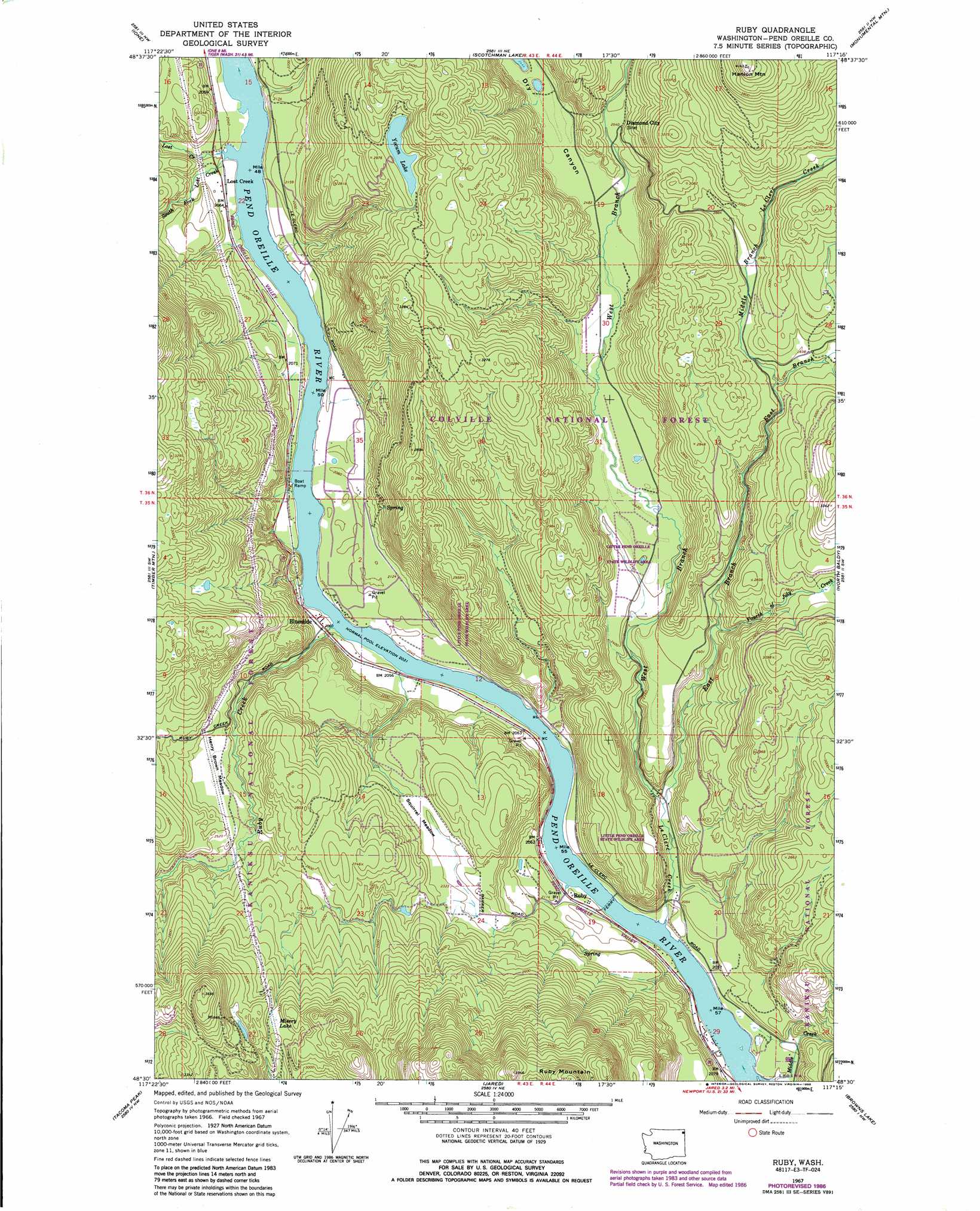
USGS Topo Quad 48117e3 - 1:24,000 scale
| Topo Map Name: | Ruby |
| USGS Topo Quad ID: | 48117e3 |
| Print Size: | ca. 21 1/4" wide x 27" high |
| Southeast Coordinates: | 48.5° N latitude / 117.25° W longitude |
| Map Center Coordinates: | 48.5625° N latitude / 117.3125° W longitude |
| U.S. State: | WA |
| Filename: | o48117e3.jpg |
| Download Map JPG Image: | Ruby topo map 1:24,000 scale |
| Map Type: | Topographic |
| Topo Series: | 7.5´ |
| Map Scale: | 1:24,000 |
| Source of Map Images: | United States Geological Survey (USGS) |
| Alternate Map Versions: |
Ruby WA 1967, updated 1971 Download PDF Buy paper map Ruby WA 1967, updated 1986 Download PDF Buy paper map Ruby WA 1992, updated 1996 Download PDF Buy paper map Ruby WA 2011 Download PDF Buy paper map Ruby WA 2014 Download PDF Buy paper map |
| FStopo: | US Forest Service topo Ruby is available: Download FStopo PDF Download FStopo TIF |
1:24,000 Topo Quads surrounding Ruby
Deep Lake |
Metaline |
Metaline Falls |
Pass Creek |
Helmer Mountain |
Aladdin Mountain |
Ione |
Scotchman Lake |
Monumental Mountain |
Orwig Hump |
Lake Gillette |
Timber Mountain |
Ruby |
North Baldy |
Gleason Mountain |
Calispell Peak |
Tacoma Peak |
Jared |
Browns Lake |
Galena Point |
Goddards Peak |
Winchester Peak |
Cusick |
Skookum Creek |
Bead Lake |
> Back to 48117e1 at 1:100,000 scale
> Back to 48116a1 at 1:250,000 scale
> Back to U.S. Topo Maps home
Ruby topo map: Gazetteer
Ruby: Flats
Henry Brown Meadow elevation 739m 2424′Squirrel Meadow elevation 712m 2335′
Ruby: Lakes
Misery Lake elevation 910m 2985′Yocum Lake elevation 900m 2952′
Ruby: Populated Places
Blueslide elevation 625m 2050′Diamond City elevation 796m 2611′
Lost Creek elevation 626m 2053′
Ruby elevation 628m 2060′
Ruby: Streams
East Branch Le Clerc Creek elevation 644m 2112′Fourth of July Creek elevation 718m 2355′
Le Clerc Creek elevation 623m 2043′
Lost Creek elevation 623m 2043′
Middle Branch Le Clerc Creek elevation 840m 2755′
Middle Creek elevation 623m 2043′
Ruby Creek elevation 621m 2037′
South Fork Lost Creek elevation 621m 2037′
West Branch LeClerc Creek elevation 644m 2112′
Ruby: Summits
Hanlon Mountain elevation 1261m 4137′Ruby: Valleys
Dry Canyon elevation 757m 2483′Ruby digital topo map on disk
Buy this Ruby topo map showing relief, roads, GPS coordinates and other geographical features, as a high-resolution digital map file on DVD: