Scotchman Lake Topo Map Washington
To zoom in, hover over the map of Scotchman Lake
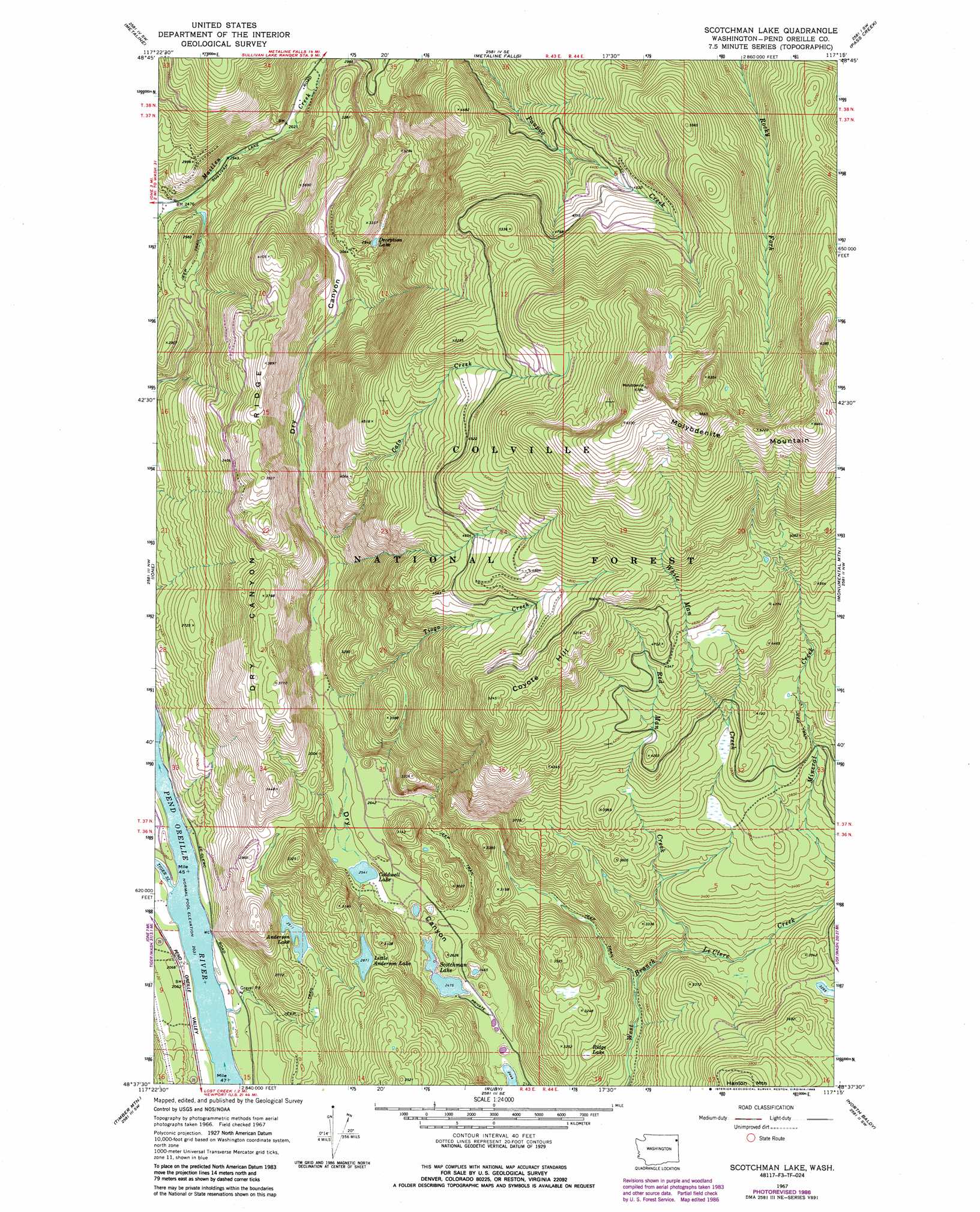
USGS Topo Quad 48117f3 - 1:24,000 scale
| Topo Map Name: | Scotchman Lake |
| USGS Topo Quad ID: | 48117f3 |
| Print Size: | ca. 21 1/4" wide x 27" high |
| Southeast Coordinates: | 48.625° N latitude / 117.25° W longitude |
| Map Center Coordinates: | 48.6875° N latitude / 117.3125° W longitude |
| U.S. State: | WA |
| Filename: | o48117f3.jpg |
| Download Map JPG Image: | Scotchman Lake topo map 1:24,000 scale |
| Map Type: | Topographic |
| Topo Series: | 7.5´ |
| Map Scale: | 1:24,000 |
| Source of Map Images: | United States Geological Survey (USGS) |
| Alternate Map Versions: |
Scotchman Lake WA 1967, updated 1971 Download PDF Buy paper map Scotchman Lake WA 1967, updated 1986 Download PDF Buy paper map Scotchman Lake WA 1967, updated 1986 Download PDF Buy paper map Scotchman Lake WA 1992, updated 1996 Download PDF Buy paper map Scotchman Lake WA 2011 Download PDF Buy paper map Scotchman Lake WA 2014 Download PDF Buy paper map |
| FStopo: | US Forest Service topo Scotchman Lake is available: Download FStopo PDF Download FStopo TIF |
1:24,000 Topo Quads surrounding Scotchman Lake
Leadpoint |
Abercrombie Mountain |
Boundary Dam |
Gypsy Peak |
Salmo Mountain |
Deep Lake |
Metaline |
Metaline Falls |
Pass Creek |
Helmer Mountain |
Aladdin Mountain |
Ione |
Scotchman Lake |
Monumental Mountain |
Orwig Hump |
Lake Gillette |
Timber Mountain |
Ruby |
North Baldy |
Gleason Mountain |
Calispell Peak |
Tacoma Peak |
Jared |
Browns Lake |
Galena Point |
> Back to 48117e1 at 1:100,000 scale
> Back to 48116a1 at 1:250,000 scale
> Back to U.S. Topo Maps home
Scotchman Lake topo map: Gazetteer
Scotchman Lake: Lakes
Anderson Lake elevation 767m 2516′Caldwell Lake elevation 776m 2545′
Deception Lake elevation 899m 2949′
Little Anderson Lake elevation 876m 2874′
Ridge Lake elevation 912m 2992′
Scotchman Lake elevation 756m 2480′
Scotchman Lake: Ridges
Dry Canyon Ridge elevation 1189m 3900′Scotchman Lake: Streams
Cato Creek elevation 845m 2772′Red Man Creek elevation 1000m 3280′
Tioga Creek elevation 822m 2696′
White Man Creek elevation 888m 2913′
Scotchman Lake: Summits
Coyote Hill elevation 1584m 5196′Molybdenite Mountain elevation 2057m 6748′
Scotchman Lake digital topo map on disk
Buy this Scotchman Lake topo map showing relief, roads, GPS coordinates and other geographical features, as a high-resolution digital map file on DVD: