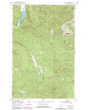
Deep Lake Topo Map Washington
To zoom in, hover over the map of Deep Lake
USGS Topo Quad 48117g5 - 1:24,000 scale
| Topo Map Name: | Deep Lake |
| USGS Topo Quad ID: | 48117g5 |
| Print Size: | ca. 21 1/4" wide x 27" high |
| Southeast Coordinates: | 48.75° N latitude / 117.5° W longitude |
| Map Center Coordinates: | 48.8125° N latitude / 117.5625° W longitude |
| U.S. State: | WA |
| Filename: | o48117g5.jpg |
| Download Map JPG Image: | Deep Lake topo map 1:24,000 scale |
| Map Type: | Topographic |
| Topo Series: | 7.5´ |
| Map Scale: | 1:24,000 |
| Source of Map Images: | United States Geological Survey (USGS) |
| Alternate Map Versions: |
Deep Lake WA 1952, updated 1953 Download PDF Buy paper map Deep Lake WA 1952, updated 1970 Download PDF Buy paper map Deep Lake WA 1952, updated 1977 Download PDF Buy paper map Deep Lake WA 1952, updated 1986 Download PDF Buy paper map Deep Lake WA 1992, updated 1996 Download PDF Buy paper map Deep Lake WA 2011 Download PDF Buy paper map Deep Lake WA 2014 Download PDF Buy paper map |
| FStopo: | US Forest Service topo Deep Lake is available: Download FStopo PDF Download FStopo TIF |
1:24,000 Topo Quads surrounding Deep Lake
> Back to 48117e1 at 1:100,000 scale
> Back to 48116a1 at 1:250,000 scale
> Back to U.S. Topo Maps home
Deep Lake topo map: Gazetteer
Deep Lake: Basins
Paradise Valley elevation 1013m 3323′Deep Lake: Flats
Chandler Meadows elevation 1163m 3815′Deep Lake: Gaps
Smackout Pass elevation 1136m 3727′Deep Lake: Lakes
Deep Lake elevation 618m 2027′Deep Lake: Mines
Bechtol Mine elevation 818m 2683′Farmer Mine elevation 692m 2270′
Jim Creek Mine elevation 1373m 4504′
Maki Mine elevation 811m 2660′
Thompson Iron Mine elevation 911m 2988′
Tyee Mine elevation 780m 2559′
Utacan Mine elevation 1392m 4566′
Deep Lake: Streams
Byers Creek elevation 911m 2988′Currant Creek elevation 611m 2004′
North Fork Currant Creek elevation 824m 2703′
South Fork Currant Creek elevation 827m 2713′
Deep Lake: Summits
Baldy Mountain elevation 1795m 5889′Huckleberry Mountain elevation 1658m 5439′
Sherlock Peak elevation 1942m 6371′
Deep Lake: Trails
Peterson Trail elevation 1072m 3517′Deep Lake: Valleys
Smackout Valley elevation 882m 2893′Deep Lake digital topo map on disk
Buy this Deep Lake topo map showing relief, roads, GPS coordinates and other geographical features, as a high-resolution digital map file on DVD:


