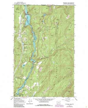
Boundary Dam Topo Map Washington
To zoom in, hover over the map of Boundary Dam
USGS Topo Quad 48117h3 - 1:24,000 scale
| Topo Map Name: | Boundary Dam |
| USGS Topo Quad ID: | 48117h3 |
| Print Size: | ca. 21 1/4" wide x 27" high |
| Southeast Coordinates: | 48.875° N latitude / 117.25° W longitude |
| Map Center Coordinates: | 48.9375° N latitude / 117.3125° W longitude |
| U.S. State: | WA |
| Filename: | o48117h3.jpg |
| Download Map JPG Image: | Boundary Dam topo map 1:24,000 scale |
| Map Type: | Topographic |
| Topo Series: | 7.5´ |
| Map Scale: | 1:24,000 |
| Source of Map Images: | United States Geological Survey (USGS) |
| Alternate Map Versions: |
Boundary Dam WA 1967, updated 1971 Download PDF Buy paper map Boundary Dam WA 1967, updated 1986 Download PDF Buy paper map Boundary Dam WA 1992, updated 1997 Download PDF Buy paper map Boundary Dam WA 1992, updated 1997 Download PDF Buy paper map Boundary Dam WA 2011 Download PDF Buy paper map Boundary Dam WA 2014 Download PDF Buy paper map |
| FStopo: | US Forest Service topo Boundary Dam is available: Download FStopo PDF Download FStopo TIF |
1:24,000 Topo Quads surrounding Boundary Dam
Leadpoint |
Abercrombie Mountain |
Boundary Dam |
Gypsy Peak |
Salmo Mountain |
Deep Lake |
Metaline |
Metaline Falls |
Pass Creek |
Helmer Mountain |
Aladdin Mountain |
Ione |
Scotchman Lake |
Monumental Mountain |
Orwig Hump |
> Back to 48117e1 at 1:100,000 scale
> Back to 48116a1 at 1:250,000 scale
> Back to U.S. Topo Maps home
Boundary Dam topo map: Gazetteer
Boundary Dam: Airports
Boundary Substation Heliport elevation 787m 2582′Boundary Dam: Bays
Deadmans Eddy elevation 651m 2135′Boundary Dam: Dams
Boundary Dam elevation 608m 1994′Pend Oreille Mine Tailings Pond Dam elevation 724m 2375′
Boundary Dam: Falls
Pewee Falls elevation 675m 2214′Boundary Dam: Lakes
Crater Lake elevation 1380m 4527′Crescent Lake elevation 764m 2506′
Ledbetter Lake elevation 772m 2532′
Lime Lake elevation 781m 2562′
Lower Lead King Lake elevation 789m 2588′
Upper Lead King Lake elevation 789m 2588′
Boundary Dam: Mines
Grandview Mine elevation 771m 2529′Josephine Mine elevation 638m 2093′
Lucky Strike Mine elevation 669m 2194′
Morning Mine elevation 731m 2398′
Pend Oreille Mine elevation 691m 2267′
Riverside Mine elevation 671m 2201′
Boundary Dam: Parks
Crawford State Park elevation 827m 2713′Boundary Dam: Ranges
Lead King Hills elevation 905m 2969′Boundary Dam: Reservoirs
Boundary Lake elevation 608m 1994′Pend Oreille Mine Taillings Pond elevation 724m 2375′
Boundary Dam: Ridges
Blue Bird Ridge elevation 1016m 3333′Boundary Ridge elevation 1435m 4708′
Confusion Ridge elevation 1308m 4291′
Boundary Dam: Streams
Beaver Creek elevation 608m 1994′Eldorado Creek elevation 1329m 4360′
Everett Creek elevation 610m 2001′
Fence Creek elevation 822m 2696′
Flume Creek elevation 615m 2017′
Lime Creek elevation 613m 2011′
Pewee Creek elevation 608m 1994′
Slate Creek elevation 625m 2050′
Slumber Creek elevation 785m 2575′
Threemile Creek elevation 640m 2099′
Boundary Dam: Summits
Contact Mountain elevation 954m 3129′Crowell Mountain elevation 1446m 4744′
Divide Peak elevation 1395m 4576′
Dolomite Mountain elevation 1152m 3779′
Forest Mountain elevation 943m 3093′
Grandview Pit elevation 772m 2532′
Horsefly Hill elevation 1100m 3608′
Slumber Peak elevation 1060m 3477′
Timber Hill elevation 974m 3195′
Boundary Dam: Valleys
Uncas Gulch elevation 829m 2719′Whiskey Gulch elevation 608m 1994′
Z Canyon elevation 608m 1994′
Boundary Dam digital topo map on disk
Buy this Boundary Dam topo map showing relief, roads, GPS coordinates and other geographical features, as a high-resolution digital map file on DVD:


