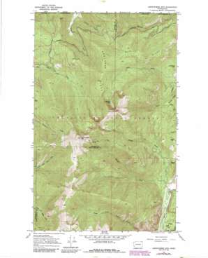
Abercrombie Mountain Topo Map Washington
To zoom in, hover over the map of Abercrombie Mountain
USGS Topo Quad 48117h4 - 1:24,000 scale
| Topo Map Name: | Abercrombie Mountain |
| USGS Topo Quad ID: | 48117h4 |
| Print Size: | ca. 21 1/4" wide x 27" high |
| Southeast Coordinates: | 48.875° N latitude / 117.375° W longitude |
| Map Center Coordinates: | 48.9375° N latitude / 117.4375° W longitude |
| U.S. State: | WA |
| Filename: | o48117h4.jpg |
| Download Map JPG Image: | Abercrombie Mountain topo map 1:24,000 scale |
| Map Type: | Topographic |
| Topo Series: | 7.5´ |
| Map Scale: | 1:24,000 |
| Source of Map Images: | United States Geological Survey (USGS) |
| Alternate Map Versions: |
Abercrombie Mtn WA 1967, updated 1986 Download PDF Buy paper map Abercrombie Mtn WA 1992, updated 1997 Download PDF Buy paper map Abercrombie Mountain WA 2011 Download PDF Buy paper map Abercrombie Mountain WA 2014 Download PDF Buy paper map |
| FStopo: | US Forest Service topo Abercrombie Mountain is available: Download FStopo PDF Download FStopo TIF |
1:24,000 Topo Quads surrounding Abercrombie Mountain
Boundary |
Leadpoint |
Abercrombie Mountain |
Boundary Dam |
Gypsy Peak |
Spirit |
Deep Lake |
Metaline |
Metaline Falls |
Pass Creek |
Aladdin |
Aladdin Mountain |
Ione |
Scotchman Lake |
Monumental Mountain |
> Back to 48117e1 at 1:100,000 scale
> Back to 48116a1 at 1:250,000 scale
> Back to U.S. Topo Maps home
Abercrombie Mountain topo map: Gazetteer
Abercrombie Mountain: Lakes
Hooknose Lake elevation 1850m 6069′Abercrombie Mountain: Mines
Gold Hill Mine elevation 791m 2595′Abercrombie Mountain: Ridges
Brush Ridge elevation 1085m 3559′Hooknose Ridge elevation 1851m 6072′
Russian Ridge elevation 1379m 4524′
Abercrombie Mountain: Streams
Middle Fork Flume Creek elevation 804m 2637′South Fork Russian Creek elevation 698m 2290′
Abercrombie Mountain: Summits
Abercrombie Mountain elevation 2203m 7227′Basalt Hill elevation 1140m 3740′
Beaver Mountain elevation 1019m 3343′
Frisco Mountain elevation 1356m 4448′
Hooknose Mountain elevation 2170m 7119′
Limestone Hill elevation 1031m 3382′
Abercrombie Mountain digital topo map on disk
Buy this Abercrombie Mountain topo map showing relief, roads, GPS coordinates and other geographical features, as a high-resolution digital map file on DVD:


