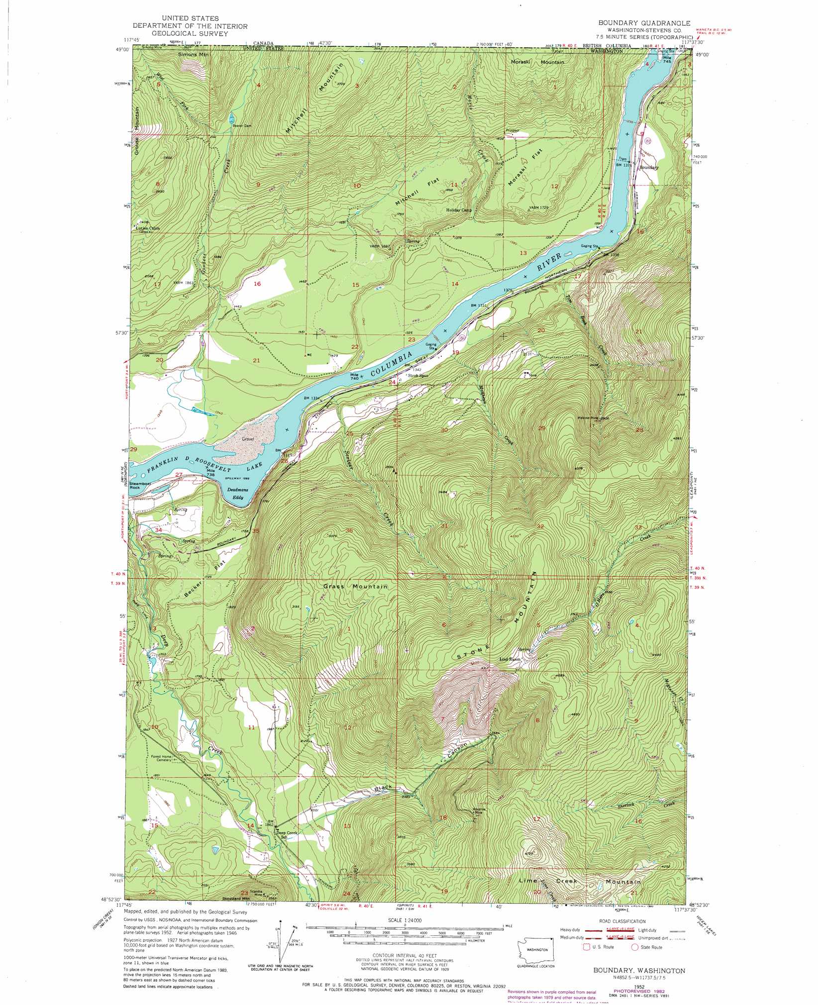
Boundary Topo Map Washington
To zoom in, hover over the map of Boundary
USGS Topo Quad 48117h6 - 1:24,000 scale
| Topo Map Name: | Boundary |
| USGS Topo Quad ID: | 48117h6 |
| Print Size: | ca. 21 1/4" wide x 27" high |
| Southeast Coordinates: | 48.875° N latitude / 117.625° W longitude |
| Map Center Coordinates: | 48.9375° N latitude / 117.6875° W longitude |
| U.S. State: | WA |
| Filename: | o48117h6.jpg |
| Download Map JPG Image: | Boundary topo map 1:24,000 scale |
| Map Type: | Topographic |
| Topo Series: | 7.5´ |
| Map Scale: | 1:24,000 |
| Source of Map Images: | United States Geological Survey (USGS) |
| Alternate Map Versions: |
Boundary WA 1952, updated 1954 Download PDF Buy paper map Boundary WA 1952, updated 1969 Download PDF Buy paper map Boundary WA 1952, updated 1982 Download PDF Buy paper map Boundary WA 1992, updated 1996 Download PDF Buy paper map Boundary WA 2011 Download PDF Buy paper map Boundary WA 2014 Download PDF Buy paper map |
| FStopo: | US Forest Service topo Boundary is available: Download FStopo PDF Download FStopo TIF |
1:24,000 Topo Quads surrounding Boundary
Belshazzar Mountain |
Northport |
Boundary |
Leadpoint |
Abercrombie Mountain |
China Bend |
Onion Creek |
Spirit |
Deep Lake |
Metaline |
Echo Valley |
Gillette Mountain |
Aladdin |
Aladdin Mountain |
Ione |
> Back to 48117e1 at 1:100,000 scale
> Back to 48116a1 at 1:250,000 scale
> Back to U.S. Topo Maps home
Boundary topo map: Gazetteer
Boundary: Bays
Deadmans Eddy elevation 394m 1292′Boundary: Dams
Ruby Dam elevation 514m 1686′Boundary: Flats
Becker Flat elevation 527m 1729′Mitchell Flat elevation 551m 1807′
Moraski Flat elevation 546m 1791′
Boundary: Mines
Advance Mine elevation 1136m 3727′Melrose Mine elevation 924m 3031′
Boundary: Streams
Goodeve Creek elevation 404m 1325′Matthews Creek elevation 413m 1354′
Moris Creek elevation 426m 1397′
North Fork Goodeve Creek elevation 696m 2283′
Scriver Creek elevation 402m 1318′
Tom Bush Creek elevation 423m 1387′
West Fork Goodeve Creek elevation 633m 2076′
Boundary: Summits
Grass Mountain elevation 1027m 3369′Lime Creek Mountain elevation 1443m 4734′
Mitchell Mountain elevation 1126m 3694′
Stone Mountain elevation 1431m 4694′
Boundary: Valleys
Black Canyon elevation 630m 2066′Boundary digital topo map on disk
Buy this Boundary topo map showing relief, roads, GPS coordinates and other geographical features, as a high-resolution digital map file on DVD: