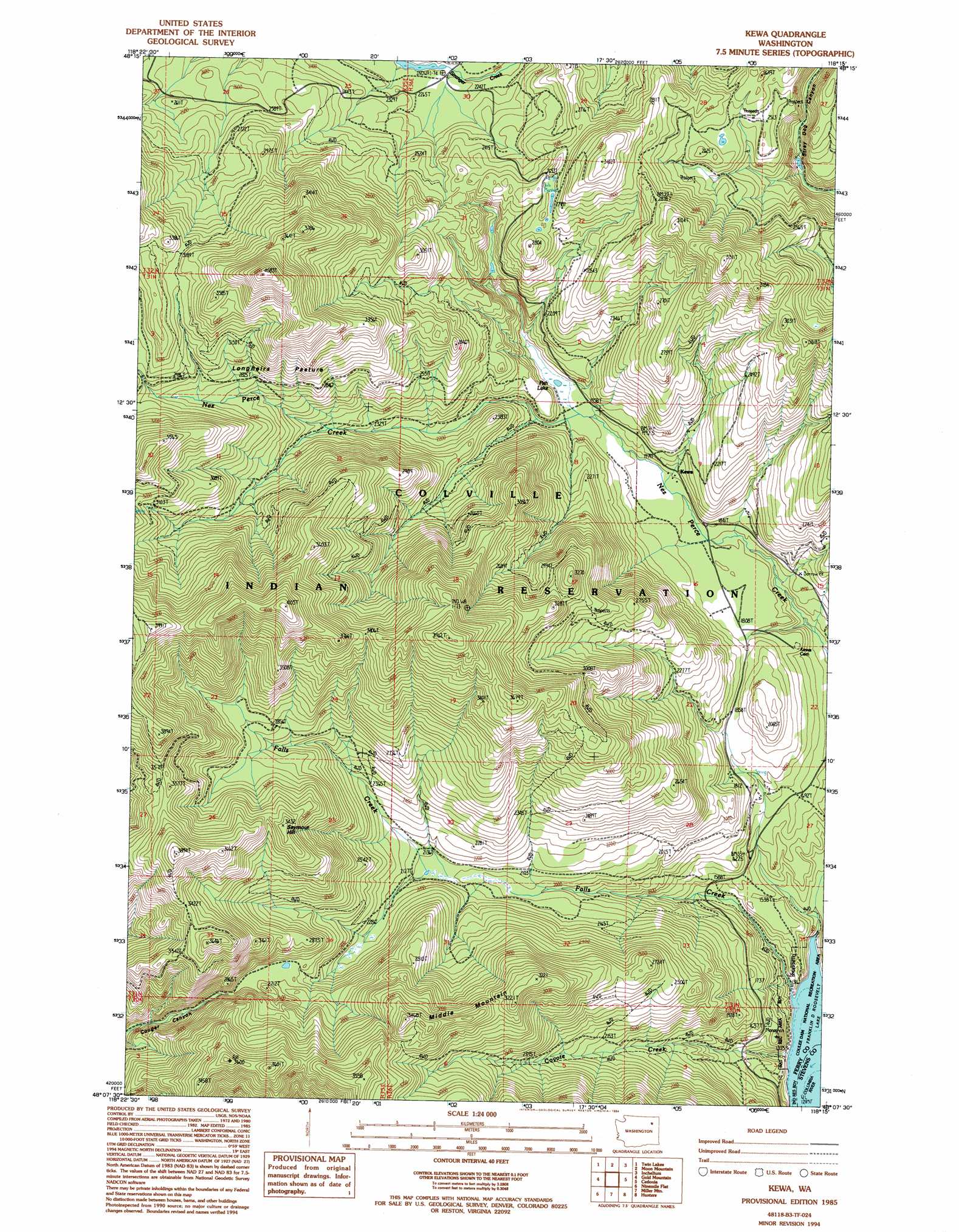
Kewa Topo Map Washington
To zoom in, hover over the map of Kewa
USGS Topo Quad 48118b3 - 1:24,000 scale
| Topo Map Name: | Kewa |
| USGS Topo Quad ID: | 48118b3 |
| Print Size: | ca. 21 1/4" wide x 27" high |
| Southeast Coordinates: | 48.125° N latitude / 118.25° W longitude |
| Map Center Coordinates: | 48.1875° N latitude / 118.3125° W longitude |
| U.S. State: | WA |
| Filename: | o48118b3.jpg |
| Download Map JPG Image: | Kewa topo map 1:24,000 scale |
| Map Type: | Topographic |
| Topo Series: | 7.5´ |
| Map Scale: | 1:24,000 |
| Source of Map Images: | United States Geological Survey (USGS) |
| Alternate Map Versions: |
Kewa WA 1985, updated 1985 Download PDF Buy paper map Kewa WA 1985, updated 1994 Download PDF Buy paper map Kewa WA 2011 Download PDF Buy paper map Kewa WA 2014 Download PDF Buy paper map |
1:24,000 Topo Quads surrounding Kewa
Seventeenmile Mountain |
Sitdown Mountain |
La Fleur Lake |
Rice |
Kentry Ridge |
Cody Lake |
Twin Lakes |
Moon Mountain |
Inchelium |
Wellington Peak |
Frosty Meadows |
Gold Mountain |
Kewa |
Cedonia |
Blackhorse Canyon |
Friedlander Meadows |
Ninemile Flat |
Miller Mountain |
Hunters |
Adams Mountain |
Whitestone Rock |
Johnny George Mountain |
Fort Spokane |
Mccoy Lake |
Turtle Lake |
> Back to 48118a1 at 1:100,000 scale
> Back to 48118a1 at 1:250,000 scale
> Back to U.S. Topo Maps home
Kewa topo map: Gazetteer
Kewa: Flats
Longhairs Pasture elevation 914m 2998′Kewa: Lakes
Fish Lake elevation 597m 1958′Kewa: Populated Places
Kewa elevation 583m 1912′Kewa: Streams
Coyote Creek elevation 394m 1292′Falls Creek elevation 397m 1302′
Kewa: Summits
Middle Mountain elevation 974m 3195′Seymour Hill elevation 1015m 3330′
Kewa: Valleys
Cougar Canyon elevation 757m 2483′Kewa digital topo map on disk
Buy this Kewa topo map showing relief, roads, GPS coordinates and other geographical features, as a high-resolution digital map file on DVD: