Nespelem Ne Topo Map Washington
To zoom in, hover over the map of Nespelem Ne
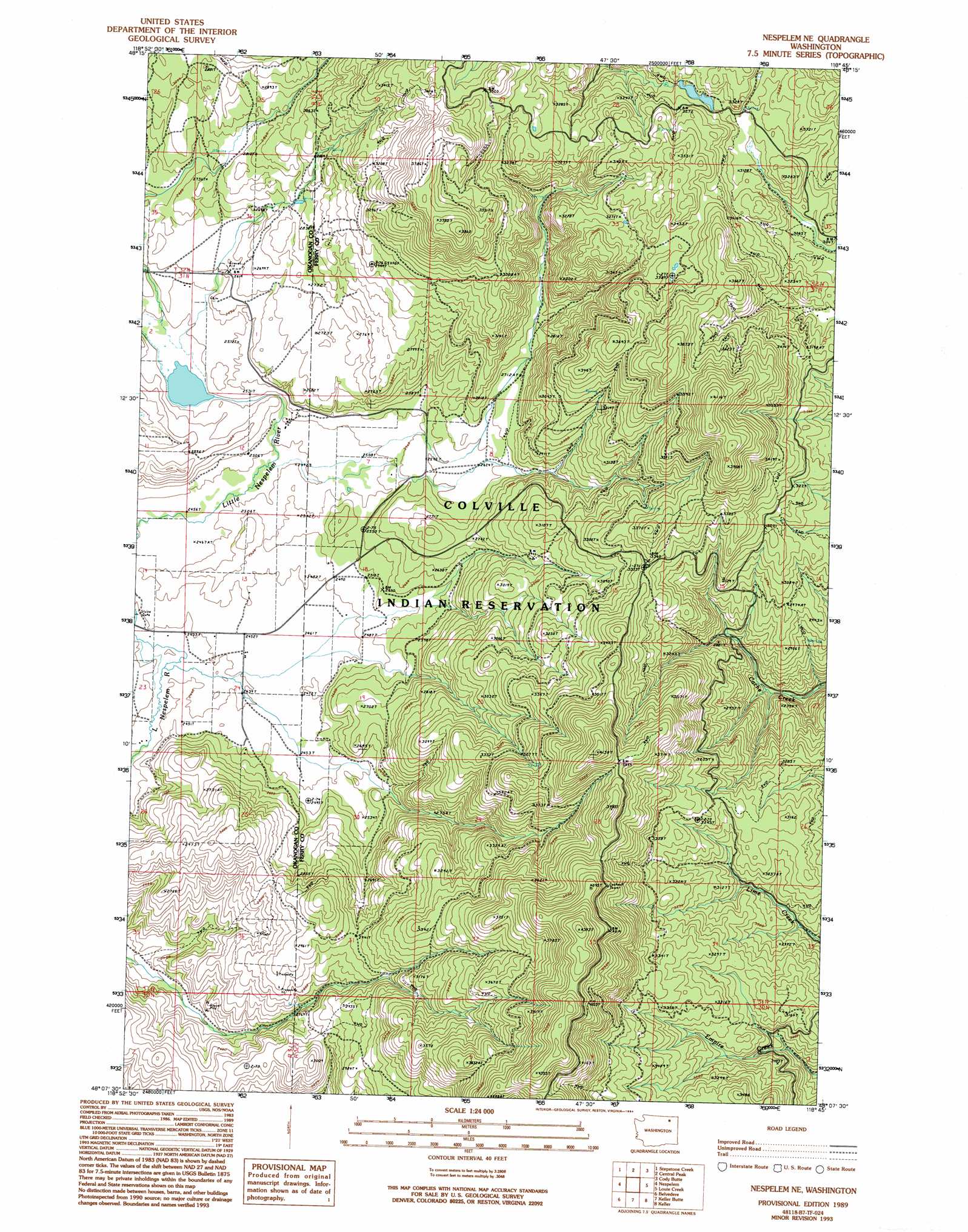
USGS Topo Quad 48118b7 - 1:24,000 scale
| Topo Map Name: | Nespelem Ne |
| USGS Topo Quad ID: | 48118b7 |
| Print Size: | ca. 21 1/4" wide x 27" high |
| Southeast Coordinates: | 48.125° N latitude / 118.75° W longitude |
| Map Center Coordinates: | 48.1875° N latitude / 118.8125° W longitude |
| U.S. State: | WA |
| Filename: | o48118b7.jpg |
| Download Map JPG Image: | Nespelem Ne topo map 1:24,000 scale |
| Map Type: | Topographic |
| Topo Series: | 7.5´ |
| Map Scale: | 1:24,000 |
| Source of Map Images: | United States Geological Survey (USGS) |
| Alternate Map Versions: |
Nespelem NE WA 1989, updated 1989 Download PDF Buy paper map Nespelem NE WA 1989, updated 1994 Download PDF Buy paper map Nespelem NE WA 2011 Download PDF Buy paper map Nespelem NE WA 2014 Download PDF Buy paper map |
1:24,000 Topo Quads surrounding Nespelem Ne
Moses Meadows |
Strawberry Mountain |
Bald Knob |
Thirteenmile Creek |
Seventeenmile Mountain |
Moses Mountain |
Stepstone Creek |
Central Peak |
Cody Butte |
Cody Lake |
Armstrong Creek |
Nespelem |
Nespelem Ne |
Louie Creek |
Frosty Meadows |
Sanderson Creek |
Belvedere |
Keller Butte |
Keller |
Friedlander Meadows |
Electric City |
Grand Coulee Dam |
Mica Mountain |
Keller Ferry |
Whitestone Rock |
> Back to 48118a1 at 1:100,000 scale
> Back to 48118a1 at 1:250,000 scale
> Back to U.S. Topo Maps home
No gazetteer data is available for the Nespelem Ne topo map sheet.
Nespelem Ne digital topo map on disk
Buy this Nespelem Ne topo map showing relief, roads, GPS coordinates and other geographical features, as a high-resolution digital map file on DVD: