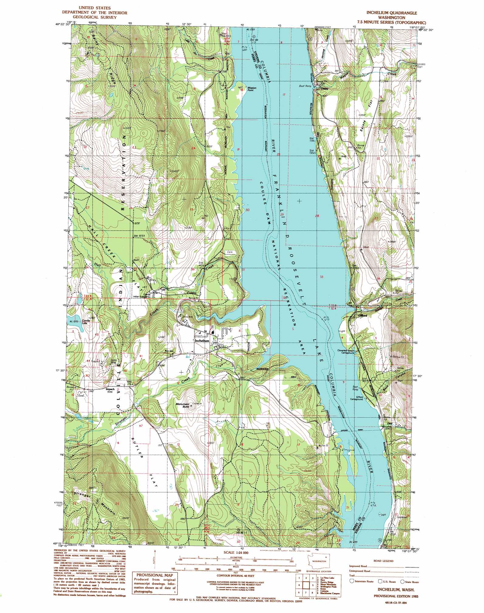
Inchelium Topo Map Washington
To zoom in, hover over the map of Inchelium
USGS Topo Quad 48118c2 - 1:24,000 scale
| Topo Map Name: | Inchelium |
| USGS Topo Quad ID: | 48118c2 |
| Print Size: | ca. 21 1/4" wide x 27" high |
| Southeast Coordinates: | 48.25° N latitude / 118.125° W longitude |
| Map Center Coordinates: | 48.3125° N latitude / 118.1875° W longitude |
| U.S. State: | WA |
| Filename: | o48118c2.jpg |
| Download Map JPG Image: | Inchelium topo map 1:24,000 scale |
| Map Type: | Topographic |
| Topo Series: | 7.5´ |
| Map Scale: | 1:24,000 |
| Source of Map Images: | United States Geological Survey (USGS) |
| Alternate Map Versions: |
Inchelium WA 1985, updated 1985 Download PDF Buy paper map Inchelium WA 1985, updated 1993 Download PDF Buy paper map Inchelium WA 2011 Download PDF Buy paper map Inchelium WA 2014 Download PDF Buy paper map |
1:24,000 Topo Quads surrounding Inchelium
Sherman Peak |
South Huckleberry Mountain |
Bangs Mountain |
Kettle Falls |
Colville |
Sitdown Mountain |
La Fleur Lake |
Rice |
Kentry Ridge |
Arden |
Twin Lakes |
Moon Mountain |
Inchelium |
Wellington Peak |
Dunn Mountain |
Gold Mountain |
Kewa |
Cedonia |
Blackhorse Canyon |
Stensgar Mountain |
Ninemile Flat |
Miller Mountain |
Hunters |
Adams Mountain |
Empey Mountain |
> Back to 48118a1 at 1:100,000 scale
> Back to 48118a1 at 1:250,000 scale
> Back to U.S. Topo Maps home
Inchelium topo map: Gazetteer
Inchelium: Bars
Bissell Flats elevation 394m 1292′Inchelium: Flats
Butler Flat elevation 519m 1702′Hall Creek Flat elevation 573m 1879′
Saints Flat elevation 584m 1916′
Inchelium: Islands
Bissell Island elevation 394m 1292′Inchelium: Lakes
Camille Lake elevation 602m 1975′Inchelium: Mines
Guinn Mine elevation 588m 1929′Inchelium: Populated Places
Daisy elevation 405m 1328′Edendale (historical) elevation 394m 1292′
Gifford elevation 419m 1374′
Impach elevation 547m 1794′
Inchelium elevation 478m 1568′
Inchelium: Streams
Cobbs Creek elevation 394m 1292′Deer Creek elevation 402m 1318′
Hall Creek elevation 395m 1295′
Jennings Creek elevation 408m 1338′
Little Jim Creek elevation 395m 1295′
Magee Creek elevation 398m 1305′
Stranger Creek elevation 394m 1292′
Stranger Creek elevation 402m 1318′
Inchelium: Summits
Monument Butte elevation 627m 2057′Stranger Mountain elevation 921m 3021′
Inchelium: Valleys
Buck Canyon elevation 428m 1404′Inchelium digital topo map on disk
Buy this Inchelium topo map showing relief, roads, GPS coordinates and other geographical features, as a high-resolution digital map file on DVD: