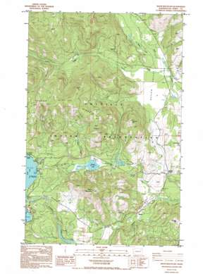
Moon Mountain Topo Map Washington
To zoom in, hover over the map of Moon Mountain
USGS Topo Quad 48118c3 - 1:24,000 scale
| Topo Map Name: | Moon Mountain |
| USGS Topo Quad ID: | 48118c3 |
| Print Size: | ca. 21 1/4" wide x 27" high |
| Southeast Coordinates: | 48.25° N latitude / 118.25° W longitude |
| Map Center Coordinates: | 48.3125° N latitude / 118.3125° W longitude |
| U.S. State: | WA |
| Filename: | o48118c3.jpg |
| Download Map JPG Image: | Moon Mountain topo map 1:24,000 scale |
| Map Type: | Topographic |
| Topo Series: | 7.5´ |
| Map Scale: | 1:24,000 |
| Source of Map Images: | United States Geological Survey (USGS) |
| Alternate Map Versions: |
Moon Mountain WA 1985, updated 1985 Download PDF Buy paper map Moon Mountain WA 1985, updated 1994 Download PDF Buy paper map Moon Mountain WA 2011 Download PDF Buy paper map Moon Mountain WA 2014 Download PDF Buy paper map |
1:24,000 Topo Quads surrounding Moon Mountain
> Back to 48118a1 at 1:100,000 scale
> Back to 48118a1 at 1:250,000 scale
> Back to U.S. Topo Maps home
Moon Mountain topo map: Gazetteer
Moon Mountain: Beaches
Carson Beach elevation 794m 2604′Moon Mountain: Flats
Seyler Valley elevation 585m 1919′Moon Mountain: Lakes
Round Lake elevation 692m 2270′Moon Mountain: Populated Places
Meteor elevation 572m 1876′Moon Mountain: Streams
Abraham Creek elevation 614m 2014′Cedar Creek elevation 693m 2273′
Cornstalk Creek elevation 532m 1745′
Lynx Creek elevation 591m 1938′
Spring Creek elevation 586m 1922′
Twin Lakes Ditch elevation 671m 2201′
Moon Mountain: Summits
Johhnys Hill elevation 984m 3228′Moon Mountain elevation 1188m 3897′
Moon Mountain digital topo map on disk
Buy this Moon Mountain topo map showing relief, roads, GPS coordinates and other geographical features, as a high-resolution digital map file on DVD:


