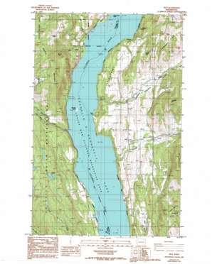
Rice Topo Map Washington
To zoom in, hover over the map of Rice
USGS Topo Quad 48118d2 - 1:24,000 scale
| Topo Map Name: | Rice |
| USGS Topo Quad ID: | 48118d2 |
| Print Size: | ca. 21 1/4" wide x 27" high |
| Southeast Coordinates: | 48.375° N latitude / 118.125° W longitude |
| Map Center Coordinates: | 48.4375° N latitude / 118.1875° W longitude |
| U.S. State: | WA |
| Filename: | o48118d2.jpg |
| Download Map JPG Image: | Rice topo map 1:24,000 scale |
| Map Type: | Topographic |
| Topo Series: | 7.5´ |
| Map Scale: | 1:24,000 |
| Source of Map Images: | United States Geological Survey (USGS) |
| Alternate Map Versions: |
Rice WA 1985, updated 1985 Download PDF Buy paper map Rice WA 1985, updated 1993 Download PDF Buy paper map Rice WA 1992, updated 1996 Download PDF Buy paper map Rice WA 2011 Download PDF Buy paper map Rice WA 2014 Download PDF Buy paper map |
| FStopo: | US Forest Service topo Rice is available: Download FStopo PDF Download FStopo TIF |
1:24,000 Topo Quads surrounding Rice
> Back to 48118a1 at 1:100,000 scale
> Back to 48118a1 at 1:250,000 scale
> Back to U.S. Topo Maps home
Rice topo map: Gazetteer
Rice: Bays
Rotter Bay elevation 396m 1299′Rice: Flats
Chalk Grade Flat elevation 489m 1604′Rice: Islands
Barnaby Island elevation 404m 1325′Rice: Lakes
Mitchell Lake elevation 947m 3106′Nettleton Lake elevation 616m 2020′
Nicholas Lake elevation 815m 2673′
Simpson Lake elevation 617m 2024′
Rice: Mines
Big Lake Mine elevation 640m 2099′Rice: Populated Places
Harvey (historical) elevation 460m 1509′Rice elevation 528m 1732′
Rice: Streams
Barnaby Creek elevation 394m 1292′Cedar Creek elevation 477m 1564′
Cheweka Creek elevation 418m 1371′
La Fleur Creek elevation 394m 1292′
Quillisascut Creek elevation 438m 1437′
Rice: Summits
Butcher Mountain elevation 968m 3175′Nicholls Mountain elevation 1032m 3385′
Staehly Mountain elevation 1014m 3326′
The Splitoff elevation 572m 1876′
Rice: Valleys
Cuba Canyon elevation 639m 2096′Pleasant Valley elevation 438m 1437′
Rice digital topo map on disk
Buy this Rice topo map showing relief, roads, GPS coordinates and other geographical features, as a high-resolution digital map file on DVD:


