Swan Lake Topo Map Washington
To zoom in, hover over the map of Swan Lake
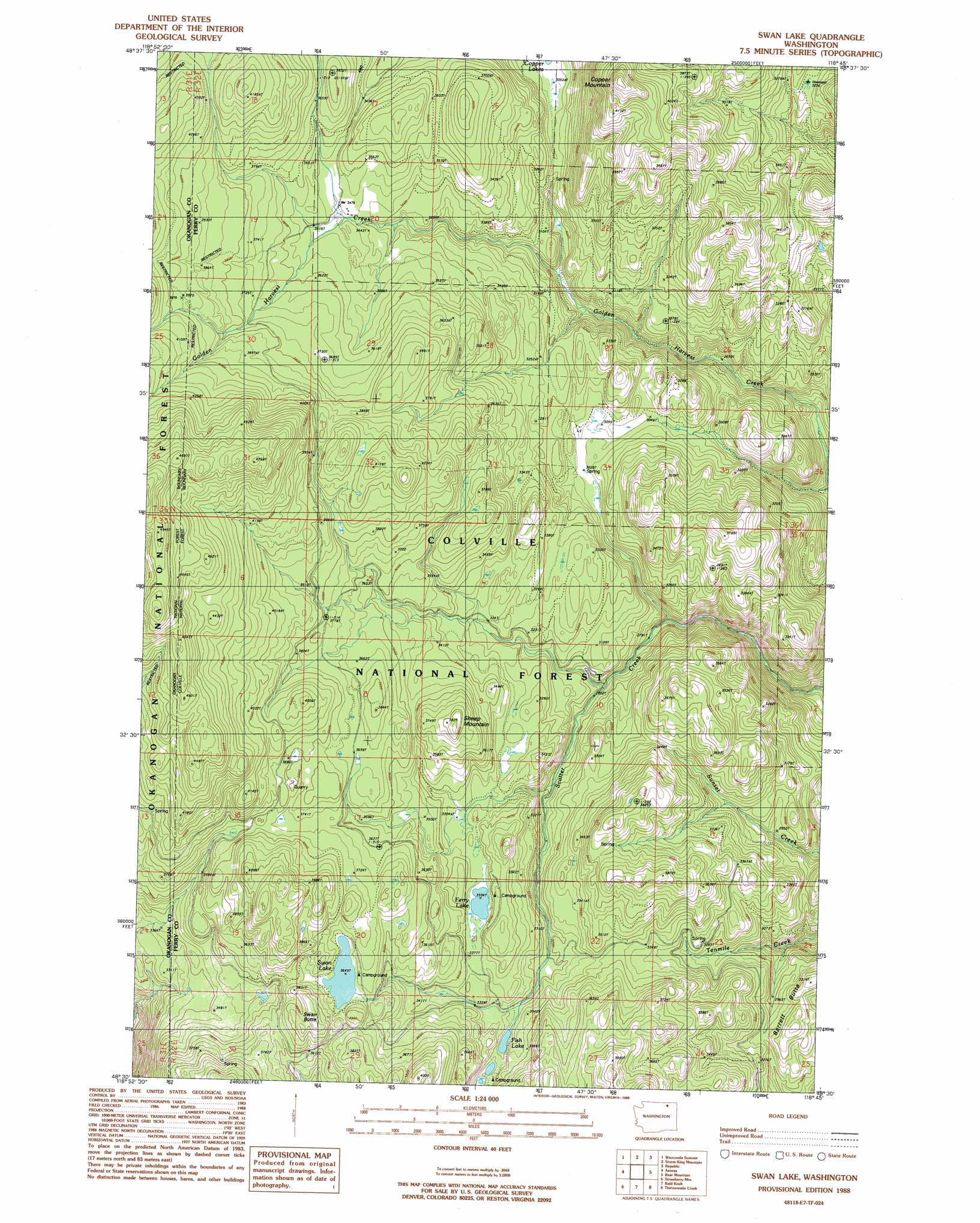
USGS Topo Quad 48118e7 - 1:24,000 scale
| Topo Map Name: | Swan Lake |
| USGS Topo Quad ID: | 48118e7 |
| Print Size: | ca. 21 1/4" wide x 27" high |
| Southeast Coordinates: | 48.5° N latitude / 118.75° W longitude |
| Map Center Coordinates: | 48.5625° N latitude / 118.8125° W longitude |
| U.S. State: | WA |
| Filename: | o48118e7.jpg |
| Download Map JPG Image: | Swan Lake topo map 1:24,000 scale |
| Map Type: | Topographic |
| Topo Series: | 7.5´ |
| Map Scale: | 1:24,000 |
| Source of Map Images: | United States Geological Survey (USGS) |
| Alternate Map Versions: |
Swan Lake WA 1988, updated 1988 Download PDF Buy paper map Swan Lake WA 1992, updated 1996 Download PDF Buy paper map Swan Lake WA 2011 Download PDF Buy paper map Swan Lake WA 2014 Download PDF Buy paper map |
| FStopo: | US Forest Service topo Swan Lake is available: Download FStopo PDF Download FStopo TIF |
1:24,000 Topo Quads surrounding Swan Lake
Mount Bonaparte |
Bodie |
Bodie Mountain |
Karamin |
Malo |
Mount Annie |
Wauconda Summit |
Storm King Mountain |
Republic |
Cooke Mountain |
Bailey Creek |
Aeneas |
Swan Lake |
Bear Mountain |
Edds Mountain |
Moses Meadows |
Strawberry Mountain |
Bald Knob |
Thirteenmile Creek |
Seventeenmile Mountain |
Moses Mountain |
Stepstone Creek |
Central Peak |
Cody Butte |
Cody Lake |
> Back to 48118e1 at 1:100,000 scale
> Back to 48118a1 at 1:250,000 scale
> Back to U.S. Topo Maps home
Swan Lake topo map: Gazetteer
Swan Lake: Lakes
Ferry Lake elevation 1019m 3343′Fish Lake elevation 988m 3241′
Swan Lake elevation 1117m 3664′
Swan Lake: Summits
Barrett Butte elevation 1001m 3284′Copper Mountain elevation 1327m 4353′
Sheep Mountain elevation 1156m 3792′
Swan Butte elevation 1133m 3717′
Swan Lake: Trails
Ferry Lake Trail elevation 1008m 3307′Golden Harvest Trail elevation 877m 2877′
Tenmile Trail elevation 963m 3159′
Swan Lake digital topo map on disk
Buy this Swan Lake topo map showing relief, roads, GPS coordinates and other geographical features, as a high-resolution digital map file on DVD: