Aeneas Topo Map Washington
To zoom in, hover over the map of Aeneas
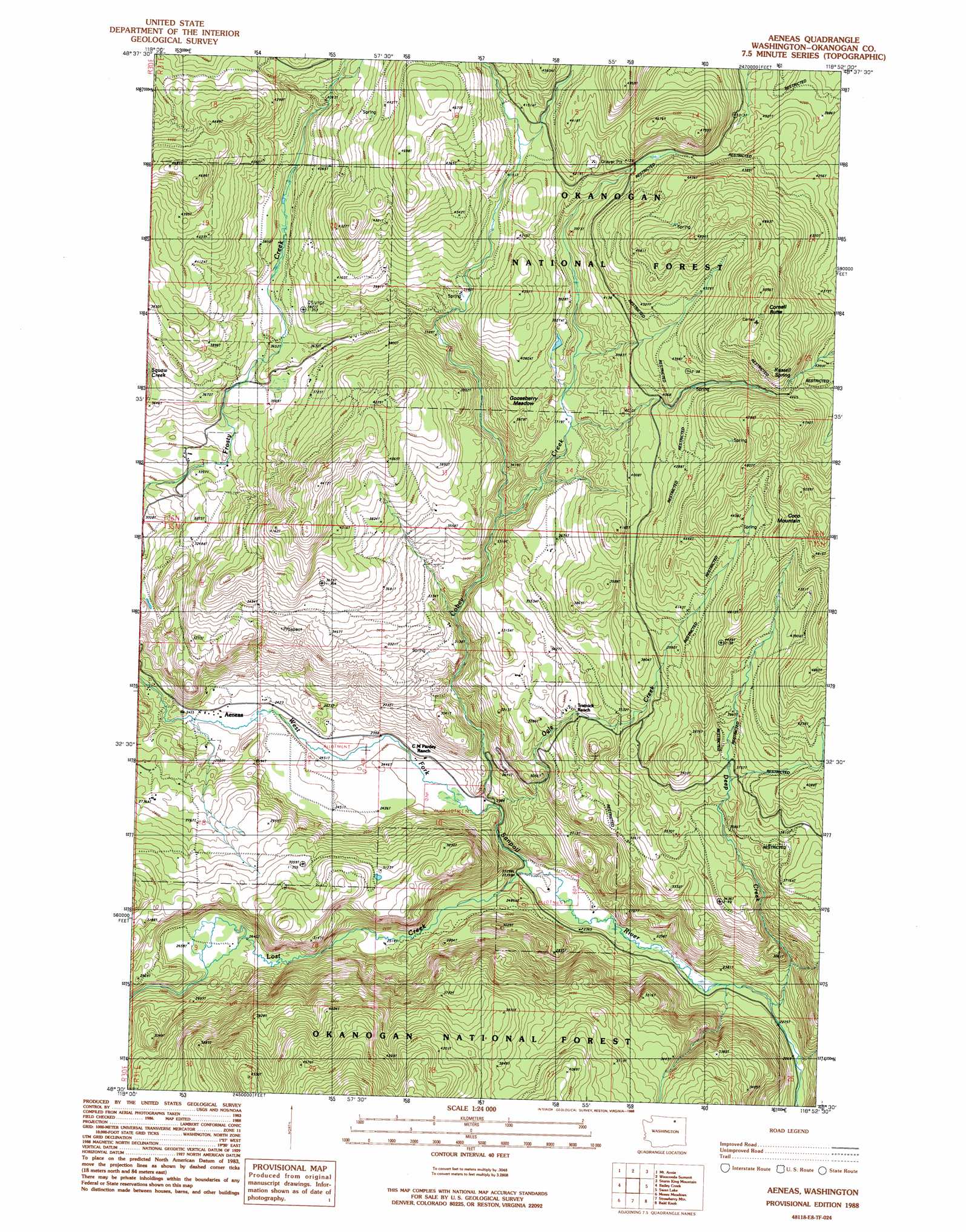
USGS Topo Quad 48118e8 - 1:24,000 scale
| Topo Map Name: | Aeneas |
| USGS Topo Quad ID: | 48118e8 |
| Print Size: | ca. 21 1/4" wide x 27" high |
| Southeast Coordinates: | 48.5° N latitude / 118.875° W longitude |
| Map Center Coordinates: | 48.5625° N latitude / 118.9375° W longitude |
| U.S. State: | WA |
| Filename: | o48118e8.jpg |
| Download Map JPG Image: | Aeneas topo map 1:24,000 scale |
| Map Type: | Topographic |
| Topo Series: | 7.5´ |
| Map Scale: | 1:24,000 |
| Source of Map Images: | United States Geological Survey (USGS) |
| Alternate Map Versions: |
Aeneas WA 1988, updated 1988 Download PDF Buy paper map Aeneas WA 2011 Download PDF Buy paper map Aeneas WA 2014 Download PDF Buy paper map |
| FStopo: | US Forest Service topo Aeneas is available: Download FStopo PDF Download FStopo TIF |
1:24,000 Topo Quads surrounding Aeneas
Havillah |
Mount Bonaparte |
Bodie |
Bodie Mountain |
Karamin |
Cayuse Mountain |
Mount Annie |
Wauconda Summit |
Storm King Mountain |
Republic |
Tunk Mountain |
Bailey Creek |
Aeneas |
Swan Lake |
Bear Mountain |
Crawfish Lake |
Moses Meadows |
Strawberry Mountain |
Bald Knob |
Thirteenmile Creek |
Disautel |
Moses Mountain |
Stepstone Creek |
Central Peak |
Cody Butte |
> Back to 48118e1 at 1:100,000 scale
> Back to 48118a1 at 1:250,000 scale
> Back to U.S. Topo Maps home
Aeneas topo map: Gazetteer
Aeneas: Flats
Gooseberry Meadow elevation 1135m 3723′Aeneas: Populated Places
Aeneas elevation 748m 2454′Aeneas: Springs
Russell Spring elevation 1363m 4471′Aeneas: Streams
Cobey Creek elevation 723m 2372′Deep Creek elevation 708m 2322′
Lost Creek elevation 713m 2339′
Ogle Creek elevation 719m 2358′
Aeneas: Summits
Coco Mountain elevation 1410m 4625′Cornell Butte elevation 1541m 5055′
Aeneas: Trails
Cobey Trail (historical) elevation 1348m 4422′Aeneas digital topo map on disk
Buy this Aeneas topo map showing relief, roads, GPS coordinates and other geographical features, as a high-resolution digital map file on DVD: